The Scenic Drive in Chaco Culture National Historical Park
New Mexico > Chaco Culture National Historical Park > Scenic Drive
Highlights:
One-way, eight mile paved loop drive past eight major groups of ruins and various smaller sites, plus trailheads for paths to three backcountry areas

The eight mile, one way loop drive in Chaco Culture National Historical Park starts at the visitor center, which is well stocked with books and local information, and is just a short walk from the first collection of ruins, the Una Vida site.
Most of the buildings here are unexcavated so the overall scene isn't too impressive; although there are about 150 rooms and five kivas (subterranean circular religious chambers), most of the site consists of earthen mounds with small piles of stones on top. Of more interest is a panel of petroglyphs on the base of the cliffs just beyond. The many other sites in the canyon are described below.
Most of the buildings here are unexcavated so the overall scene isn't too impressive; although there are about 150 rooms and five kivas (subterranean circular religious chambers), most of the site consists of earthen mounds with small piles of stones on top. Of more interest is a panel of petroglyphs on the base of the cliffs just beyond. The many other sites in the canyon are described below.
Chaco Culture Table of Contents
- Map of the NHS
- Photographs
- Hungo Pavi, Chetro Ketl and Pueblo Bonito
- Pueblo del Arroyo and Casa Rinconada
Location
Map of Chaco Culture National Historical Park.
Photographs
General views, Pueblo Alto Trail.
Hungo Pavi, Chetro Ketl and Pueblo Bonito
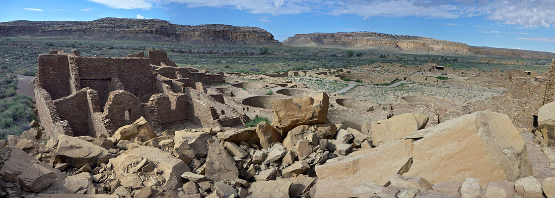
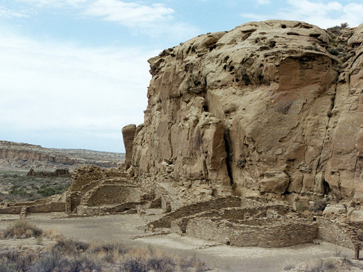
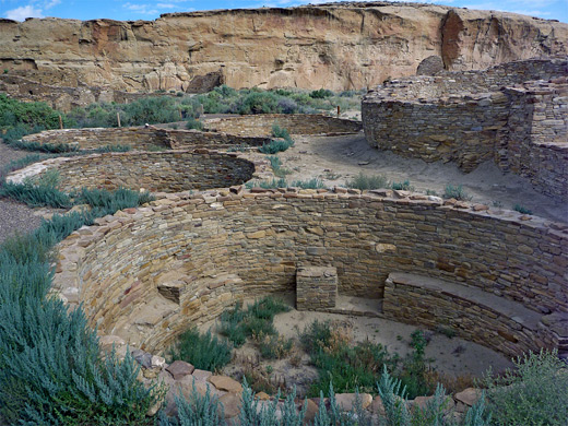
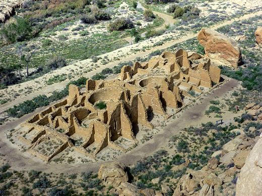
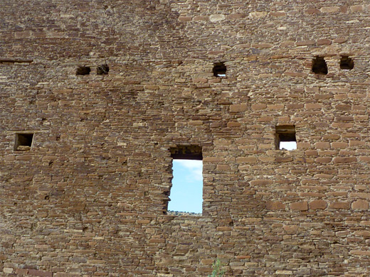
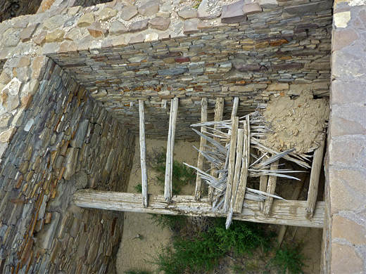
1.8 miles from the visitor center, the next stop is at Hungo Pavi, which is also rather less complete than the ruins further west, being largely unexcavated and unrestored. The site is toured by a quarter mile loop trail, and contains a collection of low wall and kiva remnants, bordered by a higher wall to the north, parallel to the cliffs. The next two sites are the best, and quite similar. Chetro Ketl and Pueblo Bonito, the oldest and largest villages, have massive, intricate and amazingly intact collections of buildings up to five storeys high with hundreds of rooms enclosed by elaborate brickwork and various well-designed styles of walls, window openings and doors. The sites are over 500 feet (150 meters) across and have some parts as yet uncovered, though the majority has been excavated. Some of the higher walls are unstable and are shored up by modern supports, and a certain amount of reconstruction has taken place but most is quite authentic and original. To prevent any further decay, visitors must stay on a designated route around the ruins, but a few of the rooms can be entered. Information about both ruins comes from useful trail guides with numbered features of interest. A separate path links Chetro Ketl with Pueblo Bonito along the base of the cliffs, where dozens more ancient petroglyphs and pictographs have been carved, plus the occasional piece of modern graffiti. In a few places the Chacoans built steep trails up the cliffs by carving hand and foot holds, allowing access to the mesa tops, and some are still evident today.
Pueblo del Arroyo and Casa Rinconada
A trail leading further downstream along Chaco Canyon starts from the far end of the scenic loop and later branches into several paths to other ruins and petroglyphs - 13.3 miles in all. Closest is Kin Kletso, reached by a walk of only 0.3 miles. The next roadside site is Pueblo del Arroyo, a slightly smaller village at the edge of Chaco Wash; the only one in the middle of the valley, not beneath the cliffs along the north edge. Today the western corner is in danger of being partially washed away, as the streambed is slowly encroaching. Although the walls here are generally lower there is still much to see, including a selection of kivas, partial remains of a few wooden roofs, and a variety of neat windows and doorways. The south (return) side of the loop drive passes only one village, notable as it contains the largest kiva in the whole valley - known as a 'great kiva', this is similar in size to the restored example at Aztec Ruins National Monument. Casa Rinconada was built about 1100 and also has several smaller kivas, together with an unusual rock staircase, but as with Una Vida, much of this site is still unexcavated.
All Contents © Copyright The American Southwest | Comments and Questions | Contribute | Affiliate Marketing Disclosure | Site Map