Map of Chaco Culture National Historical Park
New Mexico > Chaco Culture National Historical Park > Map
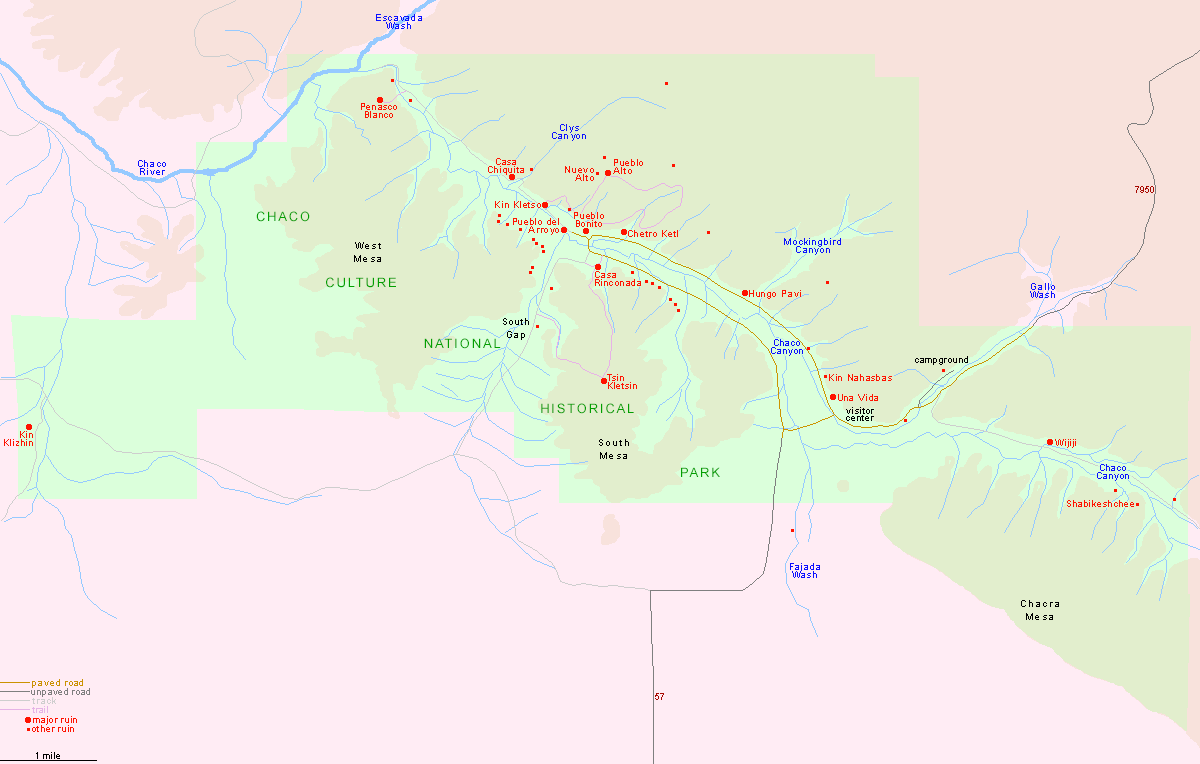
The main route to Chaco Culture National Historical Park starts 3 miles south of Nageezi on US 550, starting south along the paved road 7900, then turning west on the unpaved road 7950. The last few miles are rather rough. A secondary approach is from the south (19 miles), via road 57 starting at the paved Route 9.
PDF format maps of Chaco Culture National Historical Park, from the National Park Service:
 Overview area map (688 kb)
Park map (228 kb)
PDF format maps of Chaco Culture National Historical Park, from the National Park Service:
Park map (228 kb)
All Contents © Copyright The American Southwest | Comments and Questions | Contribute | Affiliate Marketing Disclosure | Site Map