Highlights:
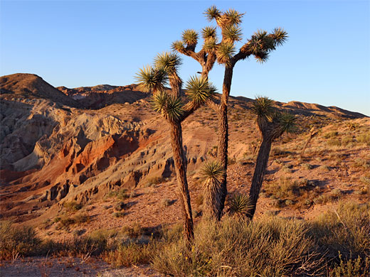
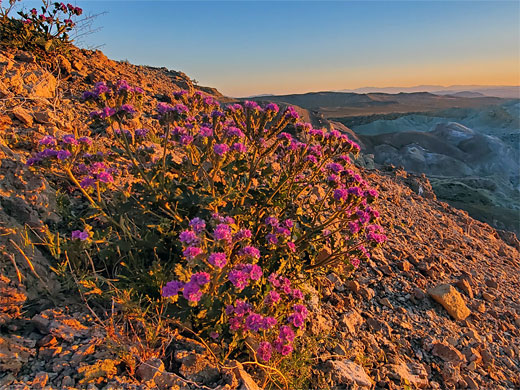
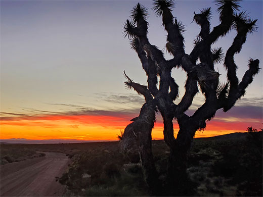
Mojave Desert badlands and differently colored strata, eroded into spires and narrow ravines, bordered by extensive, rather desolate desert plains. A good location for free camping. Abundant desert plants, including Joshua trees. Hiking in Owl Canyon
Nearby town:
Barstow, 11 miles
Management:
Location:
Seasons:
Winter, spring and fall - summers are too hot
Rating (1-5):
★★★★★
Weather:


Rainbow Basin is part of the California Deserts itinerary
Featured Hotel
Hampton Inn & Suites Barstow
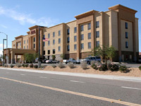 Perhaps the best hotel in Barstow, next to Tanger Outlet Mall on the southwest side of the city, just off I-15. East-facing rooms enjoy spectacular views across desert plains
Check Rates
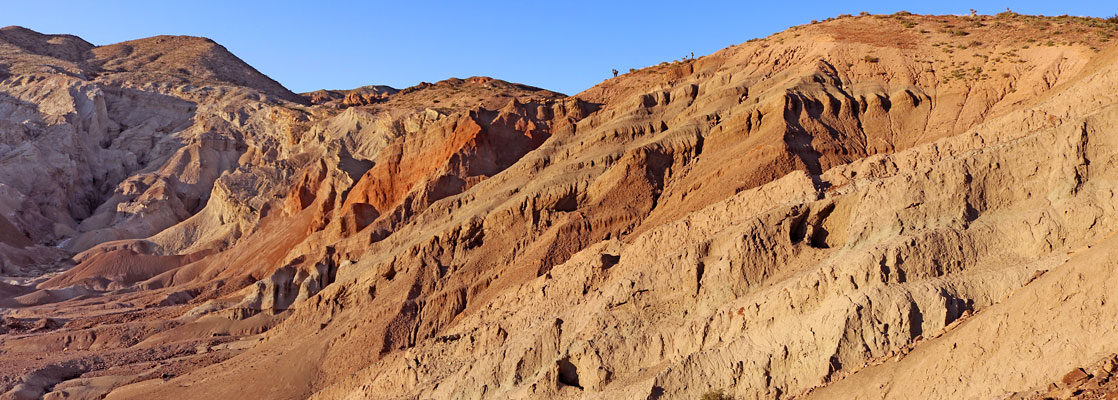
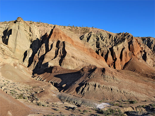
Half way from Los Angeles to Las Vegas, I-15 passes Barstow, making this a logical place to stop and break the journey. The town does not have much to offer but two interesting sites are located nearby - one is the restored and rather commercial 'ghost town' of Calico in the mountains a few miles east while the other is Rainbow Basin National Natural Landmark (also an Area of Critical Environmental Concern, and a Natural Area), an expanse of badlands and folded, differently colored strata which have been eroded into small ravines and pinnacles.
The basin is found at the edge of the Mud Hills, 8 miles north of Barstow in a completely uninhabited part of the Mojave Desert, and the loneliness of the setting is quite striking though the basin itself is less spectacular then other similar erosional sites in the Southwest such as Cathedral Gorge State Park in Nevada, certainly during the heat of the day when the colours can appear rather drab and the rocks weathered and dusty. They look better when lit by the long rays of sunset as then the hues are much more vivid and the shadows enhance the natural undulating textures.
The basin is found at the edge of the Mud Hills, 8 miles north of Barstow in a completely uninhabited part of the Mojave Desert, and the loneliness of the setting is quite striking though the basin itself is less spectacular then other similar erosional sites in the Southwest such as Cathedral Gorge State Park in Nevada, certainly during the heat of the day when the colours can appear rather drab and the rocks weathered and dusty. They look better when lit by the long rays of sunset as then the hues are much more vivid and the shadows enhance the natural undulating textures.
Rainbow Basin Table of Contents
- Photographs
- Video
- Map
- Location
- Camping at Rainbow Basin
- Hiking - Owl Canyon
- Nearby places
- Similar places
Photographs
19 views of Rainbow Basin National Natural Landmark.
Wildflowers in the basin.
Rainbow Basin Video
Scenes in the basin, in late afternoon in the spring.
Location
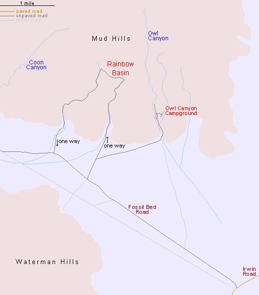
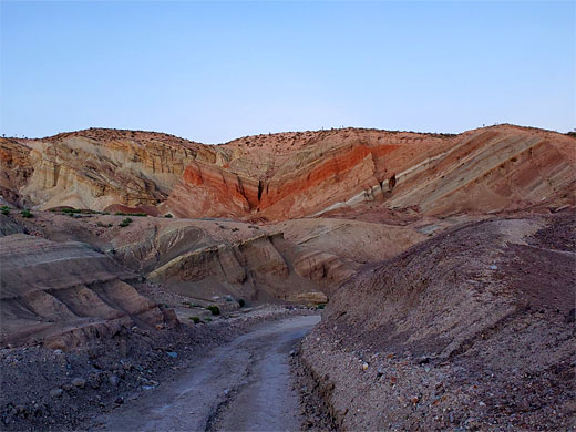
Rainbow Basin is reached by driving 6 miles along the busy Irwin Road, which heads out of town to the northeast and ends at the main gate of the Fort Irwin Military Reservation, part of a vast complex that occupies hundreds of square miles at the centre of the Mojave, then by turning left along Fossil Bed Road for another 3 miles. This is a good quality gravel track that later curves back south and meets CA 58. A signposted right turn to the basin soon forks - right is to the primitive, 22-site Owl Canyon Campground (fees $6 per night in 2025) while left is a one-way loop through the basin. A notice warns 'No RVs or Trailers' but the drive is usually suitable for all vehicles. It follows beside then partly along a dry wash, cuts left over some sandy mounds then returns down another ravine to Fossil Bed Road. Upstream, the eastern wash splits into many shallow branches, all of which end quite soon at the base of eroded mudstone cliffs and sometimes have deep, narrow places, and even small caves. The cliffs and the surrounding badlands are composed of a mixture of colours of rock and sand - reds, pinks and browns, with scattered veins of white gypsum crystals. They also occasionally contain fossil bones, and the remains of a variety of dinosaurs have been unearthed here over the years.
Camping at Rainbow Basin
Camping is seemingly not allowed along the scenic drive, but there are many (free) alternatives to the official campsite along dirt tracks that lead into the nearby desert, mainly on the south side of Fossil Bed Road, at the edge of the Waterman Hills. The surrounding area is quiet and peaceful, with the silence broken only by occasional distant explosions and gunfire from the army base over the hills to the east.
Geology of Rainbow Basin
Rocks in the vicinity of Barstow are a mix of igneous and sedimentary; the Waterman Hills, west of Fossil Bed Road, are formed of granodiorite, while most of the Mud Hills to the east, including Rainbow Basin, are composed of various layers of the Barstow Formation. Driving along the one-way road to the basin, the first exposures are the Owl Conglomerate member, granitic pebbles and boulders in a reddish sandstone matrix, soon replaced by lake-deposited clayish shale, generally greenish-gray or yellow, with some embedded limestone modules. After a brief exposure of grayish fanglomerate, similar in composition to the conglomerate, there are several more occurrences of the first two layers, both of which form all the high cliffs around the head of the basin. Beyond here, encompassing much of nearby Owl Canyon, the rocks are pyroclastic sediments from the Pickhandle Formation, including breccia, tuff and granitic conglomerate.
Rainbow Basin - Hiking
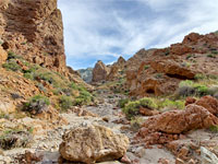
Owl Canyon
★★★★★
★★★★★
2 miles, 500 feet
Winding, generally shallow ravine, variously open and enclosed, through multicolored strata, past photogenic rock formationsRainbow Basin - Nearby Places
- Calico (15 miles) - partly restored ghost town
- Mojave National Preserve (70 miles to Baker) - excellent desert scenery
- Pinnacles National Natural Landmark (85 miles) - strange spires in the desert near Trona
Rainbow Basin - Similar Places
- Box Canyon, California - colorful ravine along the San Andreas Fault
- Red Rock Canyon State Park, California - eroded cliffs, badlands and ravines
All Contents © Copyright The American Southwest | Comments and Questions | Contribute | Affiliate Marketing Disclosure | Site Map