Highlights:
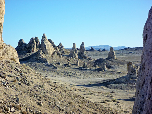
Isolated tufa spires in the middle of a vast dry lake bed in the Mojave Desert, enclosed by distant mountains; a good location for photography, and for primitive camping. Also known as the Trona Pinnacles
Nearby town:
Ridgecrest, 21 miles
Management:
Location:
Seasons:
All year, though summers are very hot
Rating (1-5):
★★★★★

Pinnacles NNL is part of the California Deserts itinerary
Searles Valley is a wide, flat expanse in the empty basin and range country towards the north of the Mojave Desert, enclosed on most sides by the huge China Lake Naval Weapons Center. Dry, barren and inordinately hot for much of the year, it was many millennia ago filled with the waters of Searles Lake to depths of 600 feet, evidence of which is provided by wave-cut terraces marking the former shoreline, still clearly visible on the grey hills all around.
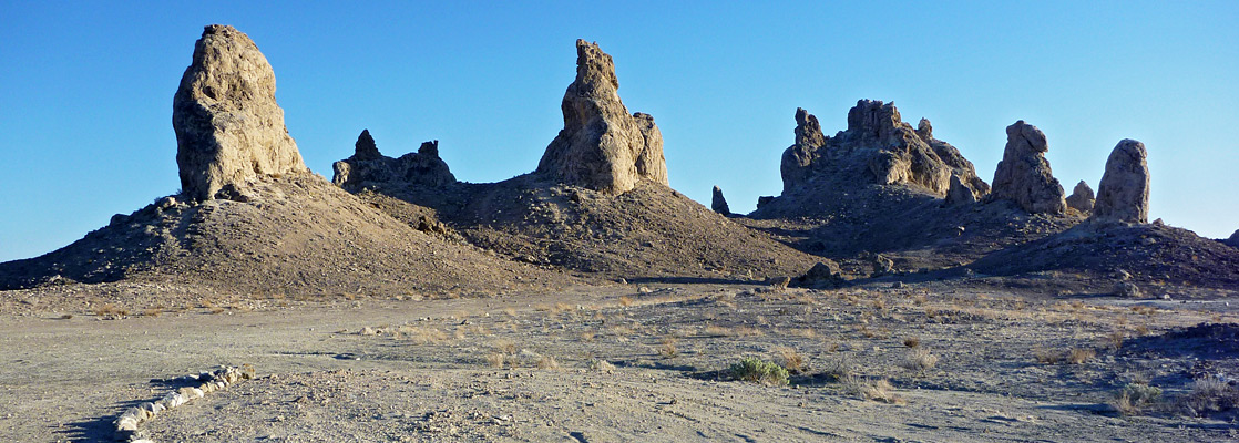
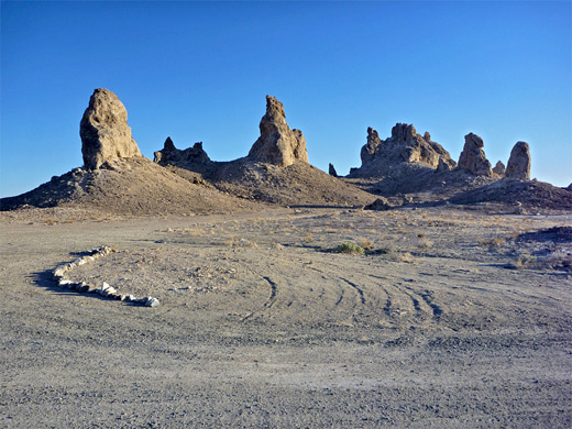
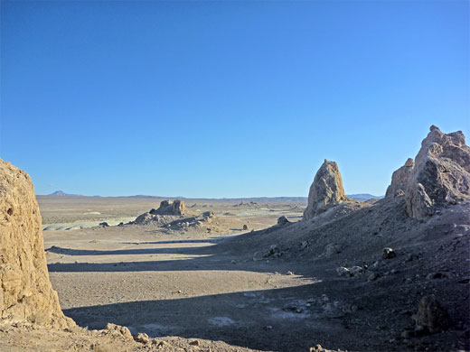
However, much more dramatic relics of the former lake are the Trona Pinnacles, a group of 500 narrow spires up to 140 feet tall formed by underwater deposition of tufa (calcium carbonate) from ancient mineral-laden springs along a fault zone on the lake bed. They now sit isolated and slowly crumbling away near the south end of the valley, surrounded by many square miles of flat, dried mud and with stark mountain ranges at either side.
However, much more dramatic relics of the former lake are the Trona Pinnacles, a group of 500 narrow spires up to 140 feet tall formed by underwater deposition of tufa (calcium carbonate) from ancient mineral-laden springs along a fault zone on the lake bed. They now sit isolated and slowly crumbling away near the south end of the valley, surrounded by many square miles of flat, dried mud and with stark mountain ranges at either side.
Pinnacles Table of Contents
Photographs
12 views of the Trona Pinnacles.
Location
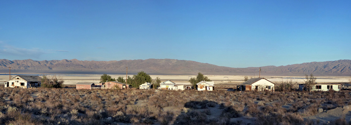
The pinnacles are recognized as a National Natural Landmark and are reached by CA 178, a connecting road between US 395 and CA 190, which leads into Death Valley 40 miles after Trona. This small town is the nearest settlement to the pinnacles and contains a strange mixture of run-down shacks, elegant modern dwellings and sprawling chemical works - a large area of the valley nearby is used for extraction of salt and a variety of other minerals. The turn off to the NNL is a few miles south, along a signposted dirt/gravel track that is rather severely graded in a few places but mostly ok, except after heavy rain. This wide road leaves CA 178 to the south, crosses a railway line then follows it for 4 miles to the edge of the formations. Several side tracks branch off around and between the cluster of rocks, and one continues, across the Spangler Hills and meeting a main road again a few miles further.
The Pinnacles
The spires are quite obvious even when seen from the highway and look intriguing from afar - a long line of sharp points that seem quite alien in the otherwise dead flat dry lake bed. There is one main group, a smaller collection a short distance east, then others further east, beyond a wide dry wash - total extent is about one mile. They are perhaps best viewed from a distance as up close the mounds are dusty and weathered with rather drab colors, though walking around is interesting enough, and the pale, low relief badlands to the south are worth exploring too. Sunsets are particularly pretty, especially viewed from the top of the small hilly area to the south, when the towers glow orange-yellow and are etched against the gaunt hills of the Slate Range at the eastern edge of the valley. Beyond, the Panamint Mountains rise higher still, topped by 11,000 feet Telescope Peak.
The pinnacles of the National Natural Landmark have some similarities to those at Pinnacles National Park, an otherwise unconnected site set in wooded, hilly land near Salinas, close to California's Pacific Coast.
Pinnacles - Nearby Places
- Death Valley National Park (56 miles to the boundary on CA 190) - starkly beautiful desert wilderness
- Red Rock Canyon State Park (60 miles) - exposed, eroded, colorful strata
Pinnacles - Similar Places
- Mono Lake - tufa spires around the edge of a high desert lake
- Pyramid Lake, Nevada - remote lake with tufa formations along the north shore
All Contents © Copyright The American Southwest | Comments and Questions | Contribute | Affiliate Marketing Disclosure | Site Map