Cuyamaca Peak Trail, Cuyamaca Rancho State Park
California > Cuyamaca Rancho State Park > Cuyamaca Peak Trail

Cuyamaca Peak Trail
Easy hike to the second highest summit in San Diego County, all along forest roads, mostly through fire-damaged woodland; old-growth trees survive at the beginning and end
Length: 2.7 miles
Elevation change: 1,640 feet
Difficulty: Easy to moderate
Type: One way, or a loop (7.4 miles) via Azalea Glen. Along forest roads, partly paved
Usage: Medium
Season: All year, though affected by snow in the winter
Trailhead: Parking area at Paso Picacho Campground
Rating (1-5): ★★★★★
Elevation change: 1,640 feet
Difficulty: Easy to moderate
Type: One way, or a loop (7.4 miles) via Azalea Glen. Along forest roads, partly paved
Usage: Medium
Season: All year, though affected by snow in the winter
Trailhead: Parking area at Paso Picacho Campground
Rating (1-5): ★★★★★

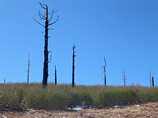
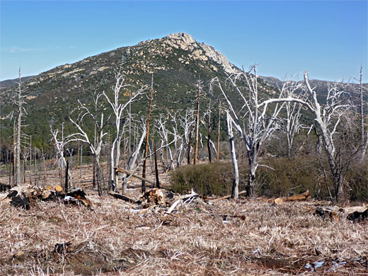
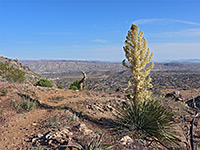
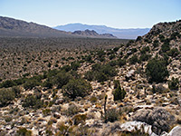
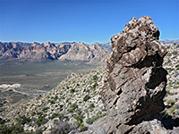
At 6,512 feet, Cuyamaca Peak is the highest summit in Cuyamaca State Park, and the second highest in San Diego County, behind only Hot Springs Mountain, just 21 feet taller. The shortest hiking route to the summit is 2.7 miles, starting from Paso Picacho Campground along the main road; longer but easier than the other popular summit route in the park (Stonewall Peak), though less interesting, for two reasons - all is along paved forest roads (closed to public vehicles), and the majority is through fire-damaged woodland, a mix of dead stumps and low shrubs, without any photogenic rock formations. Undamaged, old growth forest does persist at the start and finish, however and the views from the top are quite spectacular - west towards the Pacific coast, south into Mexico, and east to the Salton Sea and the Sonoran Desert.
The hike can be expanded, into a partial loop of 7.4 miles, incorporating a path to the north, through the nearby valley of Azalea Glen; otherwise, the there-and-back route from the campsite can be completed in just a couple of hours.
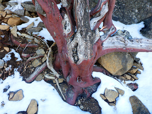
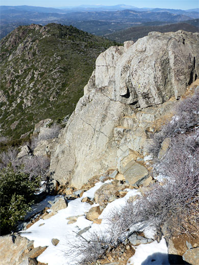
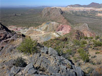
The bedrock, exposed only around the summit is gabbro, an igneous formation similar to basalt.
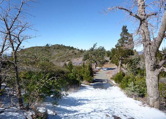
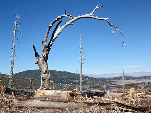
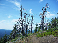
Parking for the Cuyamaca Peak hike is at the near edge of Paso Picacho Campground, turning right just after the entrance; towards the north side of the park, in the valley of Cold Creek. The route to the peak starts from the upper edge of the campground, in a surviving patch of old pines - a short path that links to one of the paved forest roads, which for over a mile winds through the burnt area, completely destroyed in the 2003 Cedar Fire. The road ascends quite steeply, through barren scenery of white or blackened trunks, and new brush, which is periodically cut back. The open landscape affords good news east towards the granitic summit of Stonewall Peak.
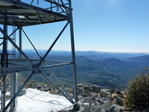
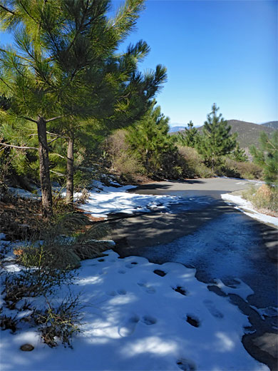
The road becomes briefly less steep across Fern Flat, as the surroundings remain uninspiring. After a four-way junction, with two unpaved tracks, both signed as trails, the road steepens again and the undamaged pines return; the road curves round a U-bend, now heading south, climbing the east side of the summit ridge. The trees become taller, the scenery much prettier, as the road traverses a little valley and rises to the ridgeline, giving the first views west. A sign requests that visitors stay on the track, in order to protect regenerating pines. The last half mile is back on the east side of the crest, through more shady woodland, this the last place where snow persists in the spring, and finally runs beneath the communication tower that sits on the actual summit, to an open viewpoint just to the north.
The hike can be expanded, into a partial loop of 7.4 miles, incorporating a path to the north, through the nearby valley of Azalea Glen; otherwise, the there-and-back route from the campsite can be completed in just a couple of hours.
The bedrock, exposed only around the summit is gabbro, an igneous formation similar to basalt.
Start of the Trail
Parking for the Cuyamaca Peak hike is at the near edge of Paso Picacho Campground, turning right just after the entrance; towards the north side of the park, in the valley of Cold Creek. The route to the peak starts from the upper edge of the campground, in a surviving patch of old pines - a short path that links to one of the paved forest roads, which for over a mile winds through the burnt area, completely destroyed in the 2003 Cedar Fire. The road ascends quite steeply, through barren scenery of white or blackened trunks, and new brush, which is periodically cut back. The open landscape affords good news east towards the granitic summit of Stonewall Peak.
Cuyamaca Peak Summit
The road becomes briefly less steep across Fern Flat, as the surroundings remain uninspiring. After a four-way junction, with two unpaved tracks, both signed as trails, the road steepens again and the undamaged pines return; the road curves round a U-bend, now heading south, climbing the east side of the summit ridge. The trees become taller, the scenery much prettier, as the road traverses a little valley and rises to the ridgeline, giving the first views west. A sign requests that visitors stay on the track, in order to protect regenerating pines. The last half mile is back on the east side of the crest, through more shady woodland, this the last place where snow persists in the spring, and finally runs beneath the communication tower that sits on the actual summit, to an open viewpoint just to the north.
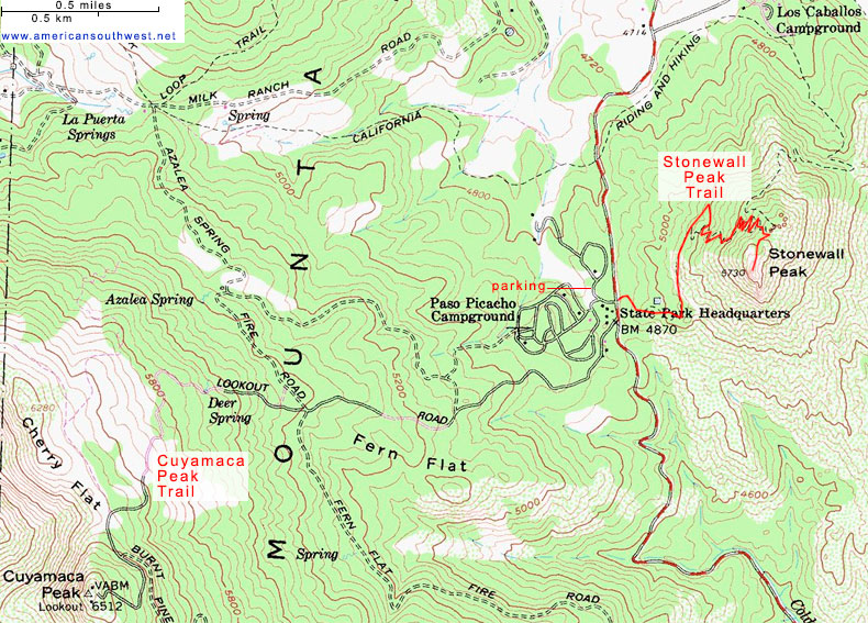
Topographic Map of the Cuyamaca Peak Trail
Cuyamaca Peak Trail - Similar Hikes
All Contents © Copyright The American Southwest | Comments and Questions | Contribute | Affiliate Marketing Disclosure | Site Map