Stonewall Peak Trail, Cuyamaca Rancho State Park
California > Cuyamaca Rancho State Park > Stonewall Peak Trail
Stonewall Peak Trail
The most popular path in the park, climbing via many switchbacks through sparse woodland of oak and manzanita, to a bald granite summit with 360 degree views
Length: 1.9 miles
Elevation change: 860 feet
Difficulty: Moderate
Type: One way
Usage: Medium
Season: All year, though affected by snow in the winter
Trailhead: Parking area at Paso Picacho Campground
Rating (1-5): ★★★★★
Elevation change: 860 feet
Difficulty: Moderate
Type: One way
Usage: Medium
Season: All year, though affected by snow in the winter
Trailhead: Parking area at Paso Picacho Campground
Rating (1-5): ★★★★★

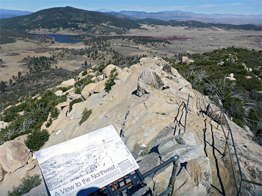
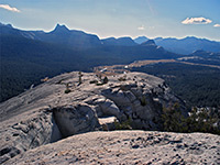
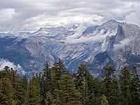
The most popular hike in Cuyamaca Rancho State Park is the 1.9 mile ascent to 5,730 foot Stonewall Peak, one of the four main summits in the preserve. Starting from the Paso Picacho Campground along Hwy 79, the path crosses an open area then zigzags up the hillside, through oak and manzanita woodland, eventually emerging above the treeline to the bare granitic summit, the final section aided by railings and rock-cut steps, like a mini version of Yosemite's Half Dome. Views from the summit cover a vast area, from the Salton Sea in the east to the actual sea in the west.
The round-trip can be done in not much more than an hour, though two hours is more typical. The hike may be inaccessible for a while in winter due to snowfall but otherwise is good all year, though the shady, northwest-facing slopes mean that ice can persist in some places well into spring.
The peak, like much of the park's bedrock, is formed of granodiorite, which is similar in appearance to granite, just a little darker in shade, and differs in composition by having a greater percentage of calcium and sodium feldspar; granite contains mostly potassium feldspar.
The peak is named after the Stonewall Gold Mine, one mile north, which was in operation between 1870 and 1892, and this was so-designated in tribute to the Confederate general Thomas 'Stonewall' Jackson.
21 views of the trail, and the park.
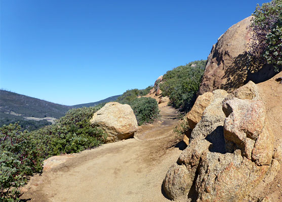
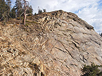
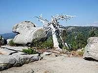
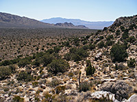
Parking for the Stonewall Peak Trail (and also the trail to Cuyamaca Peak, the highest summit in the park) is in a large lot by the entrance to the Paso Picacho campsite, on the west side of the park road. The trailhead is opposite to the east, next to a large alder tree. The route is initially along a track, soon turning right at a junction, signed 1.7 miles to the summit. The trail crosses open terrain, over coarse granitic soil, then veers northwards and starts to climb the bushy lower slopes. Views are good from the start, across the valley towards Cuyamaca Peak off to the west. The trail is lined by light-colored boulders and manzanita, plus other shrubs, mixed with many dead, white-branched trees, results of the devastating Cedar Fire of 2003. The upwards gradient is rather gentle, due to the long switchbacks.
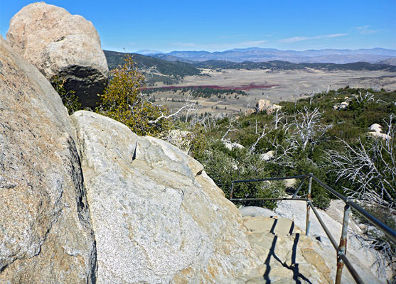
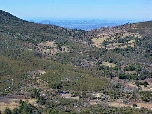
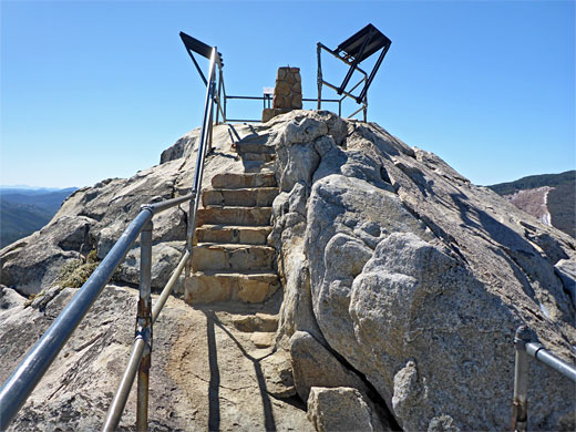
The trail moves round to the north face of the mountain, while the switchbacks - 20 or more of them - become shorter though not any steeper. Views are limited for a while owing to taller vegetation, including oak trees. Not long before the summit, another junction is reached, with a path in the north which can be used to make a 5 mile loop. The final section of the summit path climbs through the last of the bushes and onto a bare rock dome, the last part assisted by steps and railings. The very top is also railing-protected and has three notices describing the views, to the northeast - the Anza-Borrego Desert, the south - all the way to Mexico, and to the northwest, towards the Pacific Ocean.
The round-trip can be done in not much more than an hour, though two hours is more typical. The hike may be inaccessible for a while in winter due to snowfall but otherwise is good all year, though the shady, northwest-facing slopes mean that ice can persist in some places well into spring.
The peak, like much of the park's bedrock, is formed of granodiorite, which is similar in appearance to granite, just a little darker in shade, and differs in composition by having a greater percentage of calcium and sodium feldspar; granite contains mostly potassium feldspar.
The peak is named after the Stonewall Gold Mine, one mile north, which was in operation between 1870 and 1892, and this was so-designated in tribute to the Confederate general Thomas 'Stonewall' Jackson.
Photographs
21 views of the trail, and the park.
Start of the Trail
Parking for the Stonewall Peak Trail (and also the trail to Cuyamaca Peak, the highest summit in the park) is in a large lot by the entrance to the Paso Picacho campsite, on the west side of the park road. The trailhead is opposite to the east, next to a large alder tree. The route is initially along a track, soon turning right at a junction, signed 1.7 miles to the summit. The trail crosses open terrain, over coarse granitic soil, then veers northwards and starts to climb the bushy lower slopes. Views are good from the start, across the valley towards Cuyamaca Peak off to the west. The trail is lined by light-colored boulders and manzanita, plus other shrubs, mixed with many dead, white-branched trees, results of the devastating Cedar Fire of 2003. The upwards gradient is rather gentle, due to the long switchbacks.
Stonewall Peak Summit
The trail moves round to the north face of the mountain, while the switchbacks - 20 or more of them - become shorter though not any steeper. Views are limited for a while owing to taller vegetation, including oak trees. Not long before the summit, another junction is reached, with a path in the north which can be used to make a 5 mile loop. The final section of the summit path climbs through the last of the bushes and onto a bare rock dome, the last part assisted by steps and railings. The very top is also railing-protected and has three notices describing the views, to the northeast - the Anza-Borrego Desert, the south - all the way to Mexico, and to the northwest, towards the Pacific Ocean.
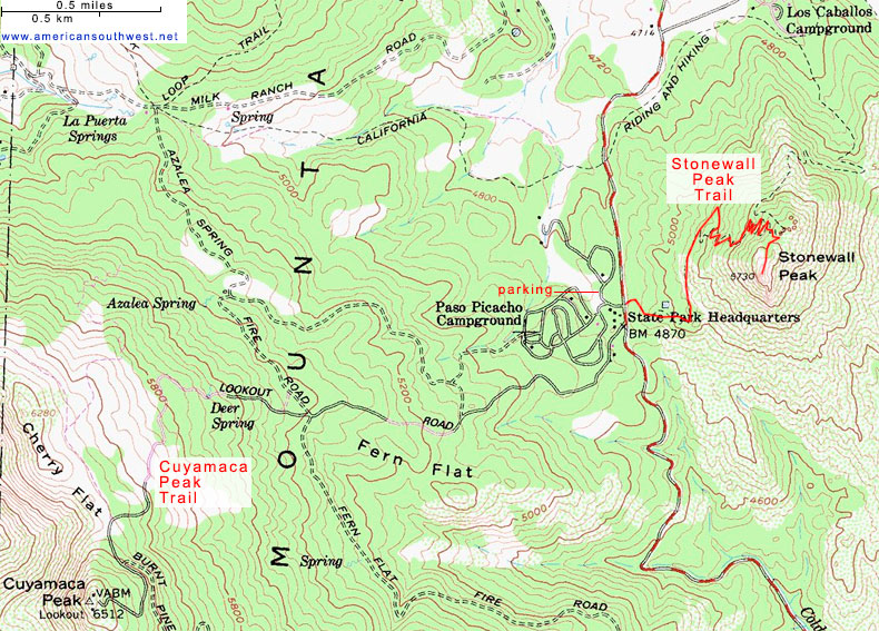
Topographic Map of the Stonewall Peak Trail
Stonewall Peak Wildflowers
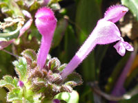 Henbit dead-nettle |
Stonewall Peak Trail - Similar Hikes
All Contents © Copyright The American Southwest | Comments and Questions | Contribute | Affiliate Marketing Disclosure | Site Map