Highlights:
The little-visited northwest corner of Zion National Park, with more high red cliffs and narrow ravines. A five mile scenic drive leads to several overlooks and trailheads, one for the long path to Kolob Arch
Location:
37.453, -113.225 (visitor center)

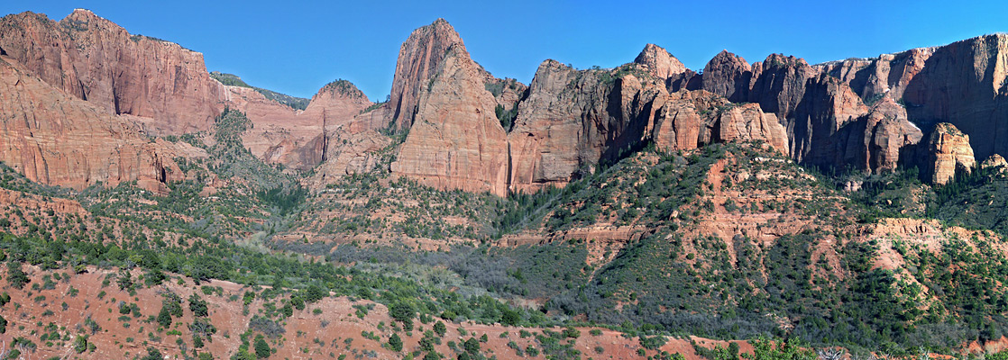
Just 2 miles from the noise and traffic of Interstate 15 lies the Kolob Canyons region of Zion National Park, a quiet, colorful and scenic collection of red Navajo sandstone cliffs split by narrow ravines - the Finger Canyons of the Kolob, with none of the overcrowding problems that affect the main valley to the southeast. To drive the 40 miles between the two sections of the park takes at least an hour, which is one reason why most tourists miss this little-known northern area, and stick to the frequently travelled west-east route, part of the Grand Circle of the Southwest through Las Vegas, Zion, Bryce Canyon and beyond.
The Kolob Canyons have their own interstate exit, at mile 40, beside which is a small visitor center (where the entrance fees are collected, and drinking water is available) at the start of a five mile scenic drive, with plenty of pull-outs, that initially follows a valley alongside Taylor Creek, a pleasant stream that flows year-round. There are no other facilities hereabouts, and no campground; the nearest official sites are to the south, beyond Toquerville, while for free primitive camping the closest location is probably along FR 029 in the Dixie National Forest northwest of New Harmony, about 9 miles away.
The Kolob Canyons have their own interstate exit, at mile 40, beside which is a small visitor center (where the entrance fees are collected, and drinking water is available) at the start of a five mile scenic drive, with plenty of pull-outs, that initially follows a valley alongside Taylor Creek, a pleasant stream that flows year-round. There are no other facilities hereabouts, and no campground; the nearest official sites are to the south, beyond Toquerville, while for free primitive camping the closest location is probably along FR 029 in the Dixie National Forest northwest of New Harmony, about 9 miles away.
Kolob Canyons Table of Contents
Map of the Kolob Canyons Region
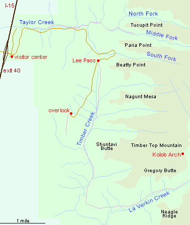
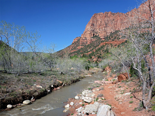
Taylor Creek
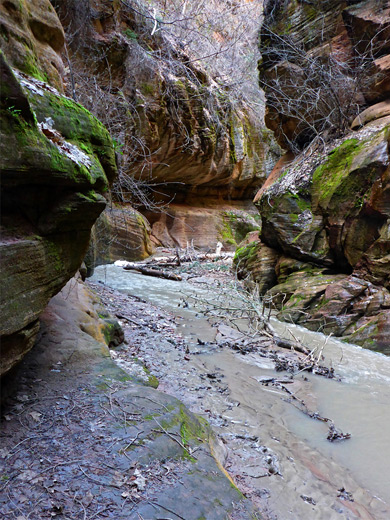
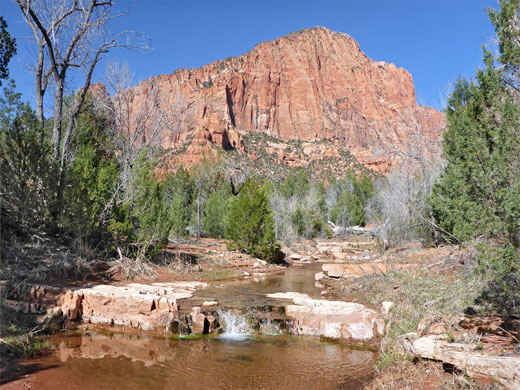
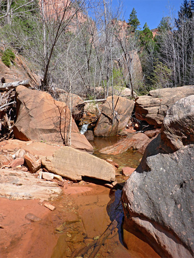
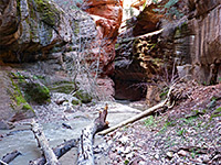
The first and most popular of the three maintained trails in the Kolob Canyons region follows the Middle Fork of Taylor Creek to Double Arch Alcove, a large overhang in the canyon walls, extravagantly colored by streaks of mineral-laden water, and sheltering hanging gardens of wildflowers. A lesser path forks off one mile along the trail, beside an old cabin, and curves round the end of a high ridge to the North Fork of Taylor Creek, a somewhat smaller drainage, not often visited, but offering similar red rock scenery. Two miles further up the scenic drive, the road curves around another side canyon, formed by the South Fork of Taylor Creek - a particularly beautiful gorge with sheer red cliffs towering above green trees and bushes on the valley floor, through which a small stream flows. Most people driving past seems to stop and take a photograph, but few venture up into the canyon; there is no official trail but a faint path follows close to the stream, and this makes for a very peaceful walk lasting a couple of hours.
Zion Tours
Explore the national park; Kolob Canyons or Zion Canyon.
Other Kolob Canyon Hikes
The other main path in the Kolob Canyons area is the La Verkin Creek Trail, starting at a high point along the road (Lee Pass); this heads south down the shallow ravine of Timber Creek then curves eastwards, round the far end of the Kolob cliffs and up a larger drainage, eventually reaching a gate at the edge of the park, adjoining private land. The usual destination, about half way along, is Kolob Arch, amongst the largest in the world, and reached after a moderately strenuous, one-way hike of 6.5 miles, so if visiting the arch some people will need to camp for at one night en route. Another path (the Hop Valley Trail) connects with the Kolob Reservoir Road; both form part of the 47 mile Zion Traverse. The scenic drive ends 1.5 miles beyond the La Verkin trailhead at an elevated parking area facing the huge red cliffs at the edge of the Upper Kolob Plateau - a particularly impressive sight, especially at sunset. The 0.6 mile, mostly level Timber Creek Overlook Trail leads south along the crest of a ridge to an alternative viewpoint.
Trails of the Kolob Canyons
All paths in the area.
Beartrap Canyon
★★★★★
★★★★★
8.8 miles, 1000 feet
Short but very pretty narrows leading to a waterfall; a remote tributary of La Verkin Creek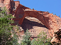
La Verkin Creek Trail to Kolob Arch
★★★★★
★★★★★
6.7 miles, 1000 feet
Long route alongside a permanent stream, over a saddle and up a larger, deeper canyon beneath tall red cliffs, then into an overgrown tributary ravine to the base of a huge sandstone arch 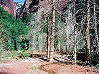
Taylor Creek, Middle Fork
★★★★★
★★★★★
3.1 miles, 700 feet
Most enclosed of the Finger Canyons of the Kolob; a narrowing, vegetation-filled valley containing a small stream, eventually becoming sheer sided, though gaining height steeply via boulders and falls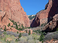
Taylor Creek, South Fork
★★★★★
★★★★★
1 miles, 200 feet
Faint path along the floor of a narrow, riparian canyon containing much vegetation and a variety of wildlifeAll Contents © Copyright The American Southwest | Comments and Questions | Contribute | Affiliate Marketing Disclosure | Site Map