South Fork of Taylor Creek, Zion National Park
Utah > Zion National Park > Kolob Canyons > Hiking > South Fork of Taylor Creek
South Fork of Taylor Creek
Path along the floor of a narrowing, riparian canyon containing much vegetation and a variety of wildlife. The upper end becomes deep and enclosed, gaining height via dryfalls and boulders
Length: 1 mile
Elevation change: 200 feet
Difficulty: Easy
Type: One way; unofficial trail
Usage: Low
Season: All year, though the canyon may be blocked by snow in winter
Trailhead: Parking area along Kolob Canyons Road
Rating (1-5): ★★★★★
Elevation change: 200 feet
Difficulty: Easy
Type: One way; unofficial trail
Usage: Low
Season: All year, though the canyon may be blocked by snow in winter
Trailhead: Parking area along Kolob Canyons Road
Rating (1-5): ★★★★★

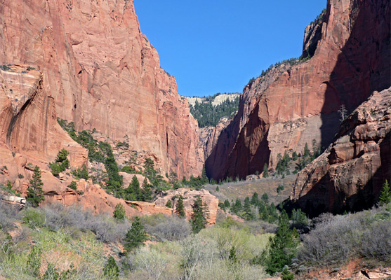
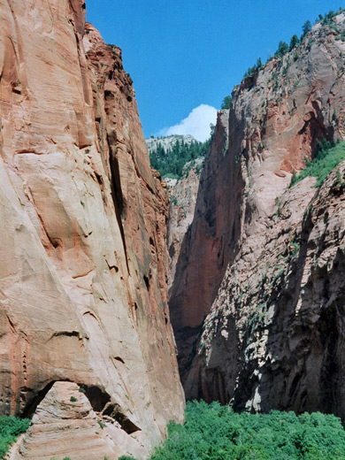
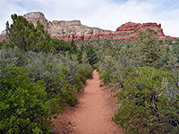
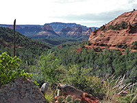
The South Fork of Taylor Creek flows through a secluded, shadowy canyon with the steep, high, red cliffs and upstream narrows that characterize many canyons in Zion National Park. Plant and animal life is particularly abundant owing to the year-round water supply, and solitude is another attraction as few venture into the canyon since there is no official trail, unlike the nearby Middle Fork of the creek.
There is however a rough path that follows the stream for a mile or so until the canyon narrows, starting just north of the road bridge over the creek; just opposite is a convenient parking area usually with several people taking photographs of the canyon, at this point quite wide and flat, bordered by two narrow, tapering cliffs (Paria Point and Beatty Point).
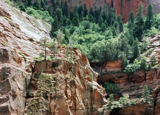
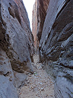
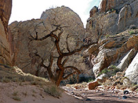
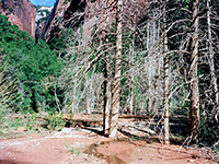
The path is occasionally steep and overgrown but presents little difficulty. It passes a variety of trees, bushes, wildflowers and cacti, and in spring at least there is much wildlife, including across deer, various small mammals, lizards and snakes, and numerous insects. After walking for 40 minutes through the riparian woodland Taylor Creek canyon starts to become quite narrow; trees cover all of the flat sandy floor while the small creek flows gently along, soon after which the drainage starts to gain height via dryfalls and piles of large boulders, marking the end of the easily-explored section.
There is however a rough path that follows the stream for a mile or so until the canyon narrows, starting just north of the road bridge over the creek; just opposite is a convenient parking area usually with several people taking photographs of the canyon, at this point quite wide and flat, bordered by two narrow, tapering cliffs (Paria Point and Beatty Point).
Taylor Creek Canyon
The path is occasionally steep and overgrown but presents little difficulty. It passes a variety of trees, bushes, wildflowers and cacti, and in spring at least there is much wildlife, including across deer, various small mammals, lizards and snakes, and numerous insects. After walking for 40 minutes through the riparian woodland Taylor Creek canyon starts to become quite narrow; trees cover all of the flat sandy floor while the small creek flows gently along, soon after which the drainage starts to gain height via dryfalls and piles of large boulders, marking the end of the easily-explored section.
South Fork of Taylor Creek - Similar Hikes
All Contents © Copyright The American Southwest | Comments and Questions | Contribute | Affiliate Marketing Disclosure | Site Map