Highlights:
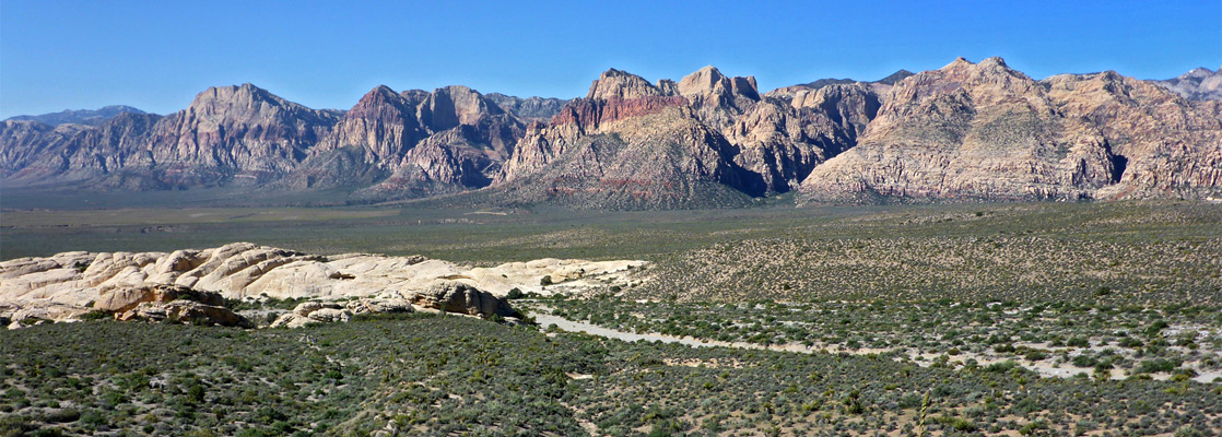
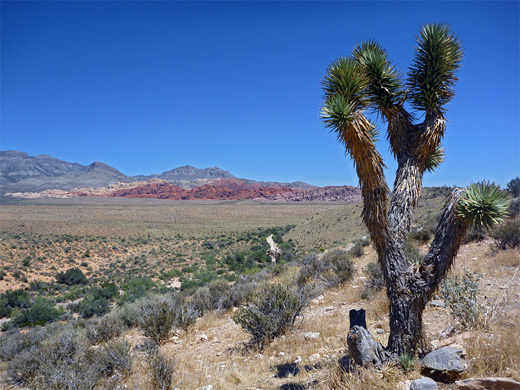
Eroded white, grey and red rock formations surrounded by Mojave Desert plains, along the east face of the Spring Mountains. The preserve is just west of Las Vegas, so receives many visitors, year round
Nearby town:
Las Vegas, 18 miles
Management:
Location:
36.161, -115.445 (Calico Hills)
Seasons:
All year
Rating (1-5):
★★★★★
Weather:


Red Rock Canyon is part of the California Deserts itinerary
Featured Hotel
Hampton Inn Las Vegas-Red Rock/Summerlin
 The Hampton Inn is one of the closest hotels to the Red Rock Canyon visitor center; 10 miles east along loop 215. Hot breakfast is complimentary
Check Rates
Red rocks feature prominently in place names of Southwest USA - New Mexico, Arizona and California each have a Red Rock State Park and there are several similarly named towns in these and other states. Nevada has at least three Red Rock Canyons; two are in sections of the Toiyabe National Forest near the center of the state but by far the most well-known is location is along the east side of the Spring Mountains - one of the ranges of hills that surround Las Vegas in most directions.
Just five miles from the edge of the city, the flat land rises to a great colorful escarpment, formed along a fault zone (the Keystone Thrust) with peaks over 8,000 feet, and including huge cliffs and ravines composed of bands of grey, white and red sandstone, all heavily eroded. The wide empty plains beneath the hills are studded with Joshua trees and other plants typical of the Mojave Desert, contributing to a most impressive spectacle.
The canyon is the largest of a dozen or more major ravines along the highest and most colorful section of the cliffs, which forms the most well-known part of Red Rock Canyon National Conservation Area. Facilities, including trailheads, overlooks, a visitor center and a scenic loop road are concentrated in an eight mile-long region towards the south end of the preserve, though the whole area is much more extensive, stretching over 40 miles; from the foothills of Mt Charleston around Hwy 156 in the north, to the remote Bird Spring Range in the south.

Red Rock Canyon Table of Contents
Red Rock Canyon FAQ
- Public land with scenic or ecological values, managed by the Bureau of Land Management rather than the National Park Service.
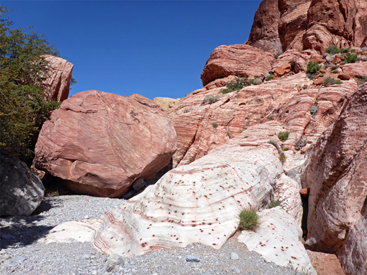
- The area is named for the Aztec sandstone, from the Jurassic period, the upper unit of which is stained deep red by iron oxide (hematite); these strata form the lower portion of cliffs of the NCA, and are exposed in other locations such as the Calico Hills.
- If just driving the 15 mile scenic loop and stopping at a few viewpoints, then one hour is needed but much better is to try a few short hikes, in which case three hours would be better.
- Icebox Canyon (1 mile, one way), Kraft Mountain (3 mile loop), Turtlehead Peak (2.5 mile, one way; gains 2,500 feet) and White Rock (6 mile loop).
- Yes, for driving the scenic loop - for entries between 8 am and 5 pm in the cooler seasons, between October 1st and May 31st. Reservations cost $20, the same as the normal entrance fee, and are good for a one hour arrival window.
- Hiking, rock climbing, horseback riding, biking, off-trail exploration, picnicking and photography.
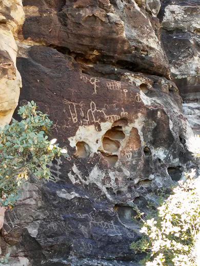
- Yes; locations include Petroglyph Wall near Willow Springs Picnic Area, and Gateway Canyon along the Kraft Mountain Loop. There are many dozens of rock art locations but most are not publicized.
- Red Rock Canyon NCA is much bigger, has many more trails, and is closer to Las Vegas, though the Valley is more photogenic, more compact and easier to explore. Both are very good!
Red Rock Canyon Tours
Hiking and e-bike tours of the canyons, from Las Vegas.
Red Rock Canyon Location
Map of Red Rock Canyon NCA, showing roads and trailheads.
Photographs
General views of Red Rock Canyon NCA.
Charleston Boulevard
The developed section of the National Conservation Area is easily reached, as one of the busiest east-west routes through the center of the city leads directly to the park entrance - this is Charleston Boulevard, which crosses Las Vegas Boulevard (The Strip) a few blocks beyond Stratosphere, northernmost of the large casinos. The look-alike suburbia extends for a long way, as the road passes miles of seemingly identical shops and houses, and finally a number of large, luxurious walled estates. More of these are under construction and the most recent development is now just a few miles from the mountains - properties here are highly desirable and enjoy sweeping views in both directions, since the whole city of Las Vegas is spread out to the east, and the cliffs and canyons are visible to the west. The park entrance is 15 miles from the Strip via Charleston Blvd, though the 20 mile alternative route along US 95 and the Summerlin Parkway might be quicker, since this has no traffic lights.
The Park
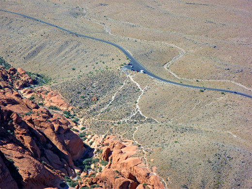
After being dead straight for 13 miles, Charleston Boulevard bends to the left, becomes Blue Diamond Road (State Route 159) and climbs into the foothills. It follows alongside the cliffs for a few miles while heading south, then curves back east towards the city. One elevated viewpoint (Red Rock Overlook) affords the best overall view of the cliffs, while for closer access there is the paved, 13 mile, one-way scenic drive (open from dawn to dusk, north to south), within the National Conservation Area boundaries. The area is administered by the BLM, although as with all other NCA sites, the National Park Service 'America the Beautiful Pass' is valid, and a yearly pass is also available ($50). The standard entry fee (2024) is $20 per vehicle. The park has a good visitor center, plus a museum, book store and gift shop. Backcountry camping is permitted for areas above 5,000 feet elevation (approximately 200 to 700 feet above the scenic drive), and there is one developed campsite, along a short side road forking south off Blue Diamond Road 2 miles east of the visitor center. This is open all year except from June to August when the weather is considered too hot for camping. Points of interest in Red Rock Canyon NCA include narrow canyons, seasonal waterfalls, petroglyphs and pictographs, while besides sight-seeing, the park is popular for hiking, rock climbing, canyoneering and mountain biking. ATVs are not allowed. Apart from the usual Southwestern creatures, wildlife in the area includes herds of wild burros, descendants of animals used by miners early last century.
Sites in Red Rock Canyon NCA
This is just a selection; the park has about two dozen overlooks and trails.
- Calico Hills - the hills are a large outcrop of eroded red Aztec sandstone, excellent for climbing. There are several overlooks, and trails for the more energetic. The top of the ridge - reachable by careful off trail scrambling - has good views over the colorful Calico Basin at the far side, and of all Las Vegas to the east - as ever the distinctive shapes of the casinos are clearly recognizable.
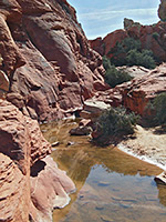
- Calico Tanks - the tanks (also known as tinajas) are natural cavities in the Aztec sandstone which hold water for some time after rainfall; they may be reached by a 1.2 mile trail starting at the parking lot at the north end of the Calico Hills.
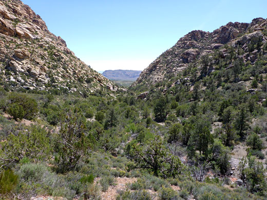
- Icebox Canyon - Icebox is one of many narrow canyons that drain the mountain slopes. A path leads up the drainage for about a mile, though more can be seen by scrambling off-trail, over boulders and up small dryfalls.
- La Madre Spring - this is found in a ravine at the base of La Madre Mountain; a fairly easy, 1.8 mile path leads to the waters, starting from the end of the spur road to Willow Spring picnic area.
- Lost Creek Canyon - this is the largest canyon through the cliffs, and it provides the only through route to the west side of the Spring Mountains. A 20 mile dirt track (requires 4WD) follows the streamway past more of the characteristic colorful, layered rocks, then across the western foothills to the desert town of Pahrump.
- Pine Creek Canyon - this pleasant canyon features a permanent stream, large shady trees and the remains of an old homestead, all accessed by an easy, 2.5 mile loop trail.
- Spring Mountain Ranch - historic ranch dating from 1876, adjoining pasture, woodland and a lake; managed by the Nevada Division of State Parks.
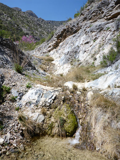
- Spring Canyon - a narrow, sheltered ravine containing a short trail that follows alongside the creek bed to the base of a (seasonal) 30 foot waterfall, Spring Canyon is dry during summer although the creek does flow year round in one short section, where the waters rise up in a narrow, overgrown channel, trickle down the hillside for several yards then sink below ground again.
Trails of Red Rock Canyon
Calico Tanks
★★★★★
★★★★★
1.2 miles, 360 feet
Seasonal pools amongst the red and white rocks of the Calico Hills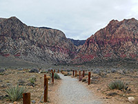
First Creek
★★★★★
★★★★★
1.1 miles, 180 feet
Tree-lined drainage containing a pool and seasonal waterfall, reached by an easy trail over a desert plain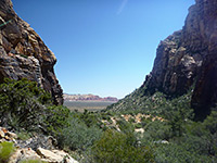
Icebox Canyon
★★★★★
★★★★★
1.1 miles, 400 feet
Deep, narrow, shady ravine through the Spring Mountains, containing boulders and dryfalls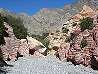
Kraft Mountain
★★★★★
★★★★★
3.1 miles, 590 feet (loop)
Loop around a summit in the Calico Hills, across open slopes and along a narrow ravine through colorful rocks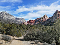
La Madre Spring
★★★★★
★★★★★
1.8 miles, 700 feet (to the stream)
Small spring above Red Rock Wash, near a waterfall, a stone cabin and an old mine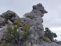
Mountain Spring Peak and Little Zion
★★★★★
★★★★★
4 miles, 1180 feet
High summit with panoramic views, and an elevated area of colorful sandstone formations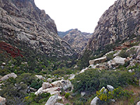
Oak Creek Canyon
★★★★★
★★★★★
1.1 miles, 250 feet
Easy path to the mouth of a narrow, quite overgrown canyon; an unofficial trail continues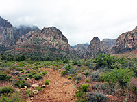
Pine Creek Canyon
★★★★★
★★★★★
2.5 miles, 200 feet (loop)
Boulder-filled ravine, the lower end reached by a popular trail alongside a bushy drainage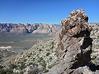
Turtlehead Peak
★★★★★
★★★★★
2.5 miles, 2000 feet
Testing trail to a detached summit of the La Madre Mountains; spectacular views of the desert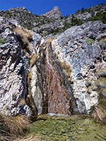
Waterfall Canyon
★★★★★
★★★★★
2.4 miles, 1200 feet
A shallow but steeply sloping ravine containing many pools and small waterfalls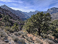
White Rock Loop
★★★★★
★★★★★
6.2 miles, 1070 feet (loop)
Circuit of a large white sandstone outcrop, encountering varied vegetation and rock formationsRed Rock Canyon Wildflowers
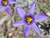
Photographs and descriptions of 250 flowering plant species found in the national conservation area; the varied habitats range from desert to mountains
Red Rock Canyon - Nearby Places
- Las Vegas (15 miles) - the City of Entertainment
- Mount Charleston (43 miles) - highest peak in the Spring Mountains
- Tule Springs Fossil Beds National Monument (20 miles) - gravelly plains and desert washes, site of Ice Age fossil discoveries
Red Rock Canyon - Similar Places
- Mojave National Preserve, California - Joshua trees and weathered cliffs
- Valley of Fire, Nevada - just 50 miles away, this park has several square miles of fantastic eroded rock formations
All Contents © Copyright The American Southwest | Comments and Questions | Contribute | Affiliate Marketing Disclosure | Site Map