Highlights:
The many roadside attractions in Mojave National Preserve, along Kelbaker Road, Cima Road, Morning Star Mine Road, Black Canyon Road and Lanfair Road - Joshua trees, cinder cones, sand dunes, granite peaks, rock formations and ruins

The most interesting direct road through the Mojave National Preserve starts in the north at exit 272 of I-15, 23 miles from the California-Nevada border, and heads southeast to Cima, south to Kelso, then exits the park near Granite Pass, where it meets I-40. The only other two paved routes into the northern section of the preserve are from Baker to Kelso, and from Wheaton Springs to Cima.
There are three major routes in the east, all mostly unpaved: Goffs to Ivanpah (Lanfair Road and Ivanpah Road), Essex to Mid Hills (Essex Road and Black Canyon Road), and a connecting route between the two (Cedar Canyon Road and Mojave Road).
All routes are shown on the national preserve map.
There are three major routes in the east, all mostly unpaved: Goffs to Ivanpah (Lanfair Road and Ivanpah Road), Essex to Mid Hills (Essex Road and Black Canyon Road), and a connecting route between the two (Cedar Canyon Road and Mojave Road).
All routes are shown on the national preserve map.
Mojave Table of Contents
Photographs
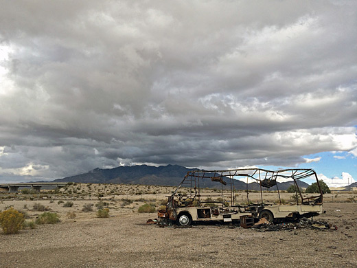
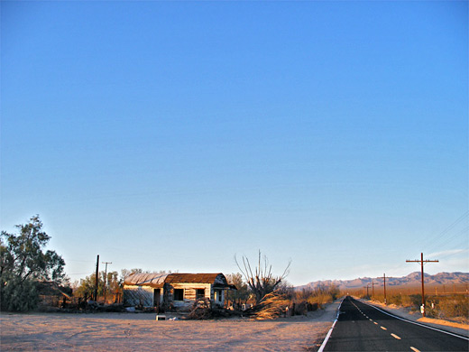
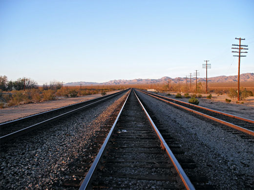
33 views of roads and landscapes.
Shadow Valley to Cima
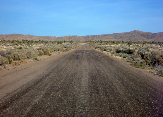
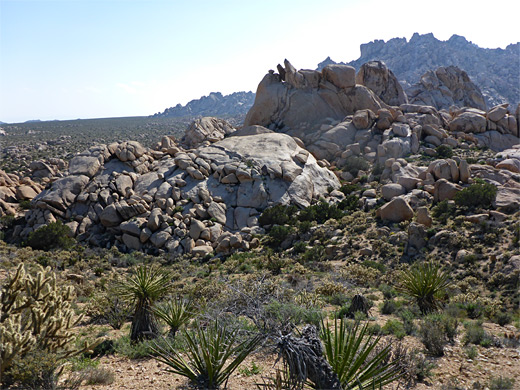
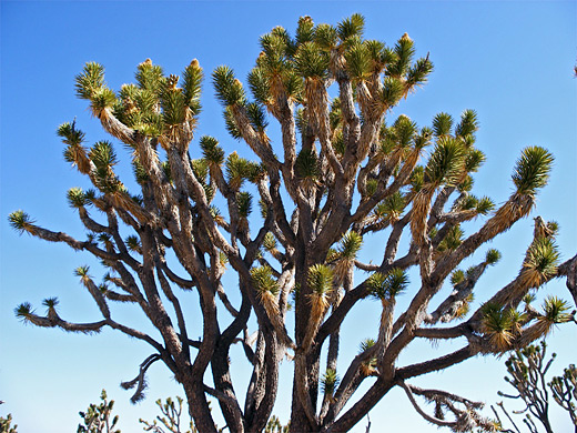
The route from I-15 exit 272 (Cima Road) begins by crossing Shadow Valley, a typically wide, flat Mojave Desert expanse with many Joshua trees. As the straight road climbs steadily towards the Ivanpah Mountains, gaining 1,300 feet in elevation, the trees grow larger and more densely, creating a forested vista equal to any in the more well-known Joshua Tree National Park, 100 miles south. As in the national park, the trees are interspersed with occasional rocky outcrops of large granite boulders, here mixed with patches of lava, which long ago flowed from Cima Dome (5,755 feet elevation), a perfectly round granite hill of volcanic origin a few miles southwest of the road.
Volcanic Features
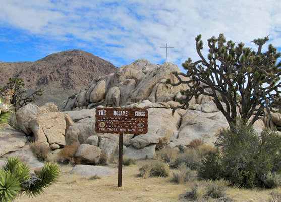
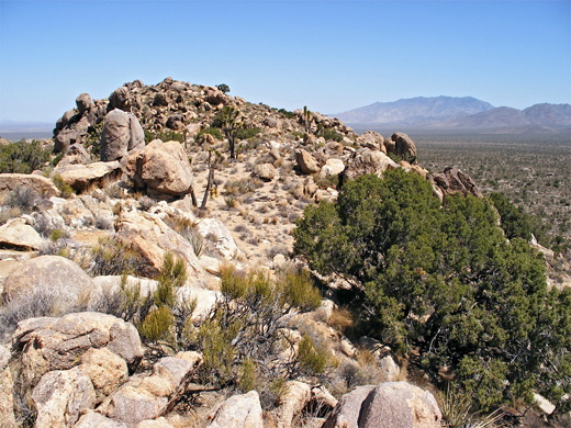
The dome is surrounded by various other eruptive features, and is close enough to the road for parts of it to be explored on foot. Nearby, one of the few maintained hiking trails in the preserve (the Teutonia Peak Trail) passes through the rather alien landscape of trees and boulders, then climbs to a summit. Nearly opposite the trailhead is the Mojave Cross, a memorial to WW1 soldiers, fixed to the top of an granite outcrop right beside the road. Lower in elevation, and 15 miles southwest, the Cinder Cone Lava Beds contain about 30 separate cinder cones of various types, a result of geologically recent (1,000 year old) volcanic activity, spread out over many square miles of older lava, but in an area away from paved roads which makes exploration difficult; the main approach is the 4WD Aiken Cinder Cone Mine Road, which begins from Kelbaker Road south of the formations.
Cima to Kelso
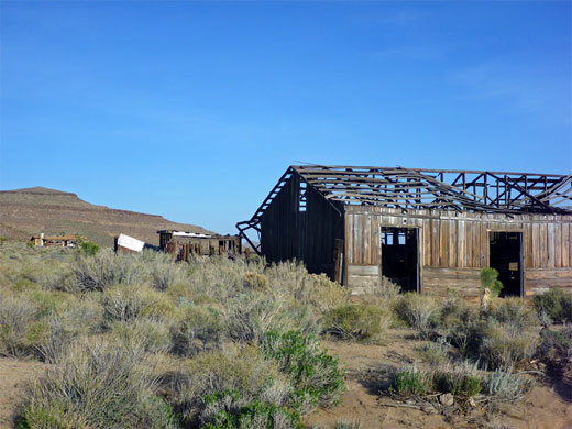
At Cima, the road is joined by the Morning Star Mine Road from Wheaton Springs, and a single route (the Kelso-Cima Road) continues through the desert. This is joined by a line of the Union Pacific railway, which then runs alongside for the next 19 miles, not passing much of immediate interest, as both begin a long but gradual descent to the next village, Kelso. There is not much more to Cima besides a collection of abandoned wooden buildings and a railyard; to the south lies a wide desolate valley with little vegetation.
Kelso
After a 1,500 foot drop in elevation from Cima, the railway reaches Kelso, where it turns west, away from the highway, en route to Barstow, and crosses the edge of a huge sandy area named the Devil's Playground - dunes and salt flats stretching over 40 miles and merging with several dry lake beds around Baker. Kelso is a small but very atmospheric settlement that looks as if it has been largely unchanged for many years, and it is easy to imagine old western movies being set there. The town is built around a large Spanish-style building lined by graceful colonnades and overlooked by several huge, flourishing palm trees; it was formerly a railway depot and now contains the new Mojave National Preserve visitor center. Kelso once had a population of 2,000, and was at one time both an important railway stop, providing water for steam trains on the Los Angeles - Salt Lake City route, and a center for iron ore mining, but is now nearly empty. Overgrown rail sidings and derelict buildings add to the air of faded prosperity. Many miles further north in Nevada, the railway passes the remote town of Caliente which has a similar depot.

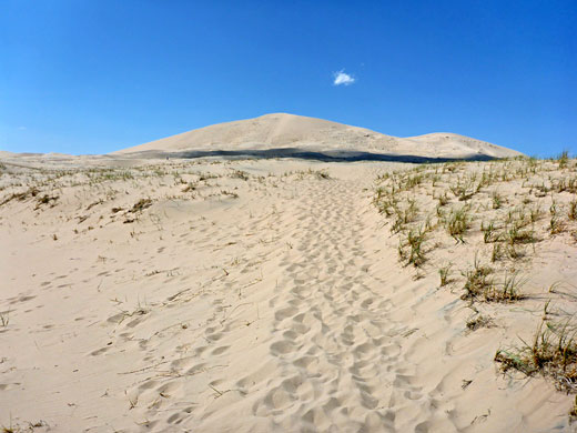
Kelso Dunes
Six miles further south, the highway (now the Kelbaker Road) comes close to the edge of the Kelso Dunes, a corner of Devils Playground with especially high and colorful sand dunes, which make a distinctive noise in windy weather as the sand slides downwards. They may be approached by a gravel track that leads past the dunes, then by a direct path into the heart of the sands. Walking on the soft surface is quite tiring, and it takes a relatively long time to hike a short distance. The sand in this area has an unusual pinkish hue, caused by particles of rose quartz.
Mojave Desert Tours
Guided tours of the desert, from Las Vegas.
Providence Mountains
Just north of the turn-off to the dunes, a rough road climbs eastwards towards the Providence Mountains State Recreational Area (currently closed due to budget constraints), which covers a small section of the rugged Providence Mountains; the central attractions are two cave systems (the Mitchell and Winding Stair caverns), which have a variety of depositional features. The caverns may also be reached by a better quality route (Essex Road) starting from interstate 40. Along here, the Black Canyon back-country road branches off northwards, past the three developed campgrounds in the reserve, at Hole-in-the-Wall, Mid Hills and Black Canyon; apart from these, free camping is allowed in most places, wherever rough tracks lead away from the main highways.
Granite Pass
South of the turn-off for Kelso Dunes, Kelbaker Road climbs once more, reaching 4,100 feet at Granite Pass, center of a scenic area of desert dotted with granite rock formations and enclosed by distant weathered cliffs. There are some good free places to camp, away from the main road and surrounded by pristine desert vegetation with various species of cacti and yucca. Six miles to the south, slowly-moving traffic on I-40 is just discernible, a gentle reminder of civilization in this otherwise empty and quiet land. On the far side of the interstate, Kelbaker Road continues to old Route 66 (the National Trails Highway), near Amboy.
Ivanpah Road
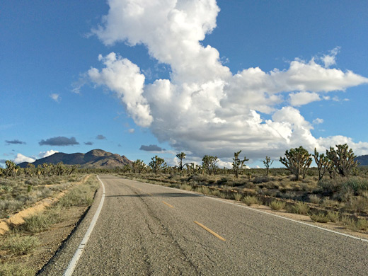
The northeast entrance to the national preserve is along Ivanpah Road initially, though most traffic soon forks off, on Morning Star Mine Road to Cima. Ivanpah Road continues, mostly unpaved, and provides access to many sites in the east. After the junction, the highway is dead straight for the next 6 miles across Ivanpah Valley, but becomes more winding once on the far side of the railway and the tiny, ruined settlement of Ivanpah. The pavement stops soon afterwards, replaced by good quality gravel, and the land rises as the road climbs towards a pass in the New York Mountains, where the surface is just a little bit bumpier. The vegetation hereabouts is dominated by Joshua trees and Mojave yucca. A few unsigned side tracks branch off into the mountains, while after the pass, Ivanpah Road descends, straightens and regains its smooth surface, now formed of hard pressed sand. Joshua trees still cover the surrounding flats, part of Lanfair Valley. Landmarks along this stretch include a working ranch, the scenic Crater Hills, an intersection with the 4WD Mojave Road and another turning (Cedar Canyon Road) that leads to the Mid Hills area; after this junction, the main route (now Lanfair Road) climbs through a low mountain range, becomes paved and exits the park several miles further at Goffs.
Cedar Canyon Road
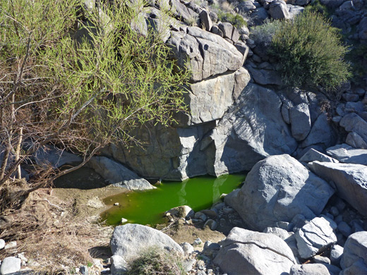
Cedar Canyon Road runs due west from the Ivanpah/Lanfair junction, over rather less scenic land with fewer Joshua trees and more empty, sandy expanses. It bends a few times and crosses a large wash, just after which is the trailhead for the short loop hike to Rock Spring, scenically situated in a narrow, granite canyon. Not far beyond, the road reaches a low saddle and descends into a shallow valley, running alongside a dry wash to a junction (with Black Canyon Road to the Hole-in-the-Wall area) then drops down a bit more steeply along the bigger ravine of Cedar Canyon through the Mid Hills, back to Joshua tree slopes on the far side, where the pavement returns and the road, now designated Mojave Road, meets the Kelso-Cima Road 5 miles south of Cima.
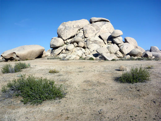
Black Canyon Road
Black Canyon Road starts in the north at an intersection with Mojave Road in the upper reaches of Cedar Canyon. It climbs a little side ravine to the extensive flatlands of Round Valley which are sprinkled with piles of big, whitish granite boulders, some close to the road, popular locations for primitive camping. There are several private inholdings in the valley, as is the case all over the national preserve. An equally good, maintained side road forks off west - this is Wild Horse Canyon Road, which enters the Mid Hills, passing several valleys and ridges and as well as one of the park's three maintained campgrounds. It rejoins Black Canyon Road in ten miles, after this route becomes temporarily more uneven and washboarded, descending a valley beside a sandy wash and crossing the streamway several times, then straightening once more as it enters the open landscape of Gold Valley.
The second intersection with Wild Horse Canyon Road is reached just after two short spurs, to the Hole-in-the-Wall campground and information center. This area is named for the large holes in the colorful volcanic cliffs that form a dramatic backdrop to the west; the best way to see the rocks close-up is via the Rings Loop Trail, which begins near the information center. The campground is very popular, all year, mostly with people traveling in RVs. The surroundings are certainly beautiful though elsewhere in the preserve are numerous other places suitable for primitive camping, for no charge and with no neighbors. Hole-in-the-Wall campground is in shadow in the evening due to the high cliffs to the west and is liable to be rather windy. The remaining ten miles of Black Canyon Road are paved; all is across open plains, descending very gradually, to the junction with Essex Road (which leads to the currently closed Providence Mountains State Recreation Area), from where the junction with I-40 at the southern edge of the national preserve is another ten miles south.
All Contents © Copyright The American Southwest | Comments and Questions | Contribute | Affiliate Marketing Disclosure | Site Map