Highlights:
The vast deserts of south California, from Death Valley to Anza Borrego, also including Joshua Tree, Palm Springs, the Salton Sea and the Mojave National Preserve, plus many lesser known sites
Type:
Loop, beginning at Las Vegas. Los Angeles would be an alternative start point
Length:
1,830 miles, 2,950 km
Duration:
11 days minimum; 15 days or more with optional side trips
Seasons:
Best for the relatively cooler seasons of winter, spring and late fall, since the whole area is commonly above 110°F for several months in summer. The ideal time would be early to mid spring since that is when most wildflowers bloom
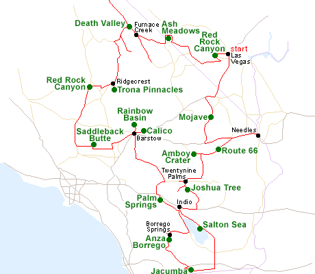
Map of the California Deserts Itinerary
Please refer to the disclosure notice for information about the affiliate (commissionable) links on this page.
Day 1 - Las Vegas to Needles, 190 miles
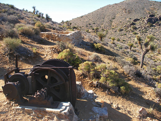
South of Las Vegas, I-15 soon enters empty desert, and an hour's drive reaches the north edge of the Mojave National Preserve, a very scenic region of sand dunes, isolated mountains, old mines, lava flows and Joshua tree forests. The night is spent at Needles, a small town beside the Colorado River.
Optional extra day: hiking in Mojave National Preserve
Day 2 - Needles to Twentynine Palms, 150 miles
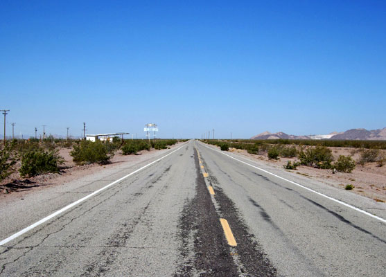
A brief journey back west on I-40 is followed by an atmospheric drive along the National Trails Highway - historic Route 66 - through more desert landscapes, also passing scattered volcanic relics including Amboy Crater. Hwy 62 south leads to Twentynine Palms, gateway to Joshua Tree National Park, and while most of the park is explored on the next day, one good trail (Fortynine Palms Oasis) starts right from the town center.
Day 3 - Twentynine Palms to Indio, 120 miles
All of the day is spent in Joshua Tree National Park, which has 100 miles of scenic roads but the landscape is best appreciated by hiking; suggested trails are Barker Dam, Lost Horse Mine and Ryan Mountain. The night is spent in Indio, near the southern park entrance.
Optional extra day: longer hikes in Joshua Tree National Park, including Lost Palms Oasis
Day 4 - Indio to Borrego Springs, 190 miles
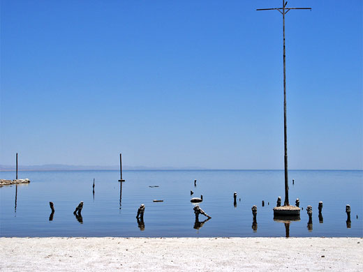
Hwy 86 is the main road south from Indio but CA 111 is less traveled and more scenic, running close to the east shore of the Salton Sea, near such unusual places as Bombay Beach and Slab City. South of the lake the land becomes temporarily irrigated and extensively farmed, but there is more empty scenery beyond - Jacumba Mountains and the Yuha Desert. From here, more backroads lead through the southern section of Anza Borrego Desert State Park.
Hotel: motel in Borrego Springs
Day 5 - Borrego Springs to Palm Springs, 100 miles
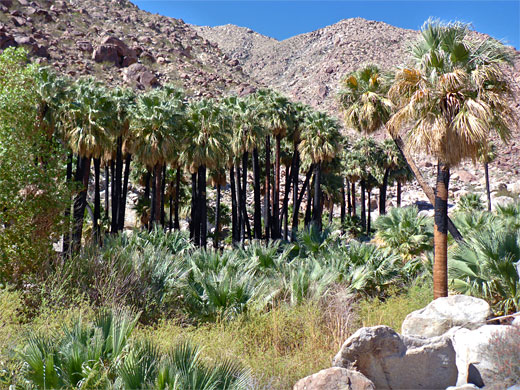
Photogenic places in the northwest and northeast of Anza Borrego Desert SP include Borrego Palm Canyon, Palm Wash slot canyons, Split Mountain and the Borrego Badlands. The arid landscapes are in great contrast to Palm Springs and the other upscale cities of the Coachella Valley, reached by a 70 mile drive north, partly along the west side of the Salton Sea.
Optional extra day: Palm Springs hiking - the Indian Canyons
Day 6 - Palm Springs to Barstow, 150 miles
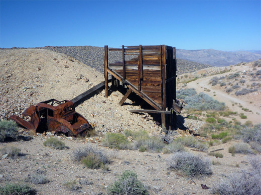
There is time in the morning to see a little of Palm Springs, before heading across the southern Mohave Desert to Barstow; two interesting sites nearby are the eroded ravines of Rainbow Basin and the partly restored ghost town of Calico.
Day 7 - Barstow to Ridgecrest, 180 miles
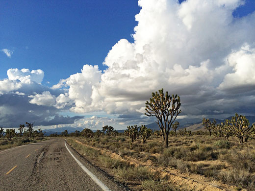
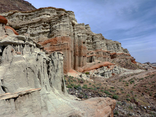
Mojave Desert attractions west of Barstow include Saddleback Butte, an isolated summit surrounded by Joshua trees, and the colorful, eroded cliffs of Red Rock Canyon. The nearby town of Ridgecrest provides a good choice of lodging.
Day 8 - Ridgecrest to Furnace Creek, 150 miles
The Trona Pinnacles rise above a vast dry lake bed a short distance east of Ridgecrest, while the main road continues north towards Death Valley National Park. Worthwhile destinations on this side (west) of the park are Darwin Canyon, Skidoo and Wildrose Point.
Hotel: The Ranch at Death Valley
Day 9 - Death Valley National Park (north), 130 miles
Recommended locations in the north section of Death Valley include Mosaic Canyon, the Stovepipe Wells Dunes, Titus or Fall canyons, Ubehebe Crater and Scotty's Castle.
Hotel: The Ranch at Death Valley
Day 10 - Death Valley National Park (south), 100 miles
Most of the well known Death Valley locations are in the south, especially Badwater, Artists Drive, Dante's View and Zabriskie Point, but there are dozens of other sites, reachable by short paths, longer hikes or back roads.
Hotel: The Ranch at Death Valley
Day 11 - Death Valley to Las Vegas, 180 miles
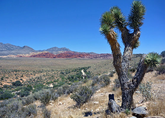
The return journey to Las Vegas is via Death Valley Junction and Pahrump, with a visit en route to the clear springs and streams of Ash Meadows National Wildlife Refuge. Just before entering the city, another short diversion passes Red Rock Canyon, featuring huge sandstone cliffs and colorful eroded rocks.
Optional extra day: Lake Mead and the Hoover Dam
All Contents © Copyright The American Southwest | Comments and Questions | Contribute | Affiliate Marketing Disclosure | Site Map