Highlights:
Spectacular views of beaches, cliffs, mountains and the Pacific Ocean, along Route 1 (Pacific Coast Highway) from San Diego near the Mexican border north to San Francisco. Route passes through Los Angeles, Santa Monica Mountains, Big Sur, Point Lobos, Carmel, Monterey and the Santa Cruz peninsula
Type:
One way, beginning at San Diego, or San Francisco
Length:
700 miles, 1,130 km
Duration:
8 days
Seasons:
All year
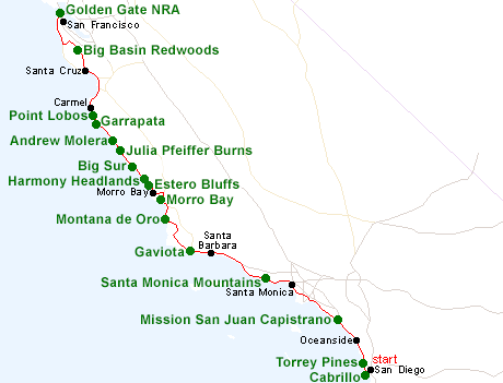
Map of the California South Coast Itinerary
Please refer to the disclosure notice for information about the affiliate (commissionable) links on this page.
Day 1 - San Diego to Oceanside, 55 miles
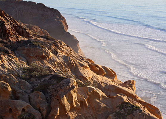
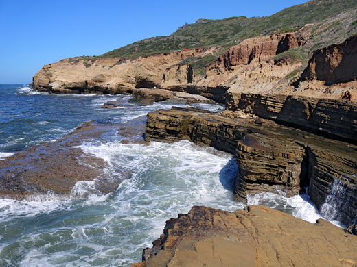
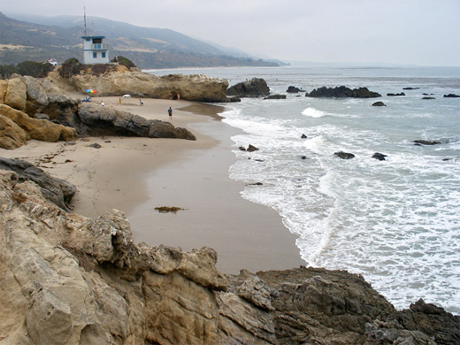
Although most of the coast around San Diego is privately owned, there are two scenic preserves near the city; one is Cabrillo National Monument, a rocky peninsula with cliffs, tidepools and a historic lighthouse. The other, 20 miles north, is Torrey Pines State Reserve, which contains beaches, eroded bluffs and a wide variety of coastal vegetation. There are also good tide pool areas near La Jolla. After Torrey Pines, the shore is sandy but developed all the way to Oceanside, at the north edge of the San Diego suburbs.
Day 2 - Oceanside to Santa Monica, 120 miles
Once through Pendleton Marine Base, I-5 reaches San Juan Capistrano (site of a historic Spanish Mission), at the south edge of greater Los Angeles, and where Highway 1 starts its long journey north, initially through a string of coastal resort cities including Laguna Beach, Newport Beach, Huntington Beach, and eventually Santa Monica, at the west end of old Route 66. Away from the coast, natural attractions in the Los Angeles area are rather limited, but Griffith Park in the Hollywood Hills is worth a diversion.
Day 3 - Santa Monica to Santa Barbara, 100 miles
Beyond Santa Monica, the next 30 miles of the Pacific coast are part of Santa Monica Mountains National Recreation Area, which features many pretty beaches plus inland hills and canyons. A leisurely day can be spent exploring the various sites, and then other sections of the shoreline along the journey to Santa Barbara, 40 miles further west.
Day 4 - Santa Barbara to Morro Bay, 130 miles
The Pacific coast takes on a more rugged appearance west of Santa Barbara and becomes less accessible, but three worthwhile destinations are Gaviota State Park south of Buelton, Pismo Dunes near Arroyo Grande and Montana De Oro State Park a few miles from Morro Bay - a charming town with a good selection of hotels. Morro Rock rises up nearby, a one mile walk from the town center.
Day 5 - Morro Bay to Carmel, 130 miles
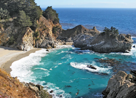
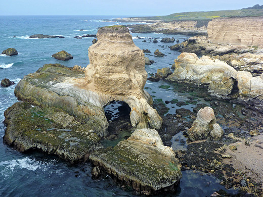
A short drive north of Morro Bay, pst two small states parks (Estero Bluffs and Harmony Headlands) reaches San Simeon, start of Big Sur - the most spectacular and remote section of the Pacific coast in south California. Highlights include the beach waterfall at Julia Pfeiffer Burns State Park, the empty beaches of Andrew Molera State Park and the rock formations at Garrapata State Park. The night is spent at Carmel, at the north end of the coast.
Optional extra day: a trip inland to the volcanic formations of Pinnacles National Monument
Day 6 - Carmel to Santa Cruz, 55 miles
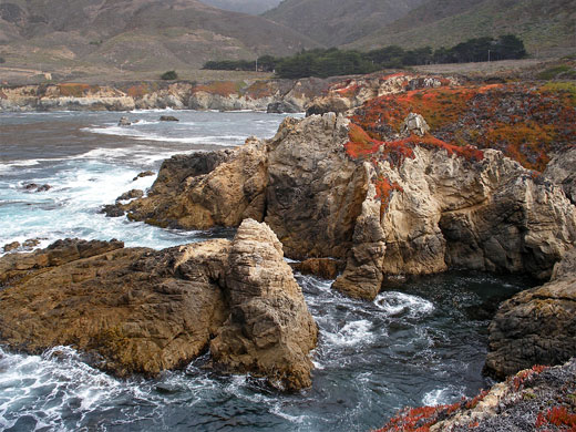
A little way back south of Carmel, Point Lobos State Reserve is perhaps the most beautiful, and varied section of the Big Sur area; a rocky promontory lined by tiny beaches, coves and sheer cliffs, home to a great variety of plants and animals. Continuing north, Hwy 1 passes through Monterey, Seaside and Watsonville, before arriving at Santa Cruz, on the north side of Monterey Bay.
Day 7 - Santa Cruz to San Francisco, 95 miles
Highway 1 stays close to the coast for the 70 miles to San Francisco, but a scenic diversion heads due north from Santa Cruz through the coastal redwood forests, the best of which are contained within Big Basin Redwoods State Park. After here, the coast road can be resumed at San Gregorio or Half Moon Bay, for the final drive north.
Day 8 - San Francisco, 20 miles
The final day is spent in and around San Francisco; many of the city's natural and historical sites are contained within Golden Gate National Recreation Area, including 59 miles of the coast either side of the famous Golden Gate Bridge.
Exploration of the Pacific shoreline can continue via the North Coast tour.
All Contents © Copyright The American Southwest | Comments and Questions | Contribute | Affiliate Marketing Disclosure | Site Map