Highlights:
Remote, lightly visited location centered on the remains of an ancient volcano; camping, rock climbing and hiking are the main activities. Most of the area is chaparral-covered mountains with eroded formations including spires, cliffs, smooth boulders, jagged ridges and talus caves. Explored by 13 trails
Nearby town:
Hollister, 30 miles (from the east entrance)
Management:
Location:
Seasons:
All year, but spring and fall are most popular. Summers are hot
Rating (1-5):
★★★★★

In a hilly, sparsely populated region of west central California, Pinnacles National Monument (elevated to a national park in January 2013) was established in 1908 to protect the remains of an ancient volcano, created 23 million years ago by an eruption associated with the San Andreas Fault, which today runs along a straight valley a few miles east.
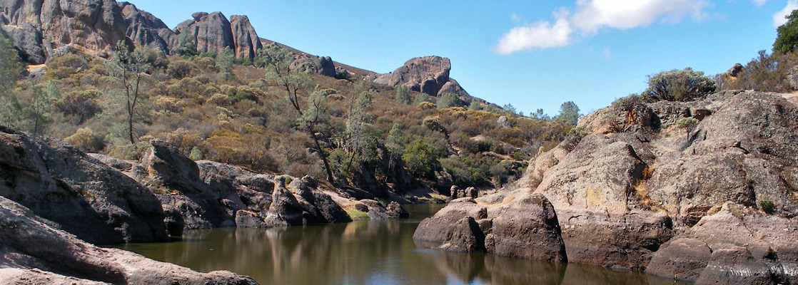
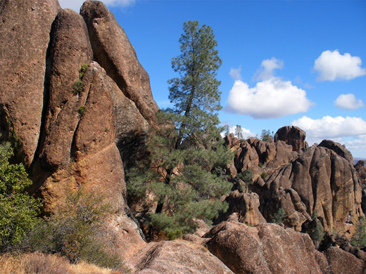
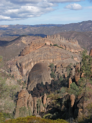
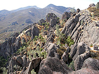
The park is centered on a range of rugged, chaparral-covered mountains topped by unusual eroded formations including spires, cliffs, smooth boulders, jagged ridges, and several talus caves, formed from narrow ravines partially filled by fallen rock. Interestingly, the original location of the volcano was 195 miles southeast, near modern day Los Angeles, but the rocks have been transported to their present setting by gradual movement along the fault.
The park is centered on a range of rugged, chaparral-covered mountains topped by unusual eroded formations including spires, cliffs, smooth boulders, jagged ridges, and several talus caves, formed from narrow ravines partially filled by fallen rock. Interestingly, the original location of the volcano was 195 miles southeast, near modern day Los Angeles, but the rocks have been transported to their present setting by gradual movement along the fault.
Pinnacles Table of Contents
Location
Map of Pinnacles National Park.
PDF format maps of Pinnacles National Park, from the National Park Service:
Photographs
13 views of Pinnacles National Park.
Introduction
Although close to Highway 101, the area is far removed from other more famous natural attractions in California and is surrounded by large tracts of nondescript farmland, so receives comparatively few visitors. Most come for camping, rock climbing (since the abrasive cliffs and boulders allow for many good, short routes), or to visit the two main caves; the various longer trails are quite lightly used, especially during the heat of summer when temperatures can exceed 100°F.
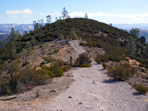
Off trail explorations are quite possible, and the park has a sizeable backcountry area, most of which is officially designated wilderness. Of other Southwest parks, Pinnacles is most similar to Chiricahua National Monument in Arizona, just with slightly fewer formations; the caves are interesting and unusual, and the place generally quiet and peaceful, though overall the scenery is not so special.
Approach Routes to Pinnacles NP
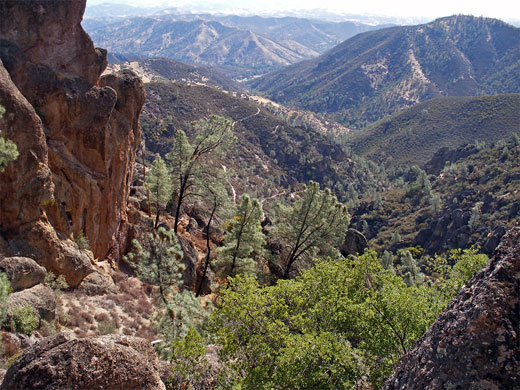
The towns nearest to Pinnacles National Park are all small places on the west side, along US 101: Gonzales, Soledad, Greenfield, King City, and none offers many facilities. Away from the highway, the roads pass through quiet farmland, occupying valleys between low, rounded hills, all covered by short, brownish grass and with only scattered trees, houses and livestock to interrupt the empty, rolling landscape. The national park has two entrances; road 146 approaches from both west and east but does not cross the mountains, so there is no through route. The distance by car from one side to the other is 56 miles and the drive takes around 2 hours, since the roads are narrow and winding in places. A hike between the two entrances also takes around 2 hours and passes through the best scenery, found in the mountains occupying the middle of the park - known as the High Peaks, or the Pinnacle Rocks. The east side approach road, along Bear Gulch, is the most used as this passes the majority of the facilities; the west entrance (Chaparral) has just a ranger station plus parking, and is reached by a narrow, 12 mile road from Soledad. In some places this reduces to a single carriageway, and the route is not recommended for RVs or other large vehicles. From roads end, 3 trails depart to the north, west and east; the most popular routes are the Juniper Canyon Trail to the High Peaks, and the Balconies Trail which leads to volcanic rocks and a talus cave.
Bear Gulch
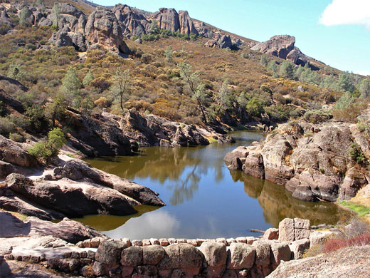
The eastern access road (CA 146) branches off CA 25, 30 miles south of Hollister, and leads up a wide, partly wooded valley alongside Bear Creek, past a privately operated campground that offers drinking water, hot showers and even a swimming pool. Deer are often spotted walking over the site, and the place is clean & pleasant. The mountains are visible to the west though they seem unremarkable from a distance as the volcanic formations are hidden behind more conventional rocks. The road bends around a side canyon and ends next to the visitor center, just as the main valley (Bear Gulch) starts to become relatively narrow. The center has exhibits, a small selection of books for sale, a public telephone, and flashlights for use in the caves. The surrounding vegetation is typical of the chaparral zone, mostly small oak trees and bushes, reflecting the low elevation, moderate rainfall and long hot summers of this part of California. In spring though, the area bears many species of wildflowers, and this is the time that most people visit. The main hiking area is to the west, further along the canyon - within 2 miles are Bear Gulch Cave, Bear Gulch Reservoir, and many rock climbing sites, while 2 miles further are the extensive formations of the High Peaks. See the hiking index for more details of the various trails.

Trails of Pinnacles National Park
All trails in the national park
Featured Pinnacles Hike
High Peaks Trail
★★★★★
★★★★★
6 miles, 1500 feet (loop)
The main route into the high mountains, passing through the center of the largest volcanic formations around Hawkins Peak, is a moderately difficult hike that has excellent views for most of its lengthPinnacles - Nearby Places
- Point Lobos State Natural Reserve (75 miles from the east entrance) - rocky peninsula with abundant wildlife, at the north end of Big Sur
Pinnacles - Similar Places
- Granite Mountain, Arizona - hill near Prescott covered with large granite boulders
- Joshua Tree National Park, California - different vegetation but the same type of eroded boulders and cliffs
All Contents © Copyright The American Southwest | Comments and Questions | Contribute | Affiliate Marketing Disclosure | Site Map