Highlights:
Scenic loop through the western San Juan Mountains, via Durango, Mancos, Dolores, Placerville, Ridgway, Ouray and Silverton, plus a spur to Telluride. The road reaches a high point of 11,018 feet at Red Mountain Pass
Length:
245 miles

The loop, known as the San Juan Skyway, can be driven in half a day but it is well worth spending at least one night en route, either in one of the small towns or camping free in the surrounding national forest.
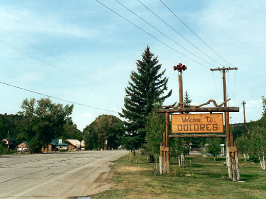
Dolores
Starting at Cortez, the main town in Montezuma County in the southwest corner of Colorado, highway 145 begins to climb gently into the scrub covered San Juan foothills and soon arrives at Dolores, a small but lively town next to the Dolores River in quite a narrow ravine. This canyon runs northwest for many miles and becomes much deeper, cutting into red layered rocks similar to those of the canyonlands of southeast Utah, and eventually meets the Colorado River near Moab. After Dolores, the highway, which is a wide, fast road most of the way, follows the wooded Upper Dolores River valley and gains height steadily while steep, rocky mountains of increasing height rise at either side. At lower elevations, the rocks are still sedimentary, red/orange in colour, as this region lies at the northeast corner of the Colorado Plateau, but at higher elevations these are replaced by the metamorphic rocks of the San Juan range. CO 145 crosses the 10,222 foot Lizard Head Pass and drops down into the top end of the San Miguel River valley, which forms a box canyon since the upper end rises abruptly, surrounding the valley floor on three sides by high cliffs and crags, an inspiring setting for the historic town of Telluride.
Telluride
Telluride is one of Colorado's major ski centers, receiving 300 inches of snowfall each year, and it is the snow and past glaciation that has helped to shape the land all around. The town sits amid typical high mountain scenery of steep, forested hillsides, sharp grey peaks, scree-covered slopes and smooth summits high above the treeline. Telluride is rather commercially-orientated, extremely clean, filled by expensive designer shops and with a 15 mph speed limit. The areas east of the center are a little more atmospheric and contain some old, unrestored buildings and a working mine. From here begins the hiking/jeep trail to Bridal Veil Falls and beyond.
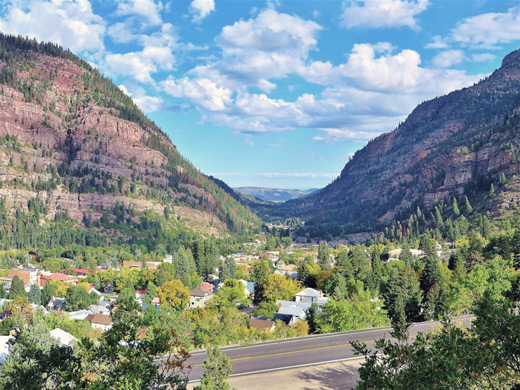
Ouray
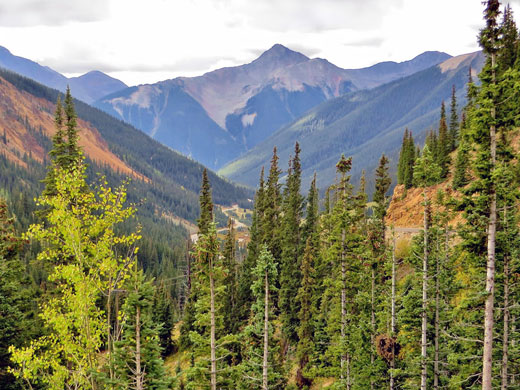
West of Telluride, CO 145 follows the San Miguel River downstream through another steep valley clad in thick forests of fir and aspen, as far as Placerville, then CO 62 heads east around the north edge of the San Juan range, through temporarily more open lands and meets US 550 just after Ridgway. This road runs south for 82 miles to Durango, through the heart of the mountains, and the next stretch has the most dramatic scenery of all. The first town is Ouray, squeezed onto a flat valley floor just half a mile across, enclosed by precipitous 2,000 foot slopes at each side. Ouray has two natural features of note, the Hot Springs, some of which are now incorporated into a municipal bathing house, and Box Canyon Falls ($7 entry in 2024), where a tributary of the Uncompahgre River flows over a dramatic, enclosed waterfall.
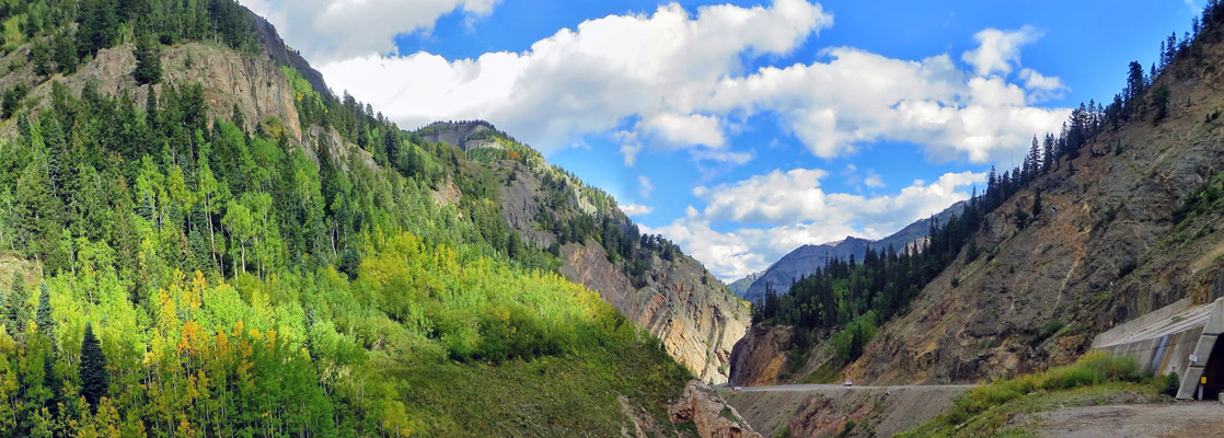
Million Dollar Highway to Silverton
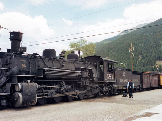
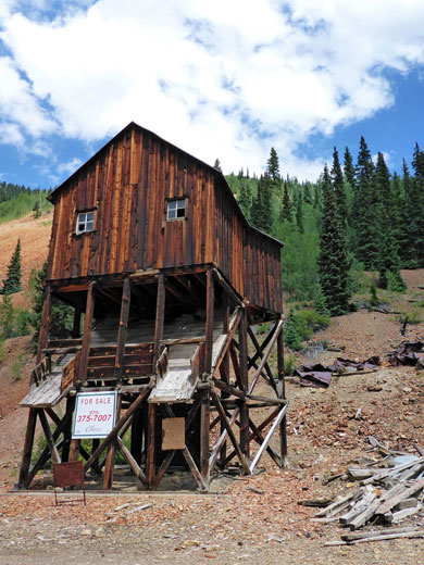
South of Ouray the road, now known as the Million Dollar Highway, becomes rather precarious as it climbs sharply and winds across the face of near vertical slopes. On the right side is a long drop to the rocky canyon floor, where a stream rushes over large boulders and broken trees, residue from the spring snowmelt. The road peaks again at Red Mountain Pass, 11,018 feet, center of a mineralized area (Red Mountain Mining District) with countless old silver and gold mines - several entire mountains here are deep red because of their high metal ore content, and all around are old shafts, spoil heaps, 4WD tracks and ruined wooden buildings, a colorful and unusual scene. From here the road descends a little, past trailheads to such places as Ice Lake Basin and Porphyry Basin, to Silverton, a similar historic town to Telluride but more interesting. It is also rather commercial, catering especially to the upmarket biker community, and like all towns hereabouts has a strictly enforced 15 mph speed limit. Silverton has many well preserved buildings from the 1870s, including the railway station, terminus of the steam trains from Durango. Most of the back streets are still unpaved, flanked by authentic old houses.
Durango
Silverton is a peasant town and also has great mountain peaks rising high above, though without Telluride's majestic box canyon location. To the south, the road climbs once more over Moles Pass (10,910 feet), through hills now less spectacular and less rugged, with grassy sides and gentler slopes. Several lakes are found along the route, and all are popular locations for fishing and camping. The hills start to recede as US 550 joins the Animas River, which it follows all the way to Durango.
All Contents © Copyright The American Southwest | Comments and Questions | Contribute | Affiliate Marketing Disclosure | Site Map