Buena Vista Peak Trail, Kings Canyon National Park
California > Kings Canyon National Park > Grant Grove > Hiking > Buena Vista Peak
Buena Vista Peak Trail
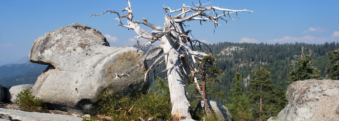
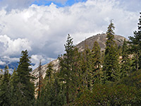
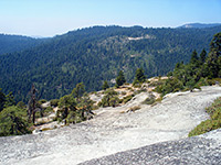
Treeless, granite summit, reached by a short trail along a partly forested ridge; views over a large area of mountains and wooded valleys
Length: 0.8 miles
Elevation change: 420 feet
Difficulty: Easy
Type: One way
Usage: Light
Season: Spring, summer, fall
Trailhead: Along the Generals Highway (CA 198), 4.7 miles from the CA 180 junction
Rating (1-5): ★★★★★
Elevation change: 420 feet
Difficulty: Easy
Type: One way
Usage: Light
Season: Spring, summer, fall
Trailhead: Along the Generals Highway (CA 198), 4.7 miles from the CA 180 junction
Rating (1-5): ★★★★★

Although the full splendor of the granite landscapes of the Sierra Nevada is only apparent above the treeline, over 9,000 feet, there are many rocky outcrops at lower elevations, and the Generals Highway (CA 198) between Kings Canyon and Sequoia national parks passes close to several granite domes whose summits can be reached by maintained trails, namely Big Baldy, Little Baldy, Sunset Rock, Moro Rock and Buena Vista Peak.
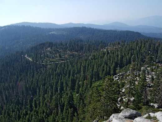
This latter has the easiest trail, just 0.8 miles up a gentle, partly wooded slope to the 7,605 foot peak, from where a sizeable area of mountains and canyons is in view, from the Central Valley in the west across to the Great Western Divide in the east. The trail begins at a small layby on the west side of the Generals Highway nearly opposite the larger parking area for Kings Canyon Overlook, and 4.7 miles from the 198/180 junction.
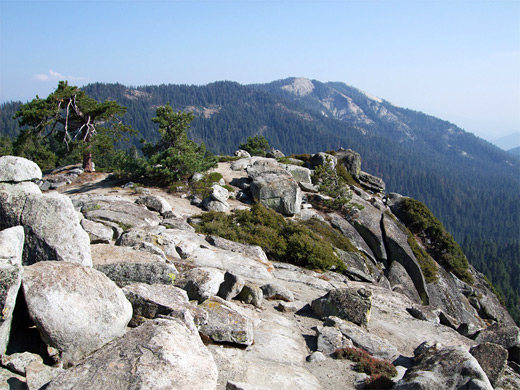
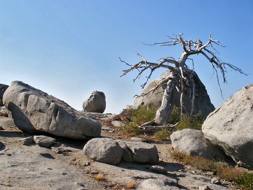
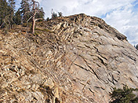
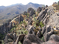
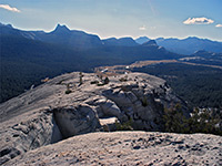
The trail to Buena Vista Peak crosses a thin belt of pine/fir woodland then follows a granite ridge dotted with groups of large rounded boulders, where the route is marked by cairns. The views are good already, down to the highway several hundred feet below and to the high Sierra on the horizon. The peak is visible ahead, above a steeper, tree-covered slope; the path curves to the left then zig-zags up the hillside to the summit, which is formed of smooth, glacier-polished granite topped by several more of the circular boulders. There are no trees to block the near 360° panorama - places in view include Redwood Canyon directly below, Park Ridge to the north, Big Baldy to the south and numerous mountains to the east.
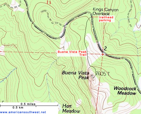
This latter has the easiest trail, just 0.8 miles up a gentle, partly wooded slope to the 7,605 foot peak, from where a sizeable area of mountains and canyons is in view, from the Central Valley in the west across to the Great Western Divide in the east. The trail begins at a small layby on the west side of the Generals Highway nearly opposite the larger parking area for Kings Canyon Overlook, and 4.7 miles from the 198/180 junction.
Buena Vista Peak Trail
The trail to Buena Vista Peak crosses a thin belt of pine/fir woodland then follows a granite ridge dotted with groups of large rounded boulders, where the route is marked by cairns. The views are good already, down to the highway several hundred feet below and to the high Sierra on the horizon. The peak is visible ahead, above a steeper, tree-covered slope; the path curves to the left then zig-zags up the hillside to the summit, which is formed of smooth, glacier-polished granite topped by several more of the circular boulders. There are no trees to block the near 360° panorama - places in view include Redwood Canyon directly below, Park Ridge to the north, Big Baldy to the south and numerous mountains to the east.
Buena Vista Peak Topographic Map
Buena Vista Peak - Similar Hikes
All Contents © Copyright The American Southwest | Comments and Questions | Contribute | Affiliate Marketing Disclosure | Site Map