Highlights:
Relatively short, little known river flowing through a desert canyon, from Alamo Reservoir to Lake Havasu on the Colorado River. Surrounded by unspoilt desert landscapes
Nearby town:
Lake Havasu City, 20 miles
Management:
BLM
Location:
34.295, -114.087 (west end)
Seasons:
All year
Rating (1-5):
★★★★★

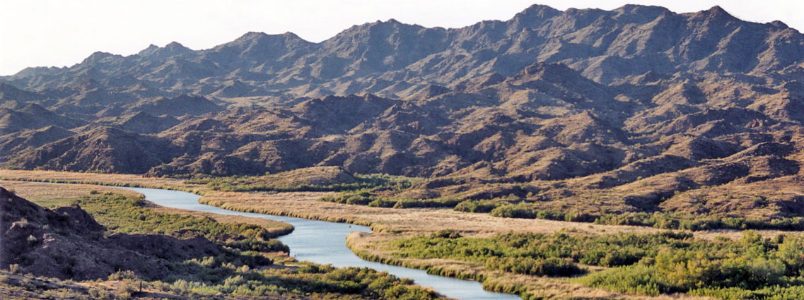
Named after an early explorer of the region, Bill Williams is a relatively short but scenic and interesting river in a little-known area of Arizona - it flows from Alamo Reservoir, in Alamo Lake State Park, through the wild Buckskin Mountains in the west central part of the state and joins the Colorado River at Lake Havasu, just above Parker Dam.
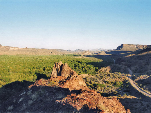
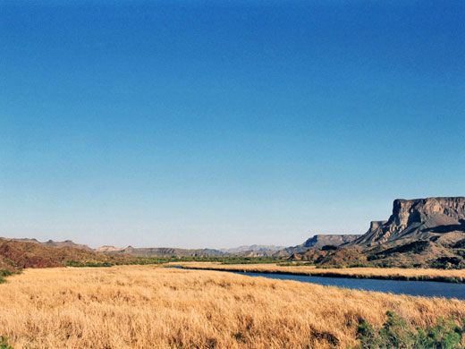
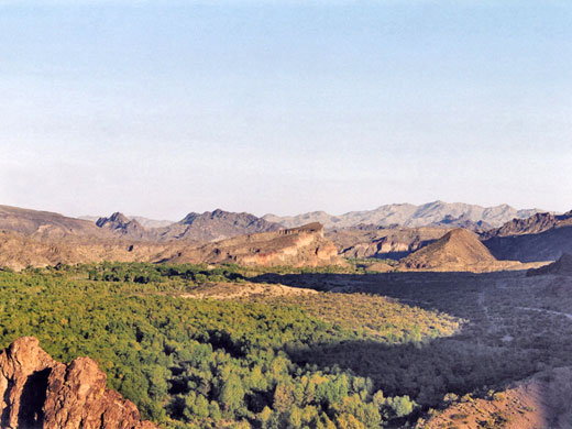
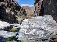
The lower stretches, reachable by road, are wide, and the river meanders across a tree-lined valley, protected as a National Wildlife Refuge mainly because of the many species of birds found there. The upper part is rather different as here the waters flow through a narrow, pathless canyon where sheer cliffs and rocky terraces alternate with sandbanks along the edge while deep pools and occasional small cascades are found along the streamway, and so exploring the river can involve an easy walk around the NWR or a rather more strenuous hike through the Sonoran desert scenery of the upper gorge.
The lower stretches, reachable by road, are wide, and the river meanders across a tree-lined valley, protected as a National Wildlife Refuge mainly because of the many species of birds found there. The upper part is rather different as here the waters flow through a narrow, pathless canyon where sheer cliffs and rocky terraces alternate with sandbanks along the edge while deep pools and occasional small cascades are found along the streamway, and so exploring the river can involve an easy walk around the NWR or a rather more strenuous hike through the Sonoran desert scenery of the upper gorge.
Bill Williams River Table of Contents
- Photographs
- The national wildlife refuge
- Approach to the upper river canyon
- Hiking; Ives Wash and the upper river canyon
- Nearby places
- Similar places
Photographs
Bill Williams River Canyon and Ives Wash.
Bill Williams River National Wildlife Refuge
After Parker Dam, AZ 95 turns due east for a while and winds above several rocky coves, passing some exclusive new property developments then drops down towards the estuarine mouth of the river. Where it meets Lake Havasu the land is quite level, with large areas of reeds, grasses and mud flats - perfect waterfowl habitat. There is a good overlook of the whole site just after the bridge, and a gravel road follows south of the river for 3 miles, initially up and down several steep ravines then across flatter ground, and has views over the cottonwood and willow-filled valley and the dark, twisted, metamorphic rocks at either side. Floods in 1993 washed out the last few miles but there is still plenty to see. The only other access is to the middle section, via the Swansea Mine Road that starts from AZ 72 in the south and leads to the Swansea Wilderness, in which is found one of the best preserved ghost towns in the state. Several other dirt tracks branch off, ending near to different parts of the river.
Approach to the Upper River Canyon
The Bill Williams River begins at Alamo Reservoir, 25 miles due east of the end of the track into the National Wildlife Refuge, but 108 miles away by paved road; the route is along AZ 95, AZ 72, US 60 and finally the Alamo Lake Road, which leaves US 60 at Wenden, crosses the Harcuvar Mountains and the Butler Valley, rounds the edge of the Buckskin Mountains then descends towards the reservoir. A day use fee of $7 (2023) is required as this area is within state park. The main road leads directly to the dam at the southwest corner of the reservoir, below which the river begins, and although the last section is private, blocked by a gate with no trespassing sign, foot traffic is allowed. A hike down the canyon can last from two hours to two days.
Bill Williams River - Hiking
Bill Williams River Canyon and Ives Wash
★★★★★
★★★★★
Up to 5 miles, 300 feet
Off trail walk to a cliff-bound canyon, and a narrow tributaryBill Williams River - Nearby Places
- Alamo Lake State Park (30 river miles from Lake Havasu) - distant reservoir at the head of the river
- Lake Havasu (20 miles) - popular lake on the Colorado River, enclosed by barren mountains
Bill Williams River - Similar Places
- Agua Fria National Monument - river canyon in the high desert
- Kaiser Spring Canyon - warm spring and a seasonal river, at the edge of the Sonoran Desert
All Contents © Copyright The American Southwest | Comments and Questions | Contribute | Affiliate Marketing Disclosure | Site Map