Highlights:
Tranquil lake with rugged, desert surroundings - popular for fishing, camping and exploring the surrounding cactus-covered hills
Nearby town:
Wickenburg, 80 miles
Management:
Location:
Seasons:
Winter, spring and fall - this area is very hot in summer
Rating (1-5):
★★★★★

Alamo Lake is part of the Arizona Deserts itinerary
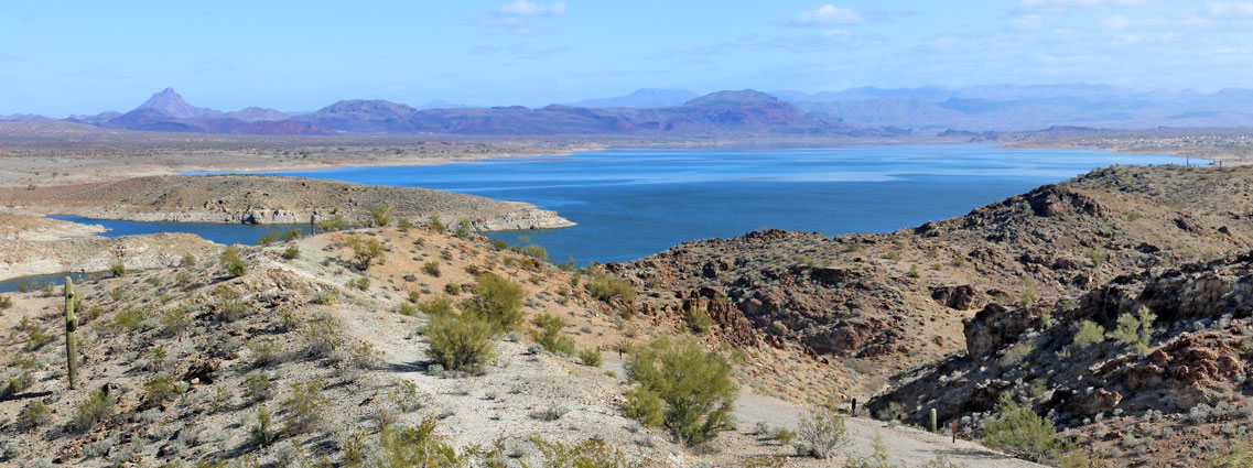
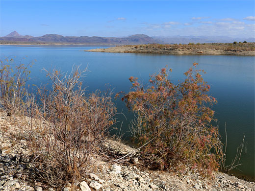
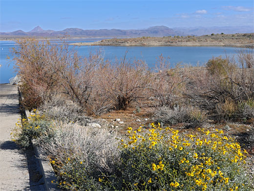
Despite its remote location, Alamo Lake State Park receives relatively large numbers of visitors in the mild seasons of spring, winter and fall, mostly because of the good fishing it offers - the park contains the southern end of Alamo Lake, in which bass and catfish are especially plentiful. The lake, or reservoir was formed in 1968 by the construction of Alamo Dam for flood control purposes on the Bill Williams River, and is now the fifth largest in Arizona, though as with all Southwest lakes, the surface area can vary a lot from year to year, depending on how much rain falls.
The lake is enclosed to the south, west and north by low, barren, stony hills and beyond by mountainous wilderness areas, and although not especially interesting itself, the state park is a good place for a few days relaxation, or as a base from which to explore the surrounding lands; the hills are crossed by many 4WD tracks, and are home to varied desert plant and animal life.
The lake is enclosed to the south, west and north by low, barren, stony hills and beyond by mountainous wilderness areas, and although not especially interesting itself, the state park is a good place for a few days relaxation, or as a base from which to explore the surrounding lands; the hills are crossed by many 4WD tracks, and are home to varied desert plant and animal life.
Alamo Lake Table of Contents
Photographs
General views, wildflowers.
Alamo Lake Road
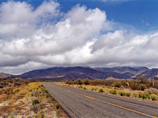
The desert setting and low elevation (1,230 feet) result in uncomfortably hot conditions in summer. The best time to visit Alamo Lake State Park is during spring because of the profusion of wildflowers and cactus blooms beside the lake and in the desert around the 33 mile approach road, which starts at the little, rather forlorn town of Wenden on US 60. The route heads due north, climbing gradually into the Harcuvar Mountain range, and soon enters a very fine region of unspoilt Sonoran Desert habitat. The hills contain a few mines and rough tracks, but once past them and into the wide Butler Valley beyond, the land is completely undeveloped with many flowers and cacti including numerous large, healthy saguaro; the long straight road running through and distant rocky mountains all around make for a perfect Arizona scene. Some of the plants occur in patches, depending on the elevation, most noticeably purple owls clover, yellow brittlebush and orange California poppies.
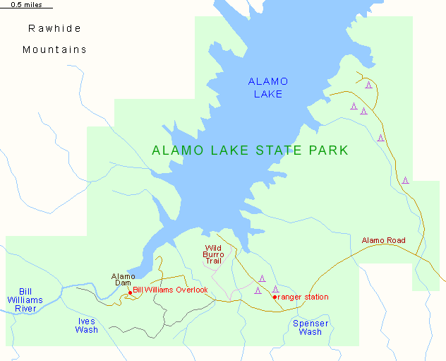
The State Park
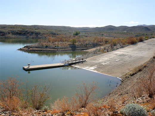
At the far side of the valley, the road curves around the edge of the Buckskin Mountains and gradually descends towards the lake. There are many options for free camping on the hillsides around the last few miles before the state park boundary, but once inside this is only permitted at the designated sites, for appropriate payment. The main route leads to the dam and an overlook just before; the dam is not so spectacular, just a wide stone embankment, but the lake looks nice, winding eastwards between distant shores and even more remote hills in the distance. The very end of the road is private but open to foot travel, and from here begins the off-trail hike to Bill Williams River Canyon and Ives Wash. Two other side roads end at the lakeshore - the main one (Lakeshore Drive), just after the crossing of Spenser Wash, leads to a campsite (which is not so near the water), picnic area, general store, ranger station and boat launch. The other, longer route (Cholla Road), branching off soon after the park entrance, follows another wash, past several more camp areas, to smaller launch ramp. Cross-country hiking is possible in many areas, and there are three short maintained paths - Wild Burro Trail (0.6 miles) links the main road to the nearby launch ramp, mostly following an exposed ridge, while the 0.4 Crosscut Trail connects to one of the camp sites, and the 0.1 mile Rattlesnake Overlook Trail climbs to a minor summit.
Alamo Lake - Hiking
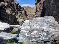
Bill Williams River Canyon and Ives Wash
★★★★★
★★★★★
Up to 5 miles, 300 feet
Off trail walk to a cliff-bound canyon, and a narrow tributaryAlamo Lake - Nearby Places
- Bill Williams River - little known river flowing through a desert canyon
- Kaiser Spring Canyon - narrow ravine and a warm spring
Alamo Lake - Similar Places
- Bartlett Reservoir - lake with desert and mountain scenery
- Lake Pleasant - popular lake in the Sonoran Desert west of Phoenix
All Contents © Copyright The American Southwest | Comments and Questions | Contribute | Affiliate Marketing Disclosure | Site Map