Home
|
Parks
|
Trails
|
Plants
|
Canyons
Maps
|
Landscapes
|
Site Map
|
Whats New?
|
More...
×
General Pages
Home
Parks
Trails
Plants
Slot Canyons
Maps
Landscapes
Itineraries
Site Map
What's New?
More pages...
States
Arizona
California
Colorado
Idaho
Nevada
New Mexico
Oregon
Texas
Utah
Wyoming
MENU
ARIZONA
CALIFORNIA
COLORADO
IDAHO
NEVADA
NEW MEXICO
OREGON
TEXAS
UTAH
WYOMING
ARIZONA
MAPS
|
PARKS
|
TRAILS
|
HOTELS
All Arizona Locations...
NPS - LANDSCAPES
Canyon de Chelly
Chiricahua
Grand Canyon
Lake Mead
Organ Pipe
Petrified Forest
Saguaro
Sunset Crater
NPS - HISTORIC SITES
Casa Grande Ruins
Coronado
Fort Bowie
Hubbell Trading Post
Montezuma Castle
Navajo
Pipe Spring
Tonto
Tumacacori
Tuzigoot
Walnut Canyon
Wupatki
Yuma Crossing
OTHER PLACES
Agua Fria National Monument
Alamo Lake State Park
Apache Trail
Aravaipa Canyon
Arizona-Sonora Desert Museum
Bartlett Reservoir
Beaver Dam Mountains
Bill Williams River
Black Canyon
Blue Canyon
Boyce Thompson Arboretum
Cabeza Prieta National Wildlife Refuge
Catalina State Park
Coal Mine Canyon
Cochise Stronghold
Copper Creek
Coronado Trail
Coyote Buttes
Dead Horse Ranch State Park
Estrella Mountain Regional Park
Granite Mountain
Ha Ho No Geh Canyon
Havasupai Reservation
Homolovi State Park
Hualapai Reservation
Ironwood Forest National Monument
Jewel of the Creek
Kaiser Spring Canyon
Kofa National Wildlife Refuge
Lake Havasu
Lake Pleasant
Lees Ferry
Little Colorado River
Lost Dutchman State Park
Madera Canyon
Meteor Crater
Mission San Xavier del Bac
Mount Lemmon
Painted Rock Petroglyph Site
Patagonia Lake State Park
Pearce Ferry
Picacho Peak State Park
Picture Canyon
Ramsey Canyon
Red Mountain
Red Rock State Park
Route 66
Sabino Canyon
San Carlos Lake
San Francisco Peaks
San Tan Mountain
Sedona
Slide Rock State Park
Sonoran Desert National Monument
South Mountain Park
Spur Cross Ranch
Superstition Mountains
Sycamore Canyon
Theodore Roosevelt Lake
Tombstone
Tonto Creek
Tonto Natural Bridge State Park
Tonto National Forest
Tortolita Mountains
Tucson Mountain Park
Usery Mountain RP
Vermilion Cliffs National Monument
Watson Lake
West Clear Creek
White Tank Mountain RP
Arizona site map
Photographs of Bill Williams River Canyon and Ives Wash
Arizona
>
Bill Williams River
>
Bill Williams River Canyon and Ives Wash
> Photographs
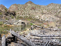
Dead trees
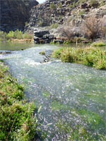
Shallow water
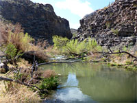
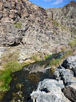
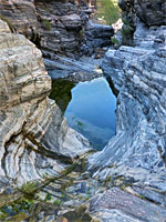
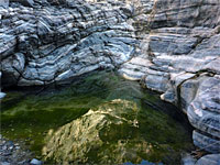
Pool and cliffs
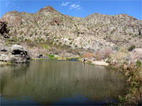
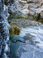
Big pool
Bushes in the canyon
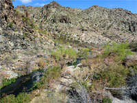
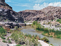
Mouth of the canyon
Narrow place
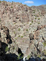
Layered cliffs
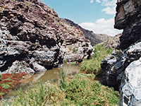
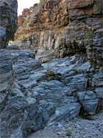
Rocky gorge
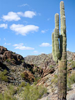
Saguaro
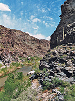
Rugged canyon
Side ravine
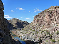
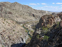
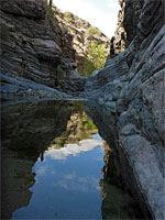
View downstream
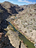
Above the river
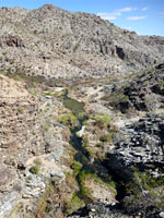
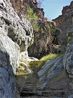
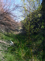
Overgrown canyon
Tall cliffs
The canyon
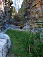
Reeds and grass
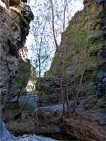
Trees
Dryfall
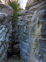
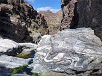
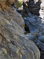
Marble veins
Vertical cliffs
Water-polished rock
Chute and pool
Grey ledges
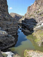
Narrows
Patch of sunlight
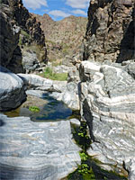
Shallow pool
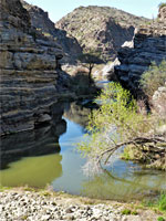
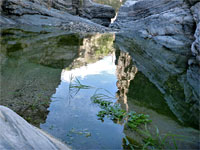
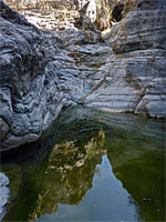
Reflections on a pool
Cllff-lined pool
Canyon walls
Shrubs
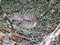
Western diamondback rattlesnake
Related Photographs:
Arizona rivers
-
Grassland
-
Snakes
Back to Top
All Contents © Copyright The American Southwest
|
Comments and Questions
|
Contribute
|
Affiliate Marketing Disclosure
|
Site Map