Bechler Falls Trail, Yellowstone National Park
Wyoming > Yellowstone National Park > The Southwest > Hiking > Bechler Falls Trail
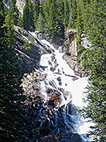
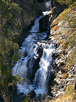
Bechler Falls
Short hike along the southernmost section of the Bechler River Trail starting at Cave Falls, past the Bechler River-Falls River confluence to Bechler Falls, a small waterfall but still quite powerful
Length: 1.3 miles
Elevation change: 60 feet
Difficulty: Easy
Type: One way
Usage: Low
Season: Summer, fall
Trailhead: Parking area at Cave Falls
Rating (1-5): ★★★★★
Elevation change: 60 feet
Difficulty: Easy
Type: One way
Usage: Low
Season: Summer, fall
Trailhead: Parking area at Cave Falls
Rating (1-5): ★★★★★

Most trails in Cascade Corner, the far southwesterly portion of Yellowstone National Park, are rather long, and primarily used by backpackers, visiting remote waterfalls like Dunanda, Union and Colonnade. The only short route to a worthwhile destination is to Bechler Falls, a small but powerful cascade along the Bechler River, reached by a 1.3 mile hike that starts at the rather larger Cave Falls and also passes the confluence of the Bechler and Falls rivers. The path, actually the southernmost section of the Bechler River Trail, winds through cool, moist woodland with a good selection of summer wildflowers, staying within sight of the rivers most of the way.
Trail map for Yellowstone National Park.
12 views along the Bechler Falls Trail.
Scenes along the trail (mp4; 0:53 min; 24 mb).
The Bechler River trailhead is at the end of Cave Falls Road, which is unpaved except for the last 3 miles, and crosses mostly wooded land of the Targhee National Forest, starting at an intersection with Mesa Falls Loop (Hwy 47), five miles from Ashton, Idaho. The USFS Cave Falls campground is located 2 miles before the trailhead, while free primitive camping is available along side tracks, such as the route to Sheep Falls. There are three small parking areas for the hike; at road's end, with space for a dozen or so vehicles, at a nearby overlook of Cave Falls, and at the end of a very short side track to the base of the falls. One other trail starts here, connecting with the Bechler Ranger Station (3 miles west), which passes nothing of great interest but does form part of several longer loop hikes.
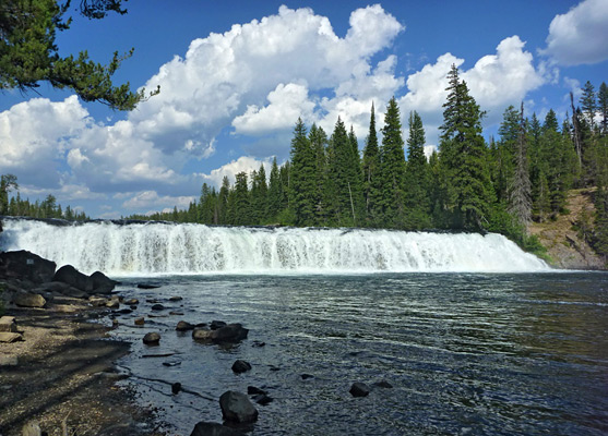
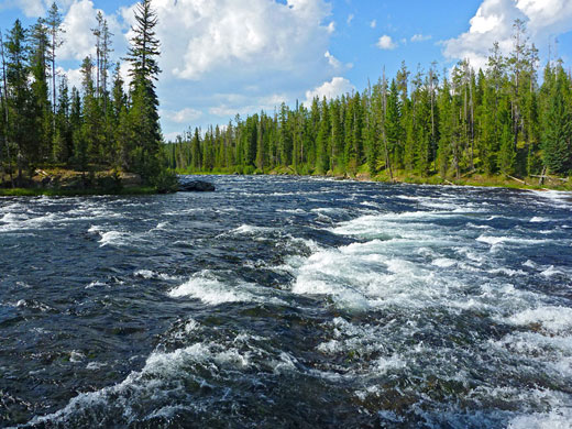
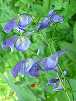
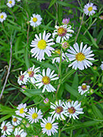
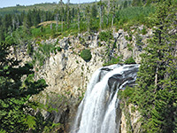
The Bechler River flows over Cave Falls right beside the trailhead, and has lesser cascades immediately above and below. The main drop is 20 feet, a uniform band of whitewater 220 feet across, on a long, straight section of the river, enclosed by thick forest. The narrow Bechler River Trail heads northwards from the end of the road, initially fairly high above the water level due to steeply-sloping sides, but still within view. The surroundings are densely wooded and quite overgrown, with ferns, bushes and long grass, plus many wildflowers in a variety of colors including yellow (Scouler's hawkweed), blue (harebell), purple (Columbian monkshood, small fringed gentian), pink (fireweed), white (Eaton's aster, western pearly everlasting) and red (Wyoming Indian paintbrush). The trail soon descends gradually, to the confluence of the Falls and Bechler rivers; these two wide, fast flowing torrents come together in a big expanse of choppy water, an impressive sight.
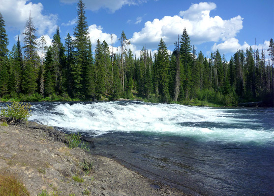
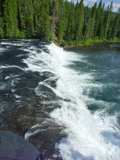
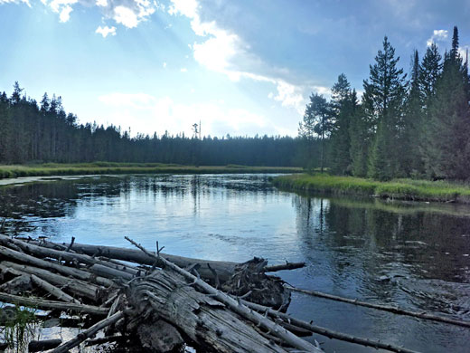
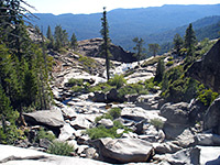
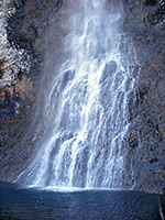
Just upstream are two small islands each with a big pile of driftwood at the far end. The trail rises again, moves temporarily further away from the water, passing through lush, moist, green surroundings, then descends again as Bechler Falls approach. Here, the drop is even less than at Cave Falls, about 15 feet, but the river is still powerful, especially early in the summer. Beyond, the river is much calmer, flowing past a meadow, and the path stays at water level for some distance, past a connecting path to Bechler Ranger Station after another 0.6 miles then winding its way northwards towards the much bigger expanse of Bechler Meadows.
Location
Trail map for Yellowstone National Park.
Photographs
12 views along the Bechler Falls Trail.
Bechler Falls Video
Scenes along the trail (mp4; 0:53 min; 24 mb).
Bechler River Approach
The Bechler River trailhead is at the end of Cave Falls Road, which is unpaved except for the last 3 miles, and crosses mostly wooded land of the Targhee National Forest, starting at an intersection with Mesa Falls Loop (Hwy 47), five miles from Ashton, Idaho. The USFS Cave Falls campground is located 2 miles before the trailhead, while free primitive camping is available along side tracks, such as the route to Sheep Falls. There are three small parking areas for the hike; at road's end, with space for a dozen or so vehicles, at a nearby overlook of Cave Falls, and at the end of a very short side track to the base of the falls. One other trail starts here, connecting with the Bechler Ranger Station (3 miles west), which passes nothing of great interest but does form part of several longer loop hikes.
Cave Falls and the Confluence
The Bechler River flows over Cave Falls right beside the trailhead, and has lesser cascades immediately above and below. The main drop is 20 feet, a uniform band of whitewater 220 feet across, on a long, straight section of the river, enclosed by thick forest. The narrow Bechler River Trail heads northwards from the end of the road, initially fairly high above the water level due to steeply-sloping sides, but still within view. The surroundings are densely wooded and quite overgrown, with ferns, bushes and long grass, plus many wildflowers in a variety of colors including yellow (Scouler's hawkweed), blue (harebell), purple (Columbian monkshood, small fringed gentian), pink (fireweed), white (Eaton's aster, western pearly everlasting) and red (Wyoming Indian paintbrush). The trail soon descends gradually, to the confluence of the Falls and Bechler rivers; these two wide, fast flowing torrents come together in a big expanse of choppy water, an impressive sight.
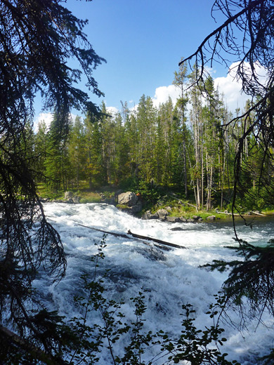
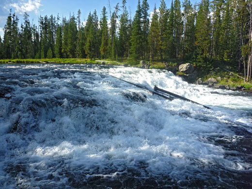
Bechler Falls
Just upstream are two small islands each with a big pile of driftwood at the far end. The trail rises again, moves temporarily further away from the water, passing through lush, moist, green surroundings, then descends again as Bechler Falls approach. Here, the drop is even less than at Cave Falls, about 15 feet, but the river is still powerful, especially early in the summer. Beyond, the river is much calmer, flowing past a meadow, and the path stays at water level for some distance, past a connecting path to Bechler Ranger Station after another 0.6 miles then winding its way northwards towards the much bigger expanse of Bechler Meadows.
Bechler Falls Trail - Similar Hikes
All Contents © Copyright The American Southwest | Comments and Questions | Contribute | Affiliate Marketing Disclosure | Site Map