Highlights:
Relatively shallow canyon near the center of the Book Cliffs, north of Thompson Springs, containing several pictograph panels, representing three styles (Barrier Canyon, Fremont, Ute), plus the ruins of the abandoned coal mining town of Sego
Nearby town:
Green River, 30 miles
Management:
Location:
39.018, -109.710 (parking lot by the rock art)
Rating (1-5):
★★★★★
Seasons:
All year, though affected by snow in the winter

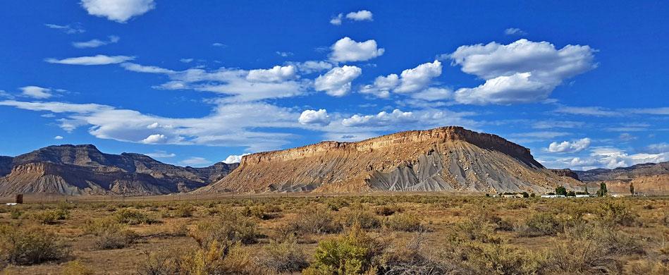
The Book Cliffs form the longest escarpment in the US, stretching over 200 miles from central Utah to the vicinity of Grand Junction in Colorado, and are split by numerous drainages, many of which contain rock art; one of the most best-known locations is Sego Canyon, a few miles north of the little settlement of Thompson Springs along Interstate 70, exit 187.
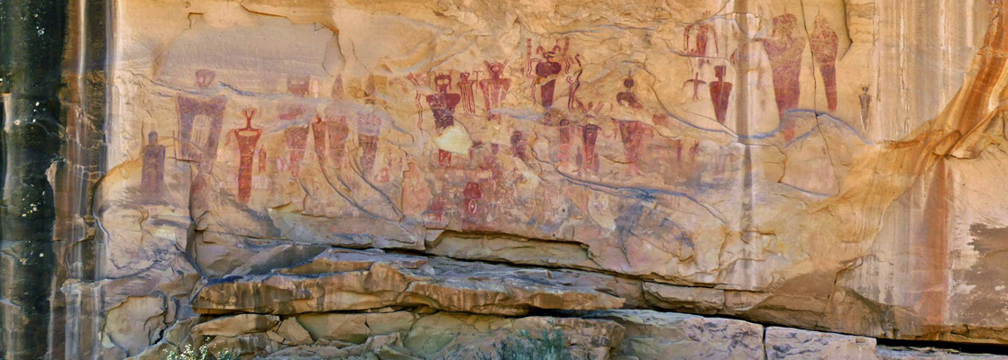
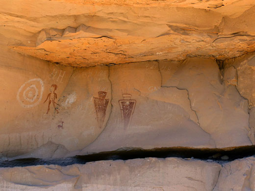
The main location, around a protruding cliff near the streambed, has hundreds of designs spanning over a thousand years of history and representing three distinctive styles. The oldest are from the Barrier Canyon period, 400 AD onwards, characterized by complex red pictographs, many still crisp and richly-colored. Later designs are petroglyphs, from the Fremont culture, approximately 1000 to 1300, then the Ute peoples after 1300. The rock art site is accessed by a paved road and served by a BLM trailhead, just 4 miles from the interstate, making this one of the easiest-reached of such locations.
Also of interest, one mile north, is the old townsite of Sego, another small town, established in 1911 as a base for workers at a nearby anthracite coal mine. The population peaked at around 200, but the place flourished for a relatively short time and was abandoned in the 1950s, partly because extraction of the coal became uneconomical and partly following damage caused by a flash flood. Just a few stone structures remain, plus the town cemetery.
Sego Canyon Table of Contents

Sego Rock Art
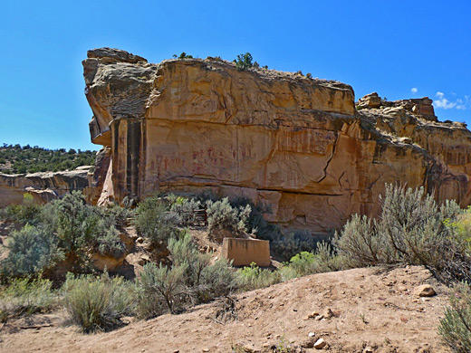
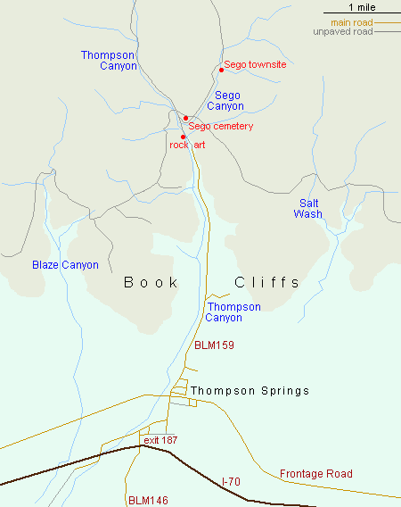
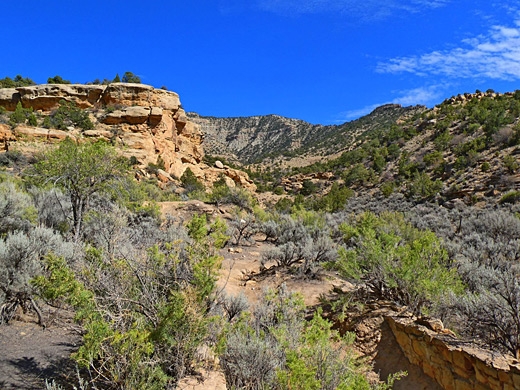
Although currently known, by the BLM, as the Sego Canyon Rock Art Interpretive Site, the petroglyphs and pictographs are located in Thompson Canyon, the wide drainage immediately north of Thompson Springs; Sego Canyon, containing the townsite, branches off a short distance north. The location was formerly known as the Thompson Wash Rock Art District. Thompson Springs is a quiet, rather forlorn place, population about 40, much reduced in recent years following construction of Interstate 70 one mile south, and removal of a stop along the Denver and Rio Grande Railroad, the tracks from which run right through town. Many buildings are derelict. A paved road (Hwy 94, BLM159) heads north into Thompson Canyon, arriving at the parking place in front of the rock art panels after 3.3 miles, just before the surface changes to gravel. The panels are on the west side of the canyon, across the lowest level of the cliffs, which are orange/brown sandstone of the Blackhawk Formation from the Cretaceous period, about 40 feet high. The largest group, mostly pictographs, is just 100 feet from the road, and the designs extend at least 500 feet south, round a promontory and along a straighter cliff. A few more can be seen on the opposite side of the canyon, though these are on private land, and fenced-off.
Sego Townsite
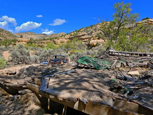
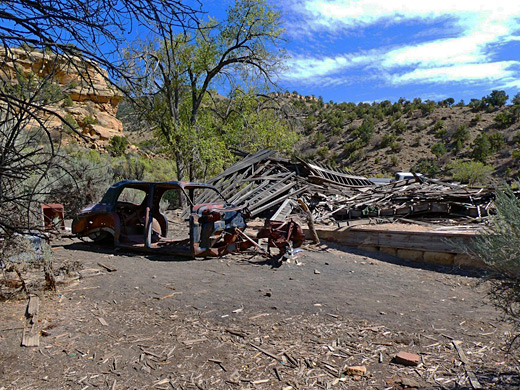
Half mile beyond the rock art, the road reaches a four-way junction, at the point where Sego Canyon joins from the northeast. Turning right, the track soon passes Sego Cemetery, a rectangular enclosure containing over a dozen graves, then continues to the townsite in another 0.9 miles. The largest of the few remaining structures at Sego is the company store, the stone walls from which are still almost complete. Directly opposite used to be the boarding house, a two-story wooden structure which collapsed during winter 2009-10. There are also various foundations, dugouts and cabins, while equipment and spoil heaps from the coal mine can be seen a short distance north, on the east side of the canyon. The road continues for many miles, climbing high into the forested land of the Roan Cliffs.
Sego Canyon - Nearby Places
- Arches National Park (37 miles) - red rock arches and many other eroded formations
- Cisco (26 miles) - abandoned railroad town in far east Utah
Sego Canyon - Similar Places
- Buckhorn Draw Road, Utah - unpaved road across the San Rafael Swell, past rock art sites
- Nine Mile Canyon, Utah - thousands of ancient petroglyphs
All Contents © Copyright The American Southwest | Comments and Questions | Contribute | Affiliate Marketing Disclosure | Site Map