Home
|
Parks
|
Trails
|
Plants
|
Canyons
Maps
|
Landscapes
|
Site Map
|
Whats New?
|
More...
×
General Pages
Home
Parks
Trails
Plants
Slot Canyons
Maps
Landscapes
Itineraries
Site Map
What's New?
More pages...
States
Arizona
California
Colorado
Idaho
Nevada
New Mexico
Oregon
Texas
Utah
Wyoming
MENU
ARIZONA
CALIFORNIA
COLORADO
IDAHO
NEVADA
NEW MEXICO
OREGON
TEXAS
UTAH
WYOMING
UTAH
MAPS
|
PARKS
|
TRAILS
|
PHOTOS
|
HOTELS
All Utah Locations...
NPS
Arches
Bryce Canyon
Canyonlands
Capitol Reef
Cedar Breaks
Dinosaur
Glen Canyon
Golden Spike
Hovenweep
Natural Bridges
Timpanogos Cave
Zion
OTHER PLACES
Anasazi SP
Antelope Island SP
Bear Lake
Bears Ears NM
Canyon Rims RA
Cedar Mesa/Grand Gulch
Cisco
Coral Pink Sand Dunes SP
Dark Canyon
Dead Horse Point SP
Dixie National Forest
Escalante Petrified Forest SP
Factory Butte
Fantasy Canyon
Fisher Towers
Flaming Gorge NRA
Goblin Valley SP
Goosenecks SP
Grafton
Grand Staircase-Escalante NM
Gunlock SP
Henry Mountains
Kanab
Kodachrome Basin SP
La Sal Mountains
Little Egypt
Little Sahara RA
McConkie Ranch Petroglyphs
Mexican Hat
Moab
Montezuma Canyon
Monument Valley
Mount Timpanogos
Nebo Loop
Nine Mile Canyon
Paria Rimrocks
Parowan Gap
Potash Road
Red Canyon
Red Cliffs NCA
Red Cliffs RA
Salt Lake Desert
San Rafael Swell
Sand Hollow SP
Santa Clara River Reserve
Sego Canyon
Snow Canyon SP
Uinta Mountains
Valley of the Gods
Wasatch Mountain SP
Yant Flat Cliffs
Utah site map
Utah - Panoramic Photographs
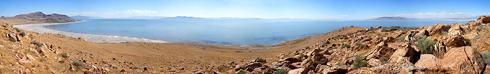
Lakeshore on the east side of the island, Antelope Island State Park
Shallow water alongside the causeway, Antelope Island State Park
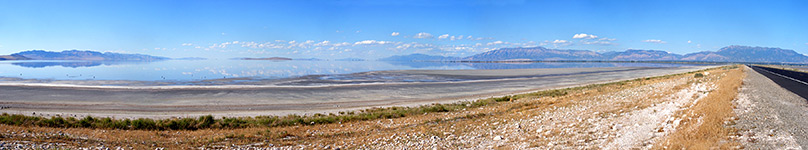
White Rock Bay, Antelope Island State Park
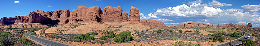
Cliffs and buttes, Arches National Park
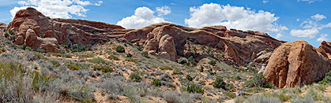
Cliffs either side of Landscape Arch, Arches National Park
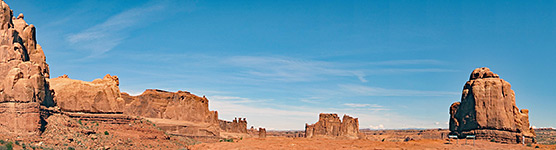
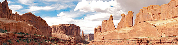
Panorama of Park Avenue, Arches National Park
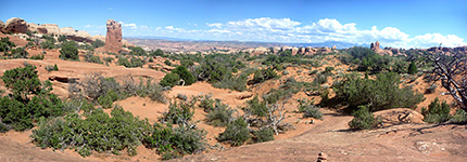
Slickrock and sand dunes, Arches National Park
The Windows Section, Arches National Park
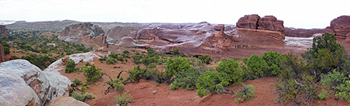
Wet rocks, Arches National Park
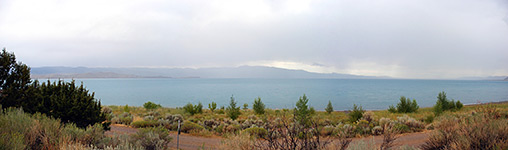
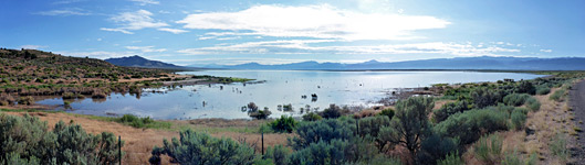
Bear Lake on a cloudy morning, Bear Lake
Campbell Canyon, Bryce Canyon National Park
Cliffs north of Rainbow Point, Bryce Canyon National Park
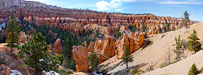
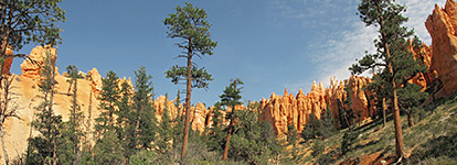
Fairyland Canyon, Bryce Canyon National Park
Fairyland Canyon and Sinking Ship, Bryce Canyon National Park
Agua Canyon, Bryce Canyon National Park
Formations above Agua Canyon, Bryce Canyon National Park
Hoodoos and ridges below Sunrise Point, Bryce Canyon National Park
Hoodoos below Inspiration Point, Bryce Canyon National Park
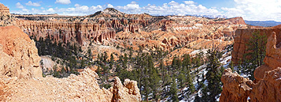
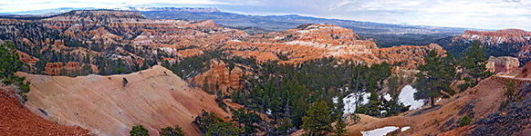
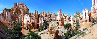
Many formations, Bryce Canyon National Park
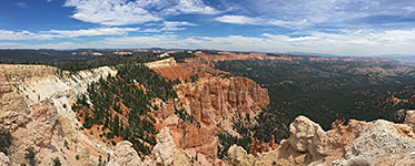
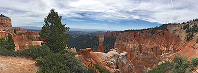
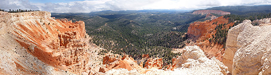
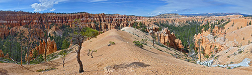
Panorama from Yovimpa Point, Bryce Canyon National Park
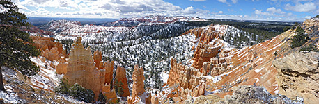
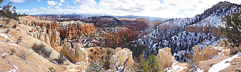
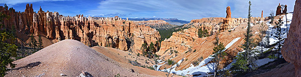
Patches of snow amongst the hoodoos, Bryce Canyon National Park
Pinnacles along the lowest section of the loop, Bryce Canyon National Park
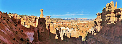
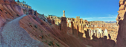
Queens Garden, Bryce Canyon National Park
Ridge on the Peekaboo Trail, Bryce Canyon National Park
Upper section of the trail, Bryce Canyon National Park
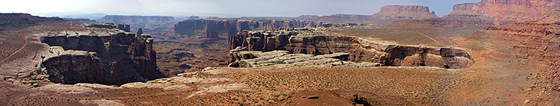
Benches and fins, Canyonlands National Park
Big Spring Canyon, Canyonlands National Park
Buck Canyon, Canyonlands National Park
Bushy plateau near the start of the trail, Canyonlands National Park
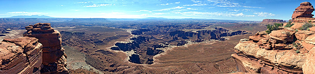
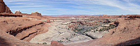
Canyon confluence, Canyonlands National Park
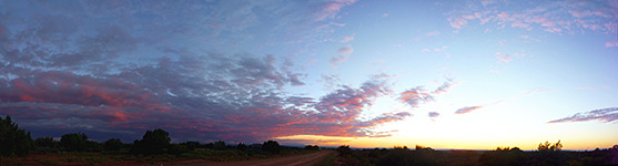
Canyonlands sunset, Canyonlands National Park
Cliffs and pinnacles on the west side of Cyclone Canyon, Canyonlands National Park
Cliffs bordering Spanish Bottom, Canyonlands National Park
Top of the plateau, Canyonlands National Park
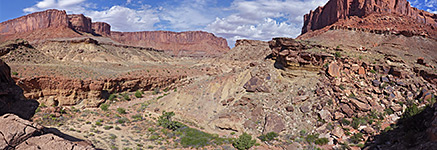
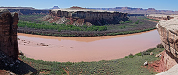
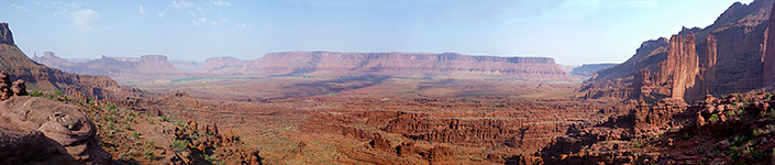
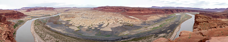
Colorado River, upstream of Red Lake Canyon, Canyonlands National Park
Differently-colored strata, Canyonlands National Park
Distant red cliffs to the west, Canyonlands National Park
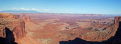
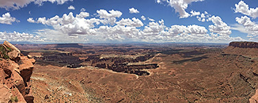
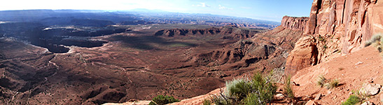
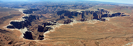
Edge of Monument Basin, from Grand View Point, Canyonlands National Park
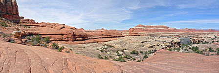
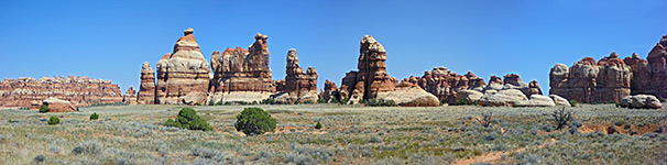
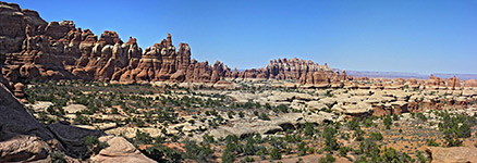
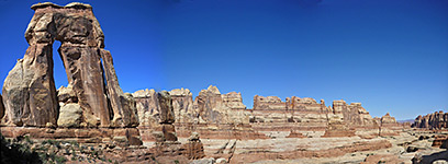
Formations in Chesler Park, Canyonlands National Park
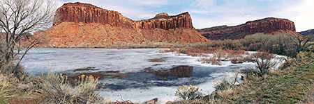
Frozen pool beside Hwy 211, Canyonlands National Park
Green River, Canyonlands National Park
Half way down the cliffs at Grand View Point, Canyonlands National Park
Holeman Springs Basin, Canyonlands National Park
Lost Canyon tributary, Canyonlands National Park
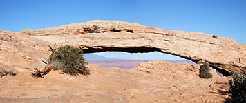
Mesa Arch, Canyonlands National Park
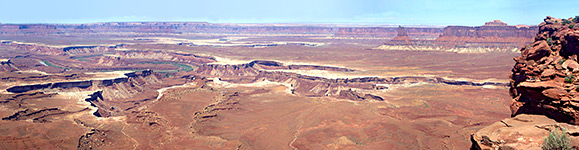
Monument Basin and the White Rim, Canyonlands National Park
Monument Basin from White Rim Overlook, Canyonlands National Park
North edge of Monument Basin, Canyonlands National Park
Northwest edge of Chesler Park, Canyonlands National Park
Pinnacles west of Druid Arch, Canyonlands National Park
Salt Creek tributary, Canyonlands National Park
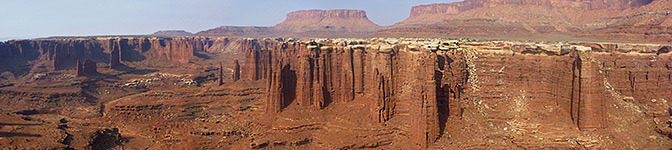
Spires and buttes in Monument Basin, Canyonlands National Park
Upheaval Valley, Canyonlands National Park
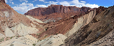
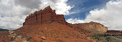
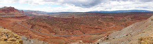
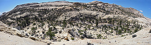
Cliffs north of Grand Wash, Capitol Reef National Park
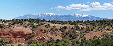
Henry Mountains, Capitol Reef National Park
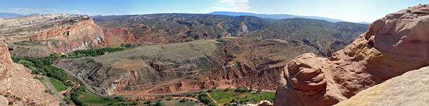
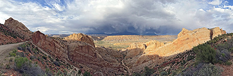
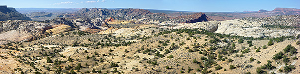
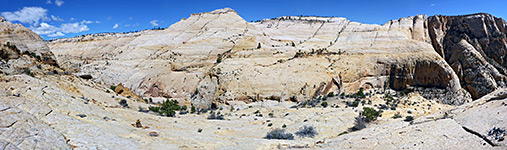
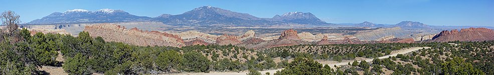
Panoramic view, Capitol Reef National Park
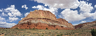
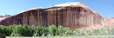
Red butte of the Moenkopi Formation, Capitol Reef National Park
Swap Mesa and the valley of Halls Creek, Capitol Reef National Park
The Burr Trail, at the edge of the reef, Capitol Reef National Park
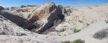
View south from Mummy Cliff, Capitol Reef National Park
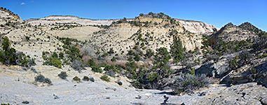
View upstream at the end of the trail, Capitol Reef National Park
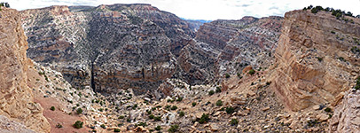
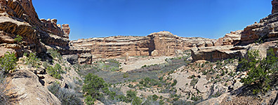
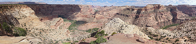
Grand Gulch, Cedar Mesa, Grand Gulch and Comb Ridge
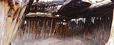
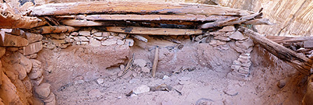
Interior of a long and stone kiva, Cedar Mesa, Grand Gulch and Comb Ridge
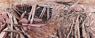
Kiva, Cedar Mesa, Grand Gulch and Comb Ridge
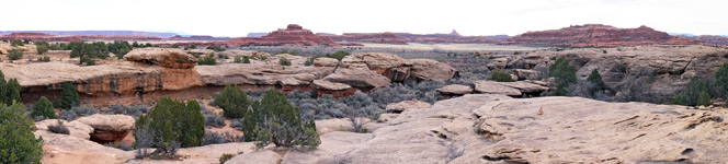
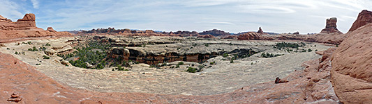
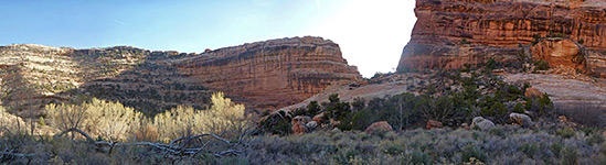
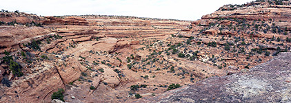
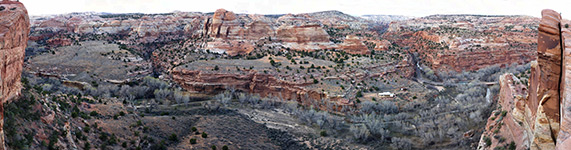
Panorama of the canyon, Cedar Mesa, Grand Gulch and Comb Ridge
South-side tributary ravine, Cedar Mesa, Grand Gulch and Comb Ridge
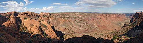
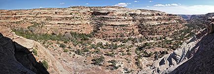
Viewpoint above Grand Gulch, Cedar Mesa, Grand Gulch and Comb Ridge
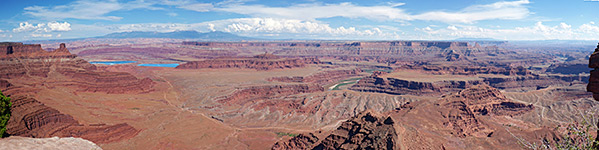
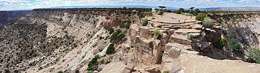
East of Dead Horse Point, Dead Horse Point State Park
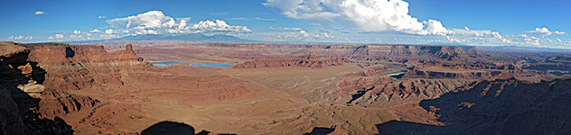
View east from Basin Overlook, Dead Horse Point State Park
Reflections, Dinosaur National Monument
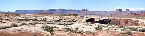
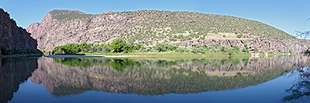
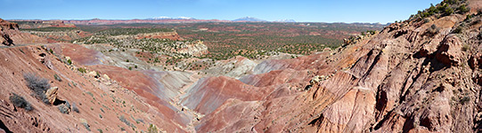
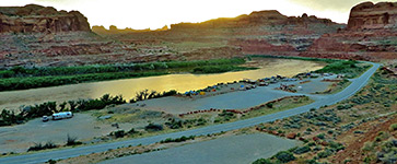
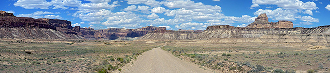
Lake Powell, to the southeast, East Sevenmile Canyon
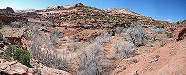
Lower end of the canyon, East Sevenmile Canyon
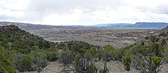
Escalante, Escalante Petrified Forest State Park
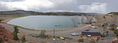
Wide Hollow Reservoir, Escalante Petrified Forest State Park
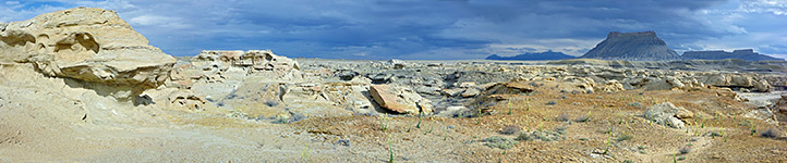
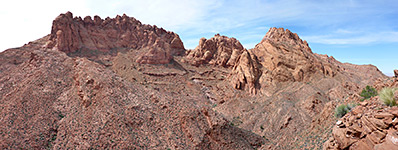
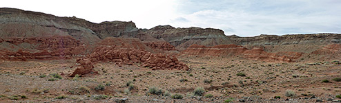
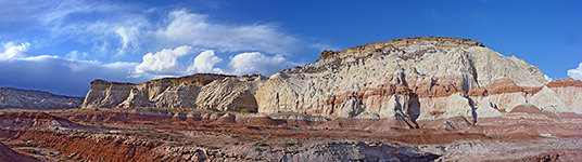
Eroded rocks northwest of Factory Butte, Factory Butte
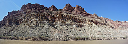
Colorado River valley, Fisher Towers
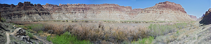
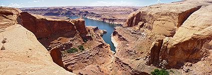
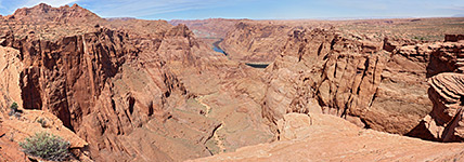
Echo Peaks and the Colorado River, Glen Canyon National Recreation Area
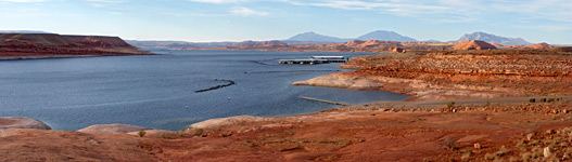
Panorama of the lake, Halls Crossing, Glen Canyon National Recreation Area
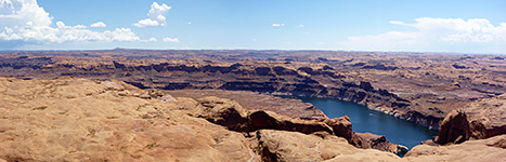
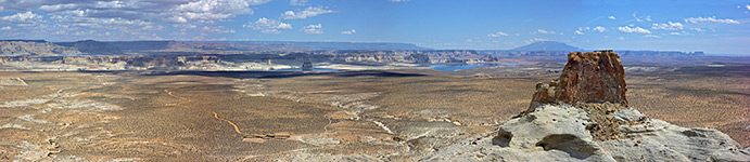
Hite Overlook, Glen Canyon National Recreation Area
Sandy flats bordering Lake Powell, Glen Canyon National Recreation Area
Sunset near White Canyon, Glen Canyon National Recreation Area
The Echo Peaks, Glen Canyon National Recreation Area
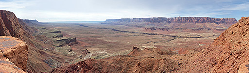
The Vermilion Cliffs, from Echo Pass, Glen Canyon National Recreation Area
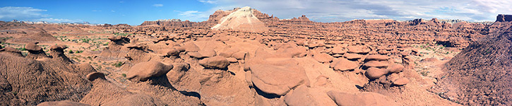
Panorama of the valley, Goblin Valley State Park
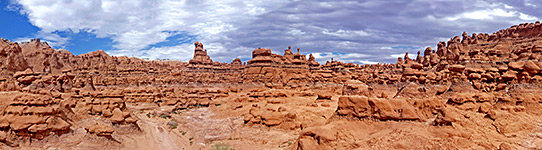
Thousands of hoodoos, Goblin Valley State Park
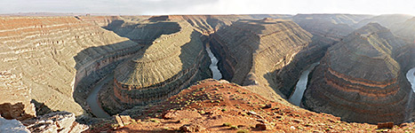
The goosenecks, late afternoon, Goosenecks State Park
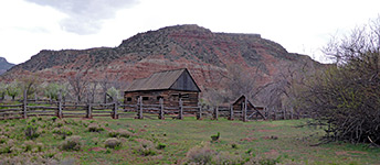
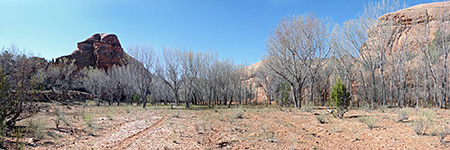
Barn and field, Grafton
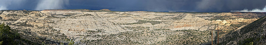
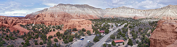
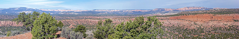
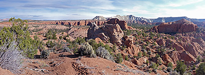
Canyon of the Escalante River, Grand Staircase-Escalante National Monument
Above Ther Gulch, Grand Staircase-Escalante National Monument
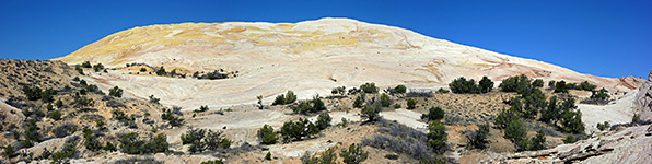
Chinle hills, Grand Staircase-Escalante National Monument
Slickrock above Calf Creek, Grand Staircase-Escalante National Monument
Cliffs around the Escalante River, Grand Staircase-Escalante National Monument
Flat canyon floor, Grand Staircase-Escalante National Monument
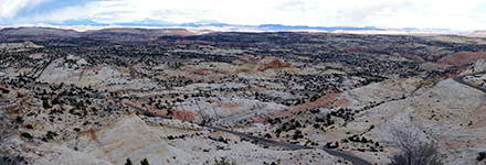
UT 12 north of Escalante, Grand Staircase-Escalante National Monument
Ridges and plains to the west of Yellow Rock, Grand Staircase-Escalante National Monument
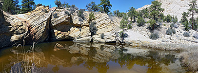
Rocks beside a pool, Grand Staircase-Escalante National Monument
Sheer cliff on the south side of the Escalante River, Grand Staircase-Escalante National Monument
Slickrock east of Death Hollow, Grand Staircase-Escalante National Monument
Slickrock west of Death Hollow, Grand Staircase-Escalante National Monument
Slopes above Mamie Creek, Grand Staircase-Escalante National Monument
The eastern rim of Death Hollow, Grand Staircase-Escalante National Monument
The shallow canyon of Sand Creek, Grand Staircase-Escalante National Monument
Waterpocket Fold and the Henry Mountains, Grand Staircase-Escalante National Monument
Yellow Rock, from the southeast, Grand Staircase-Escalante National Monument
West side of the reservoir, Gunlock State Park
Central area of the park, Kodachrome Basin State Park
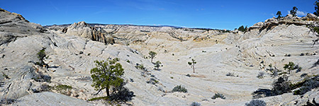
Paunsaugunt Plateau, Kodachrome Basin State Park
View north from Panorama Point, Kodachrome Basin State Park
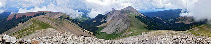
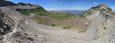
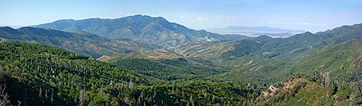
Panorama from the summit, La Sal Mountains
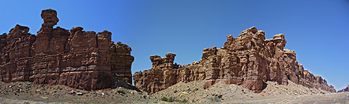
The northern section of the formations, Little Egypt
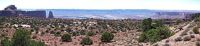
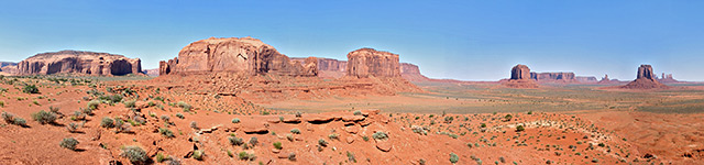
Panorama from Artists Point, Monument Valley
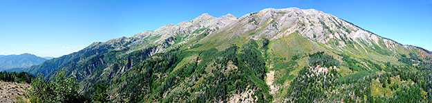
Above Timpanogos Basin, Mount Timpanogos
Dispersed spring, Mount Timpanogos
Flat valley floor, Mount Timpanogos
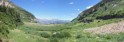
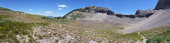
Roberts Horn and Timpanogos Basin, Mount Timpanogos
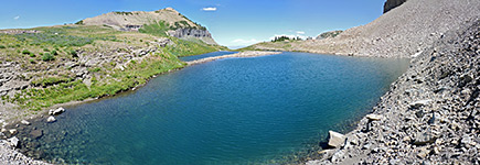
South side of Emerald Lake, Mount Timpanogos
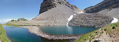
West edge of Emerald Lake, Mount Timpanogos
Remains of a kiva, Natural Bridges National Monument
Mount Nebo, Nebo Loop Scenic Byway
Salt Creek Overlook, Nebo Loop Scenic Byway
Clouds above the cliffs, Paria Rimrocks
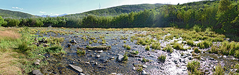
Little Salt Lake, Parowan Gap
Gold Bar Recreation Site, Potash Road
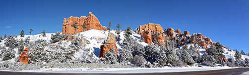
Snow on the formations, Red Canyon
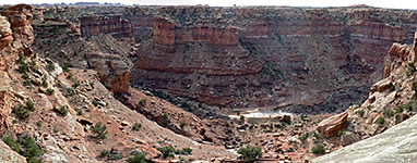
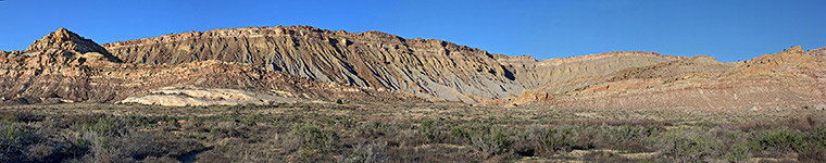
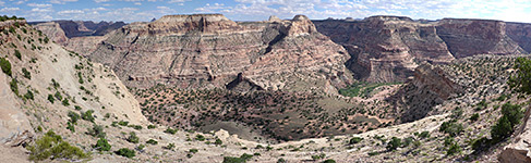
Little Grand Canyon, San Rafael Swell
Promontory, San Rafael Swell
Valley of Road Draw, San Rafael Swell
Wedge Overlook, San Rafael Swell
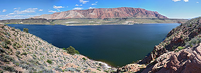
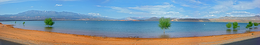
Sand Hollow Reservoir from the south side, Sand Hollow State Park
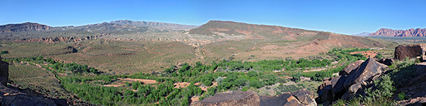
Santa Clara River valley, Santa Clara River Reserve
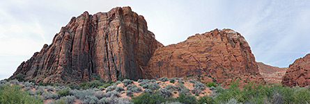
Edge of the Red Mountains, Snow Canyon State Park
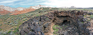
Entrance to a lava cave, Snow Canyon State Park
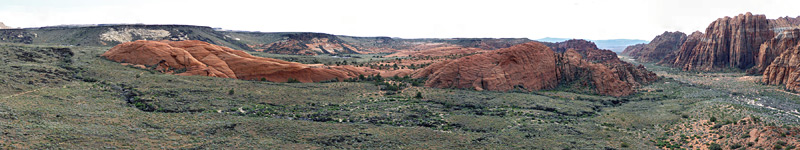
Sandy plains, Snow Canyon State Park
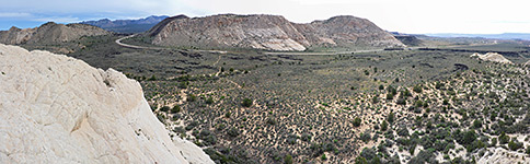
West Canyon Overlook, Snow Canyon State Park
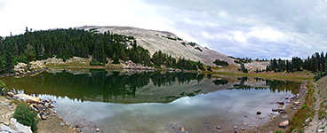
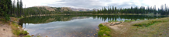
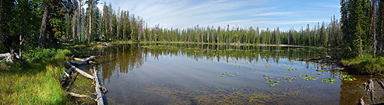
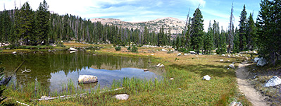
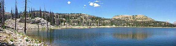
Blue Lake, Uinta Mountains
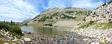
Boulders beside Faxon Lake, Uinta Mountains
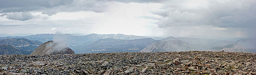
Clouds above the summit of Bald Mountain, Uinta Mountains
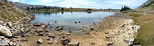
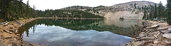
Faxon Lake, Uinta Mountains
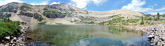
Hayden Peak, and Hayden Lake, Uinta Mountains
Jordan Lake, Uinta Mountains
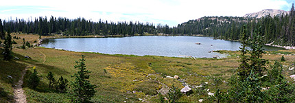
Kamas Lake, Uinta Mountains
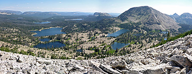
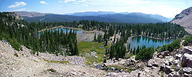
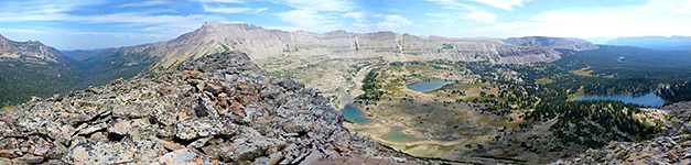
Lakes south of Notch Mountain, Uinta Mountains
Lofty Lake, Uinta Mountains
Morat Lakes, Uinta Mountains
Notch Mountain - view north, Uinta Mountains
Notch Mountain - view south, Uinta Mountains
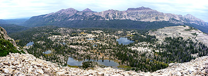
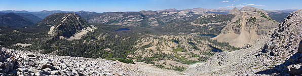
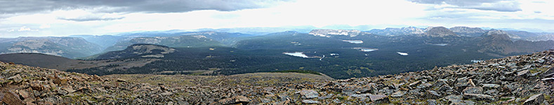
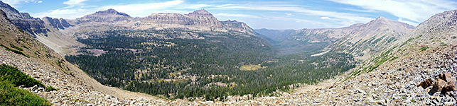
Panorama of lands to the south of Bald Mountain, Uinta Mountains
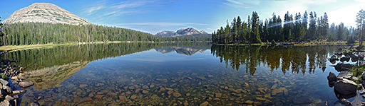
Panorama of Mirror Lake, Uinta Mountains
Ridge west of Spread Eagle Peak, Uinta Mountains
Ripples on Cliff Lake, Uinta Mountains
Scout Lake, Uinta Mountains
Scudder Lake, Uinta Mountains
Trail past Jordan Lake, Uinta Mountains
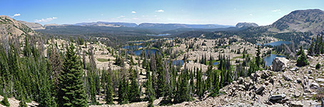
Valley of Stillwater Fork, Uinta Mountains
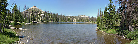
Wall Lake, Uinta Mountains
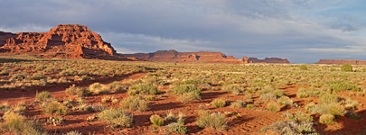
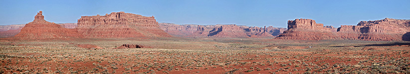
Panorama of the valley, Valley of the Gods
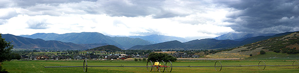
Fields and mountains, Wasatch Mountain State Park
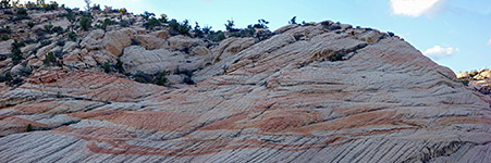
Banded rock face, Yant Flat Cliffs
Alcove along the trail, Zion National Park
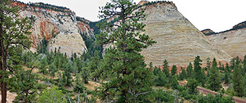
Checkerboard Mesa, Zion National Park
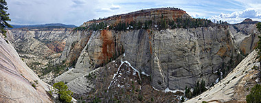
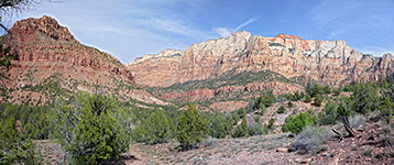
Cliffs and canyons above Timber Creek, Zion National Park
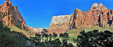
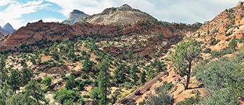
Great White Throne and Mount Majestic, Zion National Park
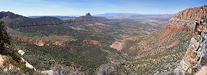
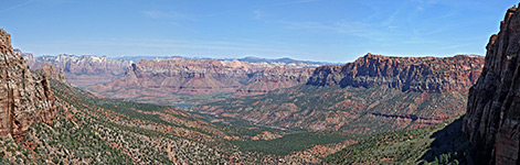
Horse Valley and Dutton Pass, Zion National Park
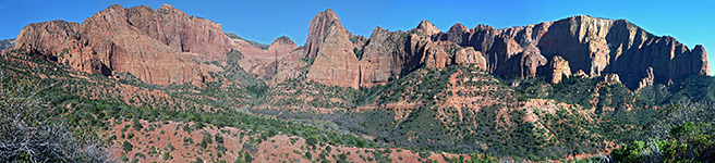
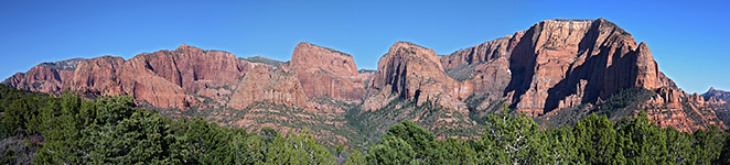
Kolob cliffs and canyons, Zion National Park
Left Fork of North Creek, Zion National Park
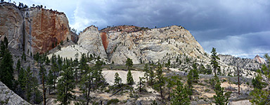
North side of Mount Majestic, Zion National Park
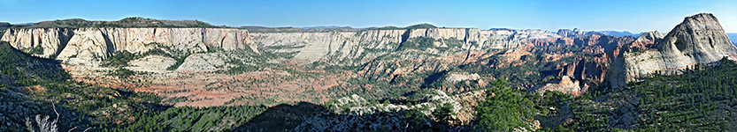
Panorama above Clear Creek, Zion National Park
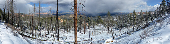
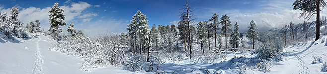
Snow-covered forest, Zion National Park
Snowy cliffs, Zion National Park
South Creek and the Vermilion Cliffs, Zion National Park
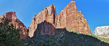
The Spearhead, Zion National Park
The Sundial, Zion National Park
Tunnel along Hwy 9, Zion National Park
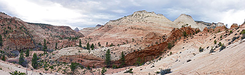
White cliffs around Telephone Canyon, Zion National Park
Back to Top
All Contents © Copyright The American Southwest
|
Comments and Questions
|
Contribute
|
Affiliate Marketing Disclosure
|
Site Map