The American Southwest
Home | Parks | Trails | Plants | Canyons
Maps | Landscapes | Site Map | Whats New? |
More...
Follow americansouthwest.net on Facebook
×
General Pages
Home
Parks
Trails
Plants
Slot Canyons
Maps
Landscapes
Itineraries
Site Map
What's New?
More pages...

States
Arizona
California
Colorado
Idaho
Nevada
New Mexico
Oregon
Texas
Utah
Wyoming


ARIZONA
CALIFORNIA
COLORADO
IDAHO
NEVADA
NEW MEXICO
OREGON
TEXAS
UTAH
WYOMING
UTAH
MAPS | PARKS | TRAILS | HOTELS

Map of the La Sal Mountains


Utah > La Sal Mountains > Map
Map of the La Sal Mountains


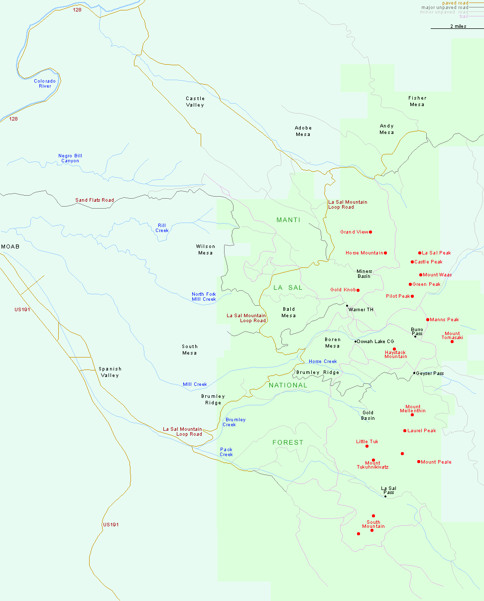
The main access to the La Sal Mountains is via the paved, 37 mile La Sal Loop Road, linking Spanish Valley along US 191 with Castle Valley off Hwy 128.

Major unpaved roads include the routes to Geyser Pass, Warner Lake, Miners Basin and Oowah Lake, and to La Sal Pass in the south.

Back to Top
Arizona | California | Colorado | Idaho | Nevada | New Mexico | Oregon | Texas | Utah | Wyoming | Slot Canyons | Travelogue | SOUTHWEST

All Contents © Copyright The American Southwest | Comments and Questions | Contribute | Affiliate Marketing Disclosure | Site Map