Horseshoe, Hackberry and Holly Groups, Hovenweep National Monument
Utah > Hovenweep > Horseshoe, Hackberry and Holly Groups
Horseshoe/Hackberry and Holly Groups
Three ruin sites, in two detached units; towers and multi-room buildings, most on the rim of shallow canyons, others on top of boulders. Accessed by two short trails, reached by an unpaved track
Length: 0.6 miles and 0.3 miles respectively, or 5.4 miles (round trip) from the paved road
Elevation change: 40 feet, or 200 feet
Difficulty: Easy, or moderate
Type: There-and-back hikes
Usage: Low
Season: All year, though the access roads may be affected by snow in winter
Trailhead: Horseshoe/Hackberry, Holly
Rating (1-5): ★★★★★
Elevation change: 40 feet, or 200 feet
Difficulty: Easy, or moderate
Type: There-and-back hikes
Usage: Low
Season: All year, though the access roads may be affected by snow in winter
Trailhead: Horseshoe/Hackberry, Holly
Rating (1-5): ★★★★★

Of the six units of Hovenweep National Monument, the next most visited, after the main Square Tower ruins, are the Horseshoe/Hackberry and Holly sites, all in Colorado, and all dating from around 1300 AD. The first two are adjacent, contained within a 150 acre section of the monument at the upper end of Hackberry Canyon, while Holly is one mile southwest, separated by a small strip of BLM land, part of Canyons of the Ancients National Monument, which protects hundreds more ancient sites.
Holly has the most spectacular ruins; two large and three small buildings, along a canyon rim and on top of large boulders; Hackberry consists of one major and one minor ruin, while Horseshoe has two sites. A nearly level, 0.6 mile trail leads to Horseshoe and Hackberry, both set on the rim of shallow ravines, while the walk to Holly is just 0.3 miles, via a path that continues 4 miles to the park campground, in the Square Tower unit. Both trailheads are reached by an unpaved track that should generally be navigable by regular vehicles, but if not then walking all the way from the paved access road is not difficult, the longest hike then being 2.2 miles, to Holly.
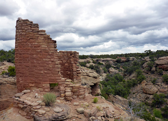
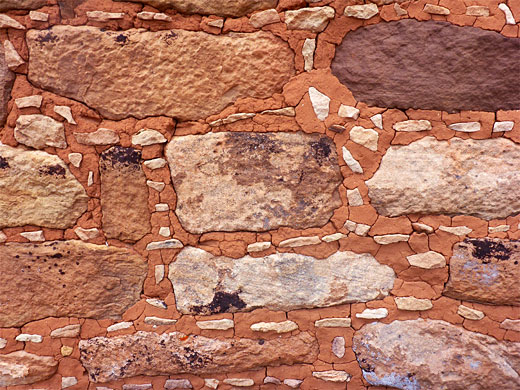
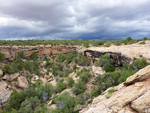
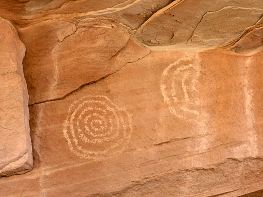
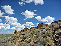
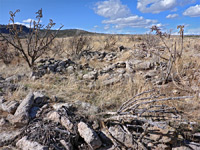
The reddish sandstone ruins are not obviously signposted, and they blend in well with the bushy, rocky though somewhat nondescript landscape, yet they are easy enough to locate. Notices warn against walking on the walls or otherwise disturbing the structures, most of which are loosely fenced off. Petroglyphs and pictographs may also be seen in the vicinity, plus some lesser, more hidden ruins.
Map of the area (within Canyons of the Ancients National Monument).
27 views of the Horseshoe, Hackberry and Holly groups.
The track to the ruins leaves paved road 10 to the south, 0.6 miles east of the Utah/Colorado stateline, and is marked with a Canyons of the Ancients signpost. This location is right opposite the usually dry bed of Little Cajon Lake. The Horseshoe/Hackberry trailhead is one mile down the track, on the east side, while that for Holly is 0.8 miles further, partly along a side track to the west. The main route is quite smooth for 0.8 miles, to a junction, then a little rougher beyond.
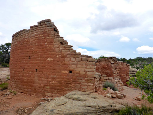
The Horseshoe/Hackberry trailhead is served by a small parking area, on a verge. A notice gives distances as Horseshoe Tower 0.2 miles, Horseshoe House 0.3 miles, Hackberry 0.5 miles. The cairned path crosses slickrock and bushy patches to the tower, a round structure at the end of a promontory between two forks of a ravine, near some low wall remnants and piles of stones from other rooms. The larger Horseshoe House is close by, at the end of the east branch of the canyon, again right on the rim. It has an approximately square outer wall enclosing the main central area, with several small rooms around the edge. Another, circular ruin can just be seen beneath the rim to the south, in a narrow alcove.
After Horseshoe, the path crosses a more extensive flat for 0.3 miles to the upper end of another shallow ravine, site of the Hackberry pueblo. The main structure is on the east side, seen first from a viewpoint on the west, next to a smaller, circular ruin. The trail continues a short distance, over the streambed just above a pour-off and an overgrown area, to the other site, two adjacent square rooms with relatively low walls. Below an overhanging cliff at the very upper end of the ravine are a spring, a small ruin, and some handprint pictographs.
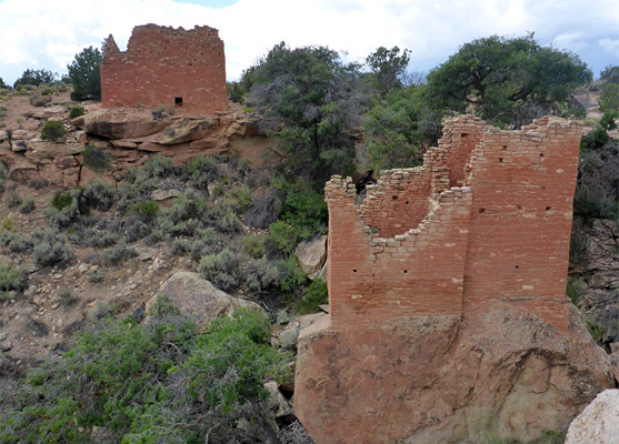
The road to Holly has a few rocky patches, especially towards the end. A sign gives the size of this unit as 63 acres. From the trailhead, a brief walk leads to the north end of a minor drainage (the uppermost section of Keeley Canyon), and the first three ruins, one on the rim, the other two on detached, flat-topped rocks, one of which is angled at about 40 degrees, a displacement thought to have occurred after the settlement was abandoned, causing the upper walls of the dwelling - now known as Tilted House - to fall away, though the lower section of the walls are still firmly attached. The other two ruins are named Detached Boulder House and Curved Wall House.
Just past this initial group are the two largest structures; Holly Tower, on another huge boulder slightly lower down the canyon, and Holly House (also known as Great House) on the opposite rim. The tower is a double structure, rectangular in outline, the walls tapering smoothly down to the sheer-sided rock at the base. A doorway can be seen, plus lines of postholes from the intermediate wooden floors, all long gone. The house has two original roof beams surviving, on top of quite tall walls, which are higher on the east side. A smaller, circular room is adjacent, missing most of its walls. A short trail follows the rim southwards, coming in sight of a big boulder with some faint, spiral petroglyphs, protected from weathering by a overhang, while another trail runs all the way to the Square Tower campground - a narrow route, seemingly very little used.
Holly has the most spectacular ruins; two large and three small buildings, along a canyon rim and on top of large boulders; Hackberry consists of one major and one minor ruin, while Horseshoe has two sites. A nearly level, 0.6 mile trail leads to Horseshoe and Hackberry, both set on the rim of shallow ravines, while the walk to Holly is just 0.3 miles, via a path that continues 4 miles to the park campground, in the Square Tower unit. Both trailheads are reached by an unpaved track that should generally be navigable by regular vehicles, but if not then walking all the way from the paved access road is not difficult, the longest hike then being 2.2 miles, to Holly.
The reddish sandstone ruins are not obviously signposted, and they blend in well with the bushy, rocky though somewhat nondescript landscape, yet they are easy enough to locate. Notices warn against walking on the walls or otherwise disturbing the structures, most of which are loosely fenced off. Petroglyphs and pictographs may also be seen in the vicinity, plus some lesser, more hidden ruins.
Location
Map of the area (within Canyons of the Ancients National Monument).
Photographs
27 views of the Horseshoe, Hackberry and Holly groups.
Horseshoe/Hackberry Access
The track to the ruins leaves paved road 10 to the south, 0.6 miles east of the Utah/Colorado stateline, and is marked with a Canyons of the Ancients signpost. This location is right opposite the usually dry bed of Little Cajon Lake. The Horseshoe/Hackberry trailhead is one mile down the track, on the east side, while that for Holly is 0.8 miles further, partly along a side track to the west. The main route is quite smooth for 0.8 miles, to a junction, then a little rougher beyond.
Horseshoe Group
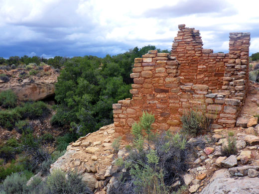
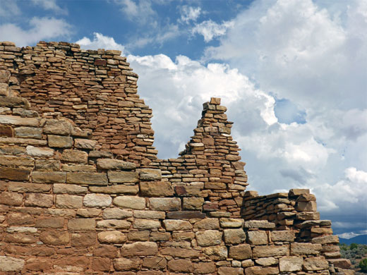
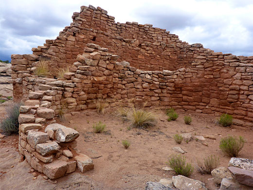
The Horseshoe/Hackberry trailhead is served by a small parking area, on a verge. A notice gives distances as Horseshoe Tower 0.2 miles, Horseshoe House 0.3 miles, Hackberry 0.5 miles. The cairned path crosses slickrock and bushy patches to the tower, a round structure at the end of a promontory between two forks of a ravine, near some low wall remnants and piles of stones from other rooms. The larger Horseshoe House is close by, at the end of the east branch of the canyon, again right on the rim. It has an approximately square outer wall enclosing the main central area, with several small rooms around the edge. Another, circular ruin can just be seen beneath the rim to the south, in a narrow alcove.
Hackberry Group
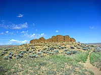
After Horseshoe, the path crosses a more extensive flat for 0.3 miles to the upper end of another shallow ravine, site of the Hackberry pueblo. The main structure is on the east side, seen first from a viewpoint on the west, next to a smaller, circular ruin. The trail continues a short distance, over the streambed just above a pour-off and an overgrown area, to the other site, two adjacent square rooms with relatively low walls. Below an overhanging cliff at the very upper end of the ravine are a spring, a small ruin, and some handprint pictographs.
Holly Group
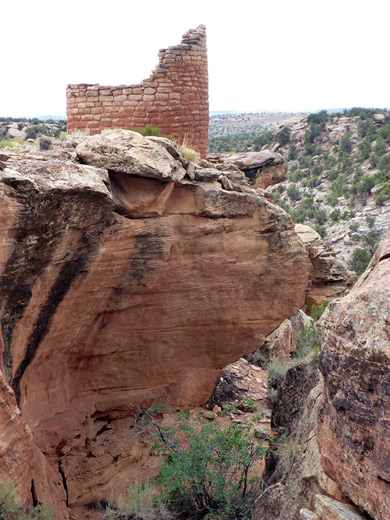
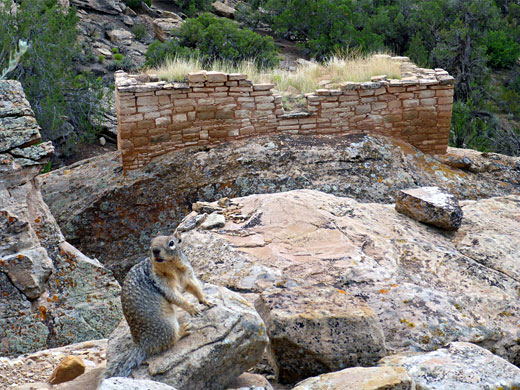
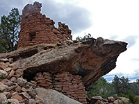
The road to Holly has a few rocky patches, especially towards the end. A sign gives the size of this unit as 63 acres. From the trailhead, a brief walk leads to the north end of a minor drainage (the uppermost section of Keeley Canyon), and the first three ruins, one on the rim, the other two on detached, flat-topped rocks, one of which is angled at about 40 degrees, a displacement thought to have occurred after the settlement was abandoned, causing the upper walls of the dwelling - now known as Tilted House - to fall away, though the lower section of the walls are still firmly attached. The other two ruins are named Detached Boulder House and Curved Wall House.
Holly House
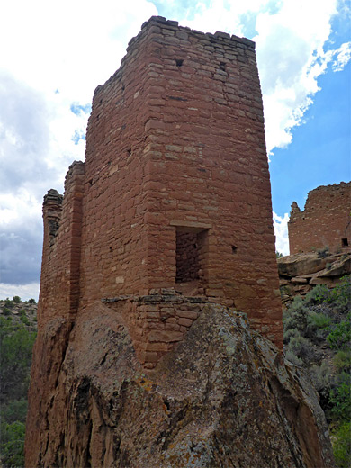
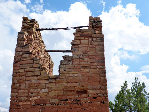
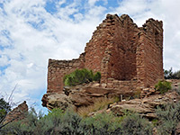
Just past this initial group are the two largest structures; Holly Tower, on another huge boulder slightly lower down the canyon, and Holly House (also known as Great House) on the opposite rim. The tower is a double structure, rectangular in outline, the walls tapering smoothly down to the sheer-sided rock at the base. A doorway can be seen, plus lines of postholes from the intermediate wooden floors, all long gone. The house has two original roof beams surviving, on top of quite tall walls, which are higher on the east side. A smaller, circular room is adjacent, missing most of its walls. A short trail follows the rim southwards, coming in sight of a big boulder with some faint, spiral petroglyphs, protected from weathering by a overhang, while another trail runs all the way to the Square Tower campground - a narrow route, seemingly very little used.
Horseshoe/Hackberry - Similar Hikes
All Contents © Copyright The American Southwest | Comments and Questions | Contribute | Affiliate Marketing Disclosure | Site Map