The American Southwest
Home | Parks | Trails | Plants | Canyons
Maps | Landscapes | Site Map | Whats New? |
More...
Follow americansouthwest.net on Facebook
×
General Pages
Home
Parks
Trails
Plants
Slot Canyons
Maps
Landscapes
Itineraries
Site Map
What's New?
More pages...

States
Arizona
California
Colorado
Idaho
Nevada
New Mexico
Oregon
Texas
Utah
Wyoming


ARIZONA
CALIFORNIA
COLORADO
IDAHO
NEVADA
NEW MEXICO
OREGON
TEXAS
UTAH
WYOMING
UTAH
MAPS | PARKS | TRAILS | HOTELS

Map of Flaming Gorge National Recreation Area


Utah > Flaming Gorge National Recreation Area > Map
Map of Flaming Gorge National Recreation Area


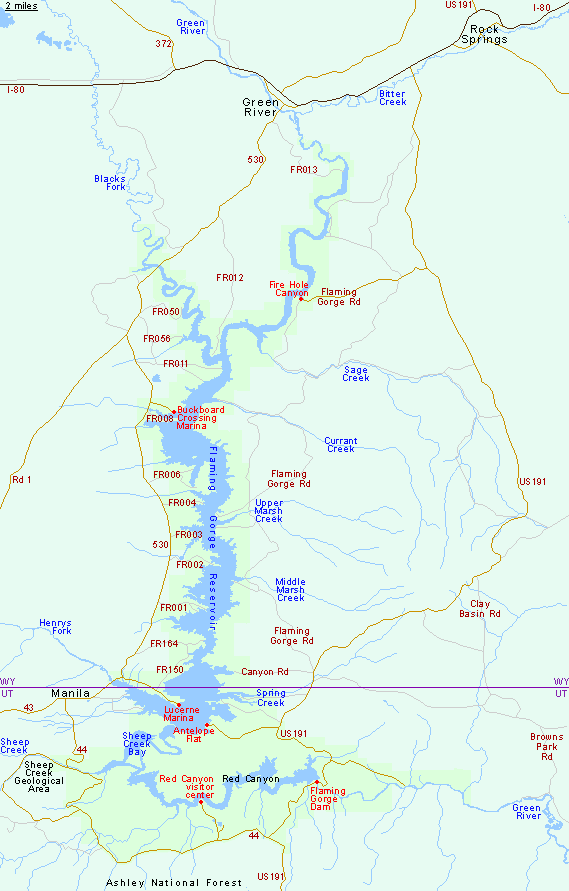
WY 530 runs close to the west side of Flaming Gorge Reservoir, between Green River and Manila (45 miles). From Manila, UT 44 gives access to various places along the south shore of the lake, including Sheep Creek Geological Area and Red Canyon, before the junction with US 191; this heads north, crosses Flaming Gorge Dam and meets I-80 after another 60 miles.

Back to Top
Arizona | California | Colorado | Idaho | Nevada | New Mexico | Oregon | Texas | Utah | Wyoming | Slot Canyons | Travelogue | SOUTHWEST

All Contents © Copyright The American Southwest | Comments and Questions | Contribute | Affiliate Marketing Disclosure | Site Map