The American Southwest
Home | Parks | Trails | Plants | Canyons
Maps | Landscapes | Site Map | Whats New? |
More...
Follow americansouthwest.net on Facebook
×
General Pages
Home
Parks
Trails
Plants
Slot Canyons
Maps
Landscapes
Itineraries
Site Map
What's New?
More pages...

States
Arizona
California
Colorado
Idaho
Nevada
New Mexico
Oregon
Texas
Utah
Wyoming


ARIZONA
CALIFORNIA
COLORADO
IDAHO
NEVADA
NEW MEXICO
OREGON
TEXAS
UTAH
WYOMING
UTAH
MAPS | PARKS | TRAILS | HOTELS

Map of Cedar Mesa, Grand Gulch and Comb Ridge


Utah > Cedar Mesa, Grand Gulch and Comb Ridge > Map
Map of Cedar Mesa, Grand Gulch and Comb Ridge

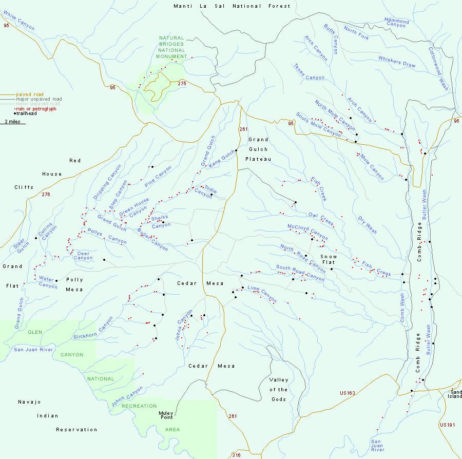
Paved roads through the Cedar Mesa/Grand Gulch area are UT 95 and UT 276 to the north, and UT 261 across the center, linking UT 95 with Mexican Hat. To the east, both sides of Comb Ridge may be reached by good quality unpaved tracks between UT 95 and US 163.

Back to Top
Arizona | California | Colorado | Idaho | Nevada | New Mexico | Oregon | Texas | Utah | Wyoming | Slot Canyons | Travelogue | SOUTHWEST

All Contents © Copyright The American Southwest | Comments and Questions | Contribute | Affiliate Marketing Disclosure | Site Map