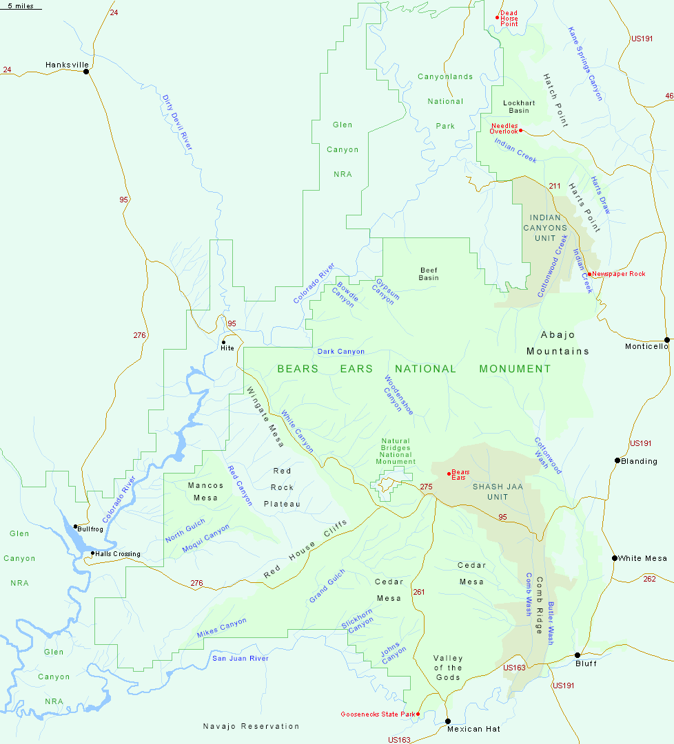
The initial, and current, boundary of Bears Ears National Monument is shown in light green. In December 2017 the monument was greatly reduced in size, and divided into two separate units, Indian Canyons in the north, adjoining Canyonlands National Park, and Shash Jaa to the south, containing Comb Ridge and the Bears Ears Buttes. The original area was restored in 2021.
Major paved roads in and around Bears Ears National Monument are US 163 between Bluff and Mexican Hat along the southern edge, Hwy 261 across Cedar Mesa, Hwy 95 across the center, Hwy 276 towards Halls Crossing, and Hwy 211 towards the Needles district of Canyonlands National Park.
All Contents © Copyright The American Southwest | Comments and Questions | Contribute | Affiliate Marketing Disclosure | Site Map