Highlights:
Unspoilt mountain range within El Paso city limits, covered with typical Chihuahuan Desert vegetation; park offers camping, picnicking and hiking
Nearby town:
Management:
Location:
Seasons:
All year
Rating (1-5):
★★★★★

Franklin Mountains State Park is part of the West and Central Texas itinerary
Featured Hotel
Candlewood Suites El Paso North
 Part of a commercial area on the northern approach to El Paso along US 54. West-facing rooms have fine views across the desert to the Franklin Mountains which rise up 2 miles away
Check Rates
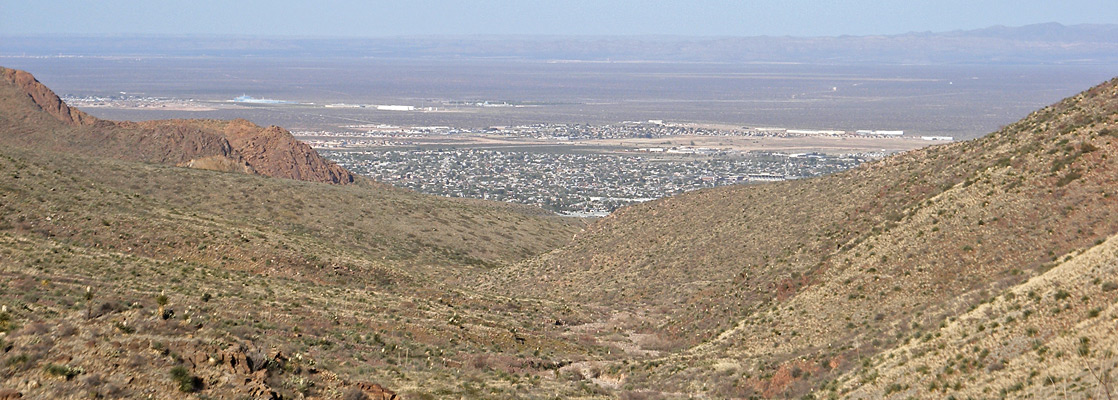
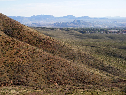
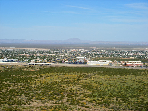
Right at the west edge of Texas, the Franklin Mountains are a relatively small range, just 4 by 23 miles in extent, but are considered by some to form the southernmost tip of the 3,000 mile Rocky Mountains that extend near continuously all the way into Canada. They dominate the skyline of El Paso (which was founded as Franklin; renamed in 1852), stretching from the city center northwards into New Mexico, and received protection relatively recently (1979) as Franklin Mountains State Park, created to prevent encroaching development and preserve the unspoilt Chihuahuan Desert landscapes - the range is treeless apart from around a few springs and in some sheltered valleys, covered instead by short grass, yucca and scattered cacti, and while not especially scenic themselves, the peaks provide good hiking opportunities and far reaching views over the surrounding flat lowlands.
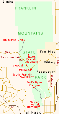
The state park is the second largest in Texas, after Big Bend Ranch. Development is limited, visitor numbers are quite low (residents of El Paso form the majority) and there are only two main access points - in the south along McKelligon Canyon, where a dead-end road leads up a narrow ravine to a high relief area popular for rock climbing, and via Highway 375, Woodrow Bean Transmountain Road, which passes several sites including a 2 mile side road to the main center for recreation, Tom Mays Unit. This has a tent campsite, a 5-vehicle RV campground, a picnic area and several trailheads.
The state park is the second largest in Texas, after Big Bend Ranch. Development is limited, visitor numbers are quite low (residents of El Paso form the majority) and there are only two main access points - in the south along McKelligon Canyon, where a dead-end road leads up a narrow ravine to a high relief area popular for rock climbing, and via Highway 375, Woodrow Bean Transmountain Road, which passes several sites including a 2 mile side road to the main center for recreation, Tom Mays Unit. This has a tent campsite, a 5-vehicle RV campground, a picnic area and several trailheads.
Franklin Mountains Table of Contents
Map of Franklin Mountains State Park
Facilities of Franklin Mountain State Park
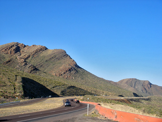
Transmountain Road was constructed in the 1960s and is the only route across the Franklin Mountains; a busy 4 lane highway running between US 54 and I-10 exit 6, climbing 1,200 feet to a highpoint of 5,280 feet at Smugglers Pass. The eastern 4 miles pass through part of Fort Bliss Military Reservation, while the higher section is within the state park, where the road is enclosed by sparsely vegetated, rocky slopes typical of the mountains. There are several viewing areas along the south side, and one trailhead, for the 2 mile hike to South Franklin Mountain, via the Ron Coleman Trail which continues southwards to McKelligon Canyon. The turn-off to the Tom Mays Unit (closed at 5 pm, winter to spring, and at 8 pm in summer) leads northwards over gently sloping ground to the trailheads and campsite, quite scenically situated at the foot of the mountain crest, with good views west towards Rio Grande valley. Much of the park's extensive network (over 100 miles) of mixed-use hiking/cycling/horse riding trails may be reached from here; one popular destination (4.5 miles) is the highest peak in the area, 7,192 foot North Franklin Mountain. At the east end of Transmountain Road are two other attractions: National Border Patrol Museum and the El Paso Museum of Archaeology, this latter exhibiting the native plants and peoples of this region. Also within the park, the Wyler Aerial Tramway is a mechanized gondola that transports visitors to an observation point at 5,632 feet.
Franklin Mountains - Nearby Places
- Aguirre Spring Recreation Area, New Mexico (53 miles) - small area of the Organ Mountains, overlooking White Sands and Tularosa Valley
- Hueco Tanks State Park (38 miles) - granite outcrop with many pictographs, also popular for rock climbing
Franklin Mountains - Similar Places
- Guadalupe Mountains National Park, Texas - isolated mountain range with diverse climate zones
- South Mountain Park, Arizona - cactus-covered mountains adjacent to Phoenix
- Superstition Mountains, Arizona - fabled desert hills
All Contents © Copyright The American Southwest | Comments and Questions | Contribute | Affiliate Marketing Disclosure | Site Map