Tuff Canyon, Big Bend National Park
Texas > Big Bend National Park > The Southwest > Hiking > Tuff Canyon
Tuff Canyon
Short, narrow, cliff-lined ravine through pyroclastic tuff, viewed from three overlooks along paths on the rim. An optional off-trail extension descends a side-ravine to the canyon floor and follows this upstream a way, to a rhyolite lens, above which the canyon is shallower
Length: 0.5 mile loop, to the overlooks. 0.5 mile one way into the canyon
Elevation change: level, 100 feet
Difficulty: Easy
Type: Loop, or off-trail route
Usage: Medium, low
Season: All year
Trailhead: Pull-out along Ross Maxwell Scenic Drive
Rating (1-5): ★★★★★
Elevation change: level, 100 feet
Difficulty: Easy
Type: Loop, or off-trail route
Usage: Medium, low
Season: All year
Trailhead: Pull-out along Ross Maxwell Scenic Drive
Rating (1-5): ★★★★★

Tuff Canyon, in Big Bend National Park, is a short, enclosed section of Blue Creek, a long drainage which originates on the western slopes of the Chisos Mountains and further upstream winds through a series of pinnacles, viewable on a 1.5 mile trail.
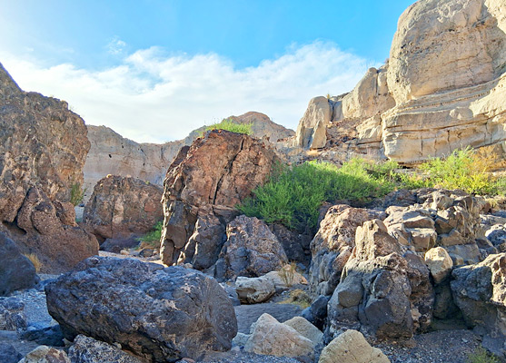
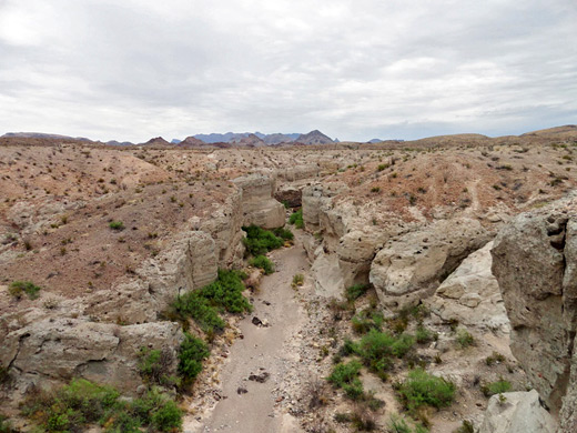
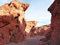
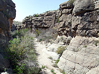
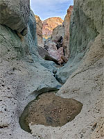
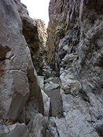
Most of Blue Creek is shallow and unenclosed; the canyon has formed where the streambed cuts into a band of tuff, this a relatively soft, light-colored rock, residue of ancient pyroclastic flows; from the Wasp Spring Member of the Delaho Formation. Downstream of the 0.7 mile-long ravine the canyon gives way to low mounds and desert flats, while above is a band of darker rhyolite (and trachyte), forming a sloping dryfall, and beyond this the drainage becomes shallow once more.
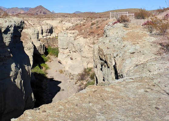
The interesting geology of Tuff Canyon may be viewed by short trails on the southern rim, leading to three railing-protected overlooks, up to 100 feet above the floor of the sheer-walled gorge. The streambed can also be easily reached, via a continuation path that descends a side gully to the creek, which can then be followed upstream, past the rhyolite lens to the more open canyon beyond. The paths to the viewpoints - a loop and a one-way section, are about half a mile in total, while the walk down to the canyon and upstream is another half mile or so.
The parking place for Tuff Canyon is a pullout along Ross Maxwell Scenic Drive, 20 miles from Panther Junction Road, and close to a peak to the southwest, Cerro Castellan, which has a similar composition to the canyon; tuff across the lower slopes, topped by a rhyolitic lava dome. From the pull-out a short path heads north to one of the three overlooks, while a loop a little way downstream passes the other two.
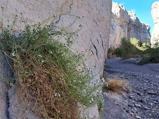
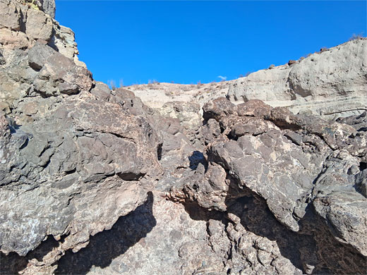
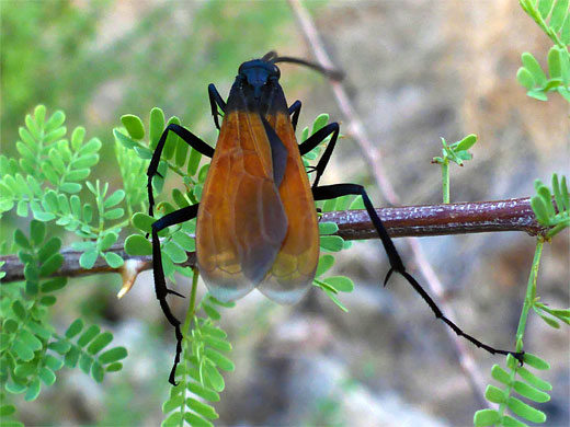
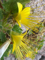
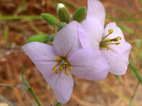
A short spur forks off the loop, down to the Blue Canyon creekbed. Upstream, this soon becomes enclosed by the tuff cliffs, vertical or slightly overhanging, light in color and coarse-grained, often with embedded clasts. The gravelly streambed covers most of the canyon floor, with just a few banks to one side or other, harboring mesquite bushes and occasional wildflowers. In between the two overlooks above, on the south side, is a sloping section of the canyon walls that provides a short-cut route back to the rim, over stony ground. Beyond is another, shorter stretch of the tuff cliffs and then an abrupt change to the underlying, dark brown rhyolite and trachyte, which forms a convoluted dryfall, extending over 300 feet. Above, the canyon is shallow and not as photogenic so the fall is an obvious point to end to the hike.
Most of Blue Creek is shallow and unenclosed; the canyon has formed where the streambed cuts into a band of tuff, this a relatively soft, light-colored rock, residue of ancient pyroclastic flows; from the Wasp Spring Member of the Delaho Formation. Downstream of the 0.7 mile-long ravine the canyon gives way to low mounds and desert flats, while above is a band of darker rhyolite (and trachyte), forming a sloping dryfall, and beyond this the drainage becomes shallow once more.
The interesting geology of Tuff Canyon may be viewed by short trails on the southern rim, leading to three railing-protected overlooks, up to 100 feet above the floor of the sheer-walled gorge. The streambed can also be easily reached, via a continuation path that descends a side gully to the creek, which can then be followed upstream, past the rhyolite lens to the more open canyon beyond. The paths to the viewpoints - a loop and a one-way section, are about half a mile in total, while the walk down to the canyon and upstream is another half mile or so.
The Overlooks
The parking place for Tuff Canyon is a pullout along Ross Maxwell Scenic Drive, 20 miles from Panther Junction Road, and close to a peak to the southwest, Cerro Castellan, which has a similar composition to the canyon; tuff across the lower slopes, topped by a rhyolitic lava dome. From the pull-out a short path heads north to one of the three overlooks, while a loop a little way downstream passes the other two.

The Canyon Floor
A short spur forks off the loop, down to the Blue Canyon creekbed. Upstream, this soon becomes enclosed by the tuff cliffs, vertical or slightly overhanging, light in color and coarse-grained, often with embedded clasts. The gravelly streambed covers most of the canyon floor, with just a few banks to one side or other, harboring mesquite bushes and occasional wildflowers. In between the two overlooks above, on the south side, is a sloping section of the canyon walls that provides a short-cut route back to the rim, over stony ground. Beyond is another, shorter stretch of the tuff cliffs and then an abrupt change to the underlying, dark brown rhyolite and trachyte, which forms a convoluted dryfall, extending over 300 feet. Above, the canyon is shallow and not as photogenic so the fall is an obvious point to end to the hike.

Tuff Canyon - Similar Hikes
All Contents © Copyright The American Southwest | Comments and Questions | Contribute | Affiliate Marketing Disclosure | Site Map