New Mexico National Forests
Other New Mexico listings: national parks and monuments and state parks.
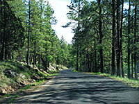
| Carson National Forest Carson is the northernmost national forest in New Mexico, covering 1.5 million acres of the Rocky Mountains around Taos, either side of the Rio Grande, and including the highest summit in the state, 13,161 foot Wheeler Peak. Most is wooded, steep, and crossed by numerous ravines, but also quite readily accessed, by several paved routes and many tracks. There are four wilderness areas (plus one proposed), 330 miles of trails, 30 campgrounds, dozens of lakes, and several ski areas. Towns in or near the national forest include Red River, Questa, Eagle Nest and Angel Fire. |
|
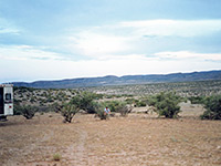
| Cibola National Forest Together with several areas of national grassland (extending into Texas and Oklahoma), Cibola National Forest covers 1.9 million acres of west and central New Mexico, with eight separate portions. Three (Magdalena District) are west of Socorro, either side of US 60; two (Mnt Taylor District) are near Grants, encompassing the Zuni and Cebolleta Mountains, two cover smaller mountain ranges near Mountainair and the other is just east of Albuquerque, and includes Sandia Peak, the most visited location. Environments range from the Chihuahuan desert, through the prairie and pinyon-juniper pine zones to subalpine spruce and fir, while elevations are from 5,000 feet to over 11,000 feet. |
|
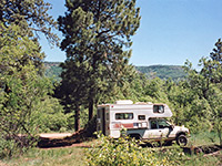
At 3.3 million acres Gila is the largest national forest in New Mexico, and the most remote, extending over a rugged, high elevation area in the west of the state centered on the Mogollon Mountains. There are three large wilderness areas (Gila, Aldo Leopold, Blue Range) within the forest, a small national monument (Gila Cliff Dwellings), three major rivers and their numerous tributaries, several hot springs and a lengthy section of the continental divide, all serviced by a network of mostly steep and winding unpaved roads. US 180 and NM 12 are the main paved highways through the forest, both towards the western edge. |
|
There are five mountain ranges within the three units of the Lincoln National Forest, becoming gradually more desert-like further south: Jicarilla, Sacramento, Capitan, Sierra Blanca and Guadalupe, this latter continuing across the Texas border in Guadalupe Mountains National Park. Access is easiest in the north, where several main roads pass through the forest, and towns such as Ruidoso and Carrizozo provide visitor services. The largest section, east of Alamogordo, is also crossed by a few paved routes, but the southern segment is particularly remote and inaccessible. |
|
The 1.6 million acres of the Santa Fe National Forest are divided into two main blocks either side of the Rio Grande; to the east, the preserve includes 13,103 foot Truchas Peak, second tallest summit in the state, together with much other high elevation land at the south end of the Sangre de Cristo Mountains. The western section is larger, less high and more accessible, in particular by scenic highway NM 4 which winds across the main hills in the area (Jemez Mountains), passing various lakes, trailheads and campgrounds. Other sites near the forest include Bandelier National Monument and the Tent Rocks. |
All Contents © Copyright The American Southwest | Comments and Questions | Contribute | Affiliate Marketing Disclosure | Site Map