Las Conchas Trail
Scenic path through a pretty section of the shallow canyon of the East Fork Jemez River, past floral meadows and ponderosa pine woodland, beneath colorful volcanic cliffs
Length: 1.8 miles
Elevation change: 60 feet
Difficulty: Easy
Type: One-way
Usage: Medium
Season: Late spring, summer, fall
Trailhead: Along Hwy 4, between mileposts 36 and 37
Rating (1-5): ★★★★★
Elevation change: 60 feet
Difficulty: Easy
Type: One-way
Usage: Medium
Season: Late spring, summer, fall
Trailhead: Along Hwy 4, between mileposts 36 and 37
Rating (1-5): ★★★★★

The Jemez River flows north to south through the Jemez Mountains, providing a course for the main access road, Hwy 4 from San Ysidro. The drainage splits into several major tributaries, the largest the East Fork, the confluence being directly below the conspicuous landmark of Battleship Rock, and this river lies at the center of a network of trails, the most popular hiking area in the mountains.
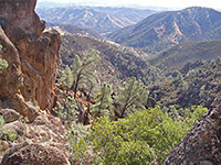
The East Fork flows through a deep, sometimes cliff-lined canyon, much of which is not easily accessible at water level, so the paths mostly cross the slopes and ridges above. Upstream, the canyon becomes rather less deep above Jemez Falls, and beyond here, over the next five miles, it is crossed by Hwy 4 in three places, before the terrain flattens out and the river winds across the open plains of Valles Caldera.
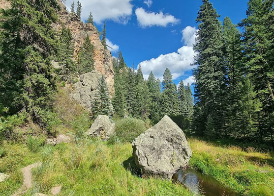
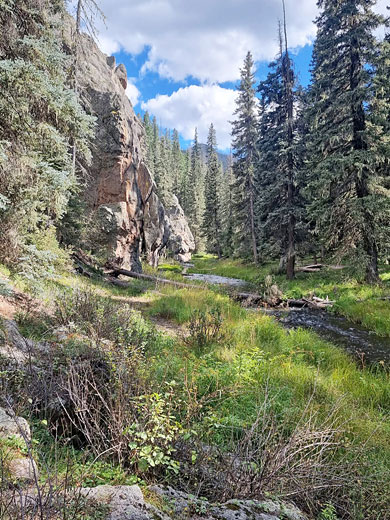
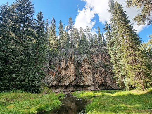
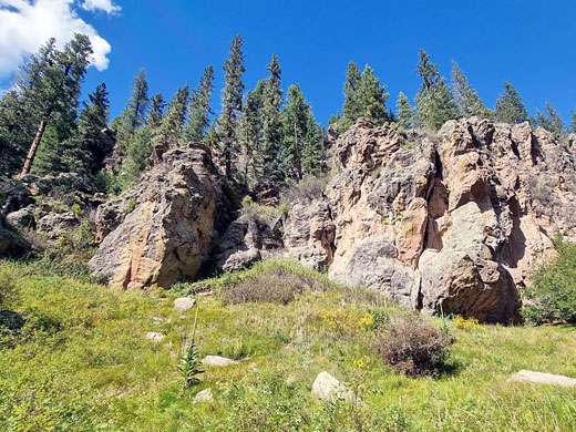
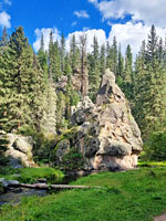
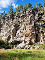
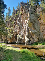
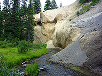
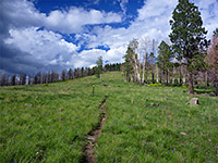
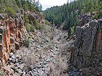
Perhaps the best short trail in this area is along the river, beginning from the middle of the three Hwy 4 crossing places; this is the 1.8 mile Las Conchas Trail, easy and nearly level, following the river downstream along a shallow canyon up to a point where the water covers all of the valley floor, from cliff to cliff. The river is lined by colorful, jagged walls of rhyolite lava, rising above patches of ponderosa pine woodland and lush meadows filled with a great variety of wildflowers.
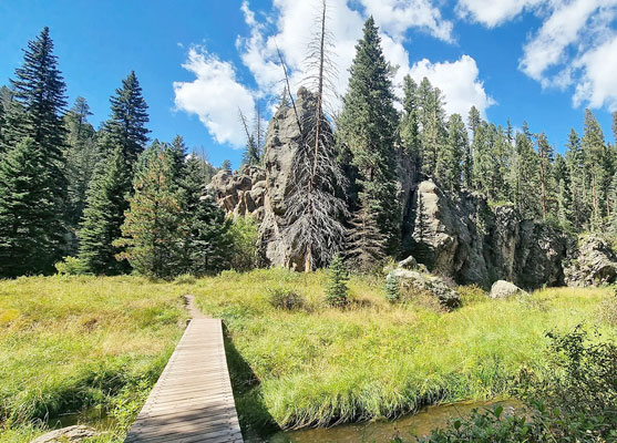
The path crosses the river six times on narrow wooden bridges, and all the scenery is especially pristine and pretty. A continuation hike is possible along the East Fork Trail (#137) which climbs the slope to the south, starting shortly before the (west) end of the Las Conchas Trail. The path has relatively high elevation, 8,400 feet, so is best hiked in summer; wildflowers bloom between June and September.
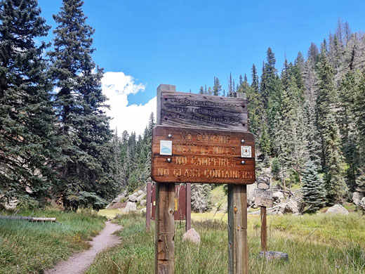
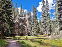
The Las Conchas Trail is provided with a small parking place with room for about eight vehicles, on the north side of Hwy 4, ten miles east of the Hwy 126 junction, beside a bridge over the East Fork River; more spaces are available a short distance east in a pullout. The trail descends a flight of wooden steps to the river, which is usually just a few feet wide and very shallow, though subject to occasional flash floods, as stated by a warning notice at the start. Another path joins from the right, crossing a bridge to the alternative parking place. Ahead, the trail runs at the foot of the first of many short cliffs, whilst heading due north, through a grassy corridor with pines at the edges, then past a few more cliffs and across to the east side of the river, first of the six crossings, quickly followed by the second.
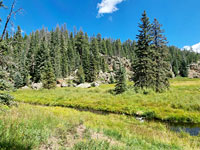
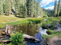
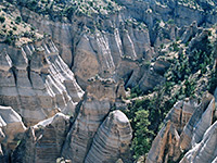
The next section is more shady, the path partly within the trees, before the valley widens and path traverses a big meadow, as the drainage curves round to the west. After another wooded patch, the third footbridge takes the trail to the north side of the valley, and below more cliffs, followed by a lengthy straight section, somewhat enclosed for a while and then wider, with extensive riverside meadows. The fourth and fifth crossings are close together, either side of a bend along the river, and soon after the sixth and final bridge as the canyon starts to deepen and becomes more cliff-bound. The path ends in front of a tight bend where the river enters a slot-like channel between two rhyolite walls, impassable without wading. This is just before a junction, where the East Fork Trail climbs the steep slopes to the south, meeting Hwy 4 again in 3.7 miles.
The East Fork flows through a deep, sometimes cliff-lined canyon, much of which is not easily accessible at water level, so the paths mostly cross the slopes and ridges above. Upstream, the canyon becomes rather less deep above Jemez Falls, and beyond here, over the next five miles, it is crossed by Hwy 4 in three places, before the terrain flattens out and the river winds across the open plains of Valles Caldera.
Perhaps the best short trail in this area is along the river, beginning from the middle of the three Hwy 4 crossing places; this is the 1.8 mile Las Conchas Trail, easy and nearly level, following the river downstream along a shallow canyon up to a point where the water covers all of the valley floor, from cliff to cliff. The river is lined by colorful, jagged walls of rhyolite lava, rising above patches of ponderosa pine woodland and lush meadows filled with a great variety of wildflowers.
The path crosses the river six times on narrow wooden bridges, and all the scenery is especially pristine and pretty. A continuation hike is possible along the East Fork Trail (#137) which climbs the slope to the south, starting shortly before the (west) end of the Las Conchas Trail. The path has relatively high elevation, 8,400 feet, so is best hiked in summer; wildflowers bloom between June and September.
Start of the Trail
The Las Conchas Trail is provided with a small parking place with room for about eight vehicles, on the north side of Hwy 4, ten miles east of the Hwy 126 junction, beside a bridge over the East Fork River; more spaces are available a short distance east in a pullout. The trail descends a flight of wooden steps to the river, which is usually just a few feet wide and very shallow, though subject to occasional flash floods, as stated by a warning notice at the start. Another path joins from the right, crossing a bridge to the alternative parking place. Ahead, the trail runs at the foot of the first of many short cliffs, whilst heading due north, through a grassy corridor with pines at the edges, then past a few more cliffs and across to the east side of the river, first of the six crossings, quickly followed by the second.
Las Conchas Canyon
The next section is more shady, the path partly within the trees, before the valley widens and path traverses a big meadow, as the drainage curves round to the west. After another wooded patch, the third footbridge takes the trail to the north side of the valley, and below more cliffs, followed by a lengthy straight section, somewhat enclosed for a while and then wider, with extensive riverside meadows. The fourth and fifth crossings are close together, either side of a bend along the river, and soon after the sixth and final bridge as the canyon starts to deepen and becomes more cliff-bound. The path ends in front of a tight bend where the river enters a slot-like channel between two rhyolite walls, impassable without wading. This is just before a junction, where the East Fork Trail climbs the steep slopes to the south, meeting Hwy 4 again in 3.7 miles.
Las Conchas Trail - Similar Hikes
All Contents © Copyright The American Southwest | Comments and Questions | Contribute | Affiliate Marketing Disclosure | Site Map