Highlights:
Unusual group of large, rounded volcanic boulders, surrounded by flat prairie. Park is mostly popular for camping, but the rocks are good to photograph and fun to explore
Nearby town:
Deming, 28 miles
Management:
Location:
Seasons:
All year
Rating (1-5):
★★★★★

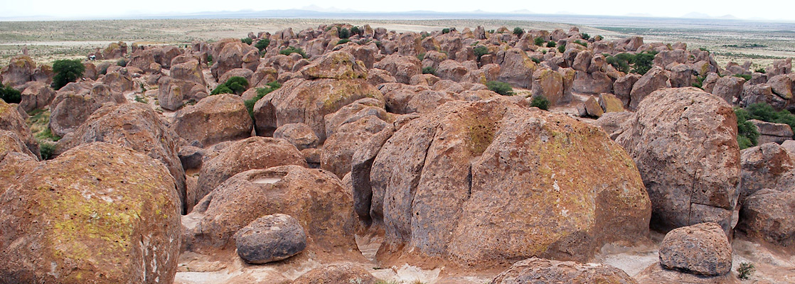
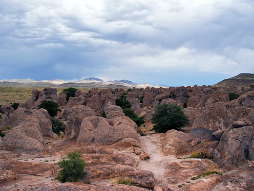
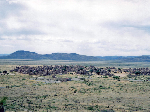
The rolling, grassy plains of southwest New Mexico are not an obvious place to find unusual, eroded rock formations but in one shallow valley near Deming, well south of though still in sight of the rugged Gila Mountains, is a half mile expanse of large volcanic columns up to 40 feet tall, known as the City of Rocks.
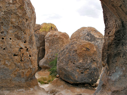
The area was incorporated as a state park in 1952 and is popular for camping, photography, wildlife watching or just walking amongst the rocks - some can be climbed, others have sheer sides that form a maze of narrow passages between them.
The park is a favorite with children, who can explore the rocks all day, though the average non-camping visitor may only stay for an hour or so.
Photographs
7 views of City of Rocks State Park.
Facilities at the City of Rocks
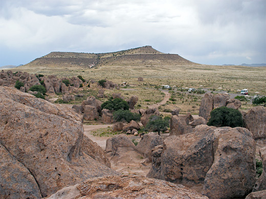
The park lies in the Mimbres River valley, half way between Deming and Silver City along US 180, then 3 miles northeast on NM 61 and 1 mile down a side road. The day use fee (2024) is $5, or $18/8 for camping, paid at a self-service entrance station, next to which is a short spur road that climbs 100 feet to the top of a small hill that gives a panoramic overview of the formations and the surrounding empty Chihuahuan desert prairie. The main road ends at a visitor center, astronomical observatory (the dark nighttime skies hereabouts make for good star gazing), desert botanical garden and the campground - this has 52 well separated sites (ten with electricity), some nestled in alcoves right among the rocks, all furnished with fire gills and picnic tables. The sites are distributed all around the formations, which are encircled by a 1.5 mile dirt track.
The Rocks
The rocks are light brown to pink in color, often covered by various shades of lichen, and eroded into many wonderful shapes and forms. They are the result of wind and water erosion of compacted tuff, formed by eruption of a nearby volcano about 35 million years ago. The eruption was from the Emory Caldera, centered near Hillsboro Peak at the southern end of the Black Range, and which has left other volcanic residues spread across 50 miles of this part of the state, including nearby Table Mountain, recently (2005) added to the park after being purchased from a local landowner. Little vegetation grows around the boulders, just the occasional oak or emory tree - between most are either bare, sandy chambers or narrow, slot-like passages.
City of Rocks - Nearby Places
- Gila Cliff Dwellings National Monument (74 miles) - ancient ruins in a remote canyon setting
- Rock Hound State Park (42 miles) - mountain with desert surroundings; a fruitful location for mineral collecting
City of Rocks - Similar Places
- City of Rocks National Reserve - eroded granite formations in a remote part of southern Idaho
- Joshua Tree National Park, California - large expanses of rounded granite boulders
- Pinnacles National Monument, California - ancient volcanic mountains, topped by eroded rock formations
All Contents © Copyright The American Southwest | Comments and Questions | Contribute | Affiliate Marketing Disclosure | Site Map