Hiking in Chaco Culture National Historical Park
New Mexico > Chaco Culture National Historical Park > Hiking
Trails are shown on the Chaco Culture map.

| Penasco Blanco Trail Length 3.6 miles (5.8 km) Elevation change 160 feet (49 meters) Difficulty Easy Type One way Usage Low Season All year, unless snow-covered in winter Trailhead West end of the park road, by Pueblo del Arroyo Rating (1-5) ★★★★★ Starting at the west end of the park loop road, the Penasco Blanco Trail (an old vehicle track) follows Chaco Wash further downstream past several other ruins and many petroglyphs, before a short climb to the plateau on the south side, location of a larger set of ruins. |
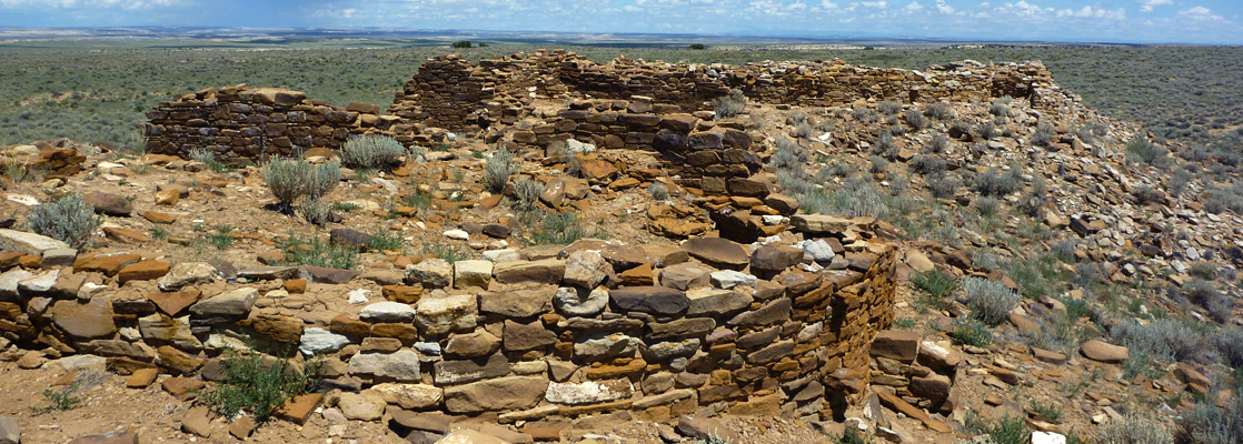
 Length 5.1 miles (8.2 km), loop Elevation change 270 feet (82 meters) Difficulty Easy to moderate Type Loop Usage Low to medium Season All year, unless snow-covered in winter Trailhead West end of the park road, by Pueblo del Arroyo Rating (1-5) ★★★★★ This varied loop hike passes two lesser-known ruins (Kin Kletso and Pueblo Alto), the latter on the plateau on the north side of Chaco Wash. To reach here the path has a two-stage climb from the valley floor; it later turns east, then south along a narrowing promontory before returning to the trailhead right along the edge of the cliffs, giving good views of Chetro Ketl and Pueblo Bonito. |
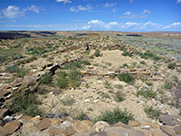
 Length 4.4 miles (7.1 km), loop Elevation change 450 feet (137 meters) Difficulty Easy to moderate Type Loop Usage Low Season All year, unless snow-covered in winter Trailhead West end of the park road, near Casa Rinconada Rating (1-5) ★★★★★ A crumbling backcountry ruin (Tsin Kletsin) is reached by this 4.4 mile loop trail that starts by climbing the cliffs on the south side of Chaco Wash then crosses the flat plateau beyond, to the ancient settlement. From here the route is west, down a side valley that leads to the larger South Gap, and finally north along an old vehicle track back to the trailhead. |
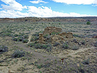 Length 1.5 miles (2.4 km) Elevation change 20 feet (6 meters) Difficulty Easy Type One way Usage Low Season All year, unless snow-covered in winter Trailhead Parking area near Gallo Campground Rating (1-5) ★★★★★ Wijiji is a multi-room settlement along Chaco Wash, east of the park road, and may be viewed by a level trail along an old vehicle track (once the main park access route). The ruin dates from around 1100, later than many of the pueblos further west. |
All Contents © Copyright The American Southwest | Comments and Questions | Contribute | Affiliate Marketing Disclosure | Site Map