Highlights:
Part of the wide, empty valley between the Spring Mountains and the Sheep Range, just north of Las Vegas - seasonal drainages, mud hills and desert plains, explorable by off-trail hiking. Site of many Ice Age fossil discoveries; very limited visitor facilities
Nearby town:
North Las Vegas, 10 miles
Management:
Location:
36.335, -115.279 (Durango entrance)
Seasons:
All year, though cooler seasons are preferred
Rating (1-5):
★★★★★
Weather:


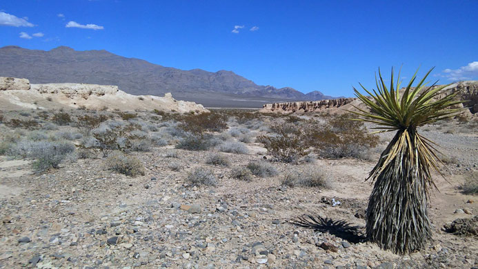
Established December 19th 2014, Tule Springs Fossil Beds was for just a short time the newest national monument in Nevada, until creation of Basin and Range National Monument in 2015. The name refers to a group of springs on the northern edge of Las Vegas, contained within Floyd Lamb Park; these are surrounded by tall trees and much other riparian vegetation but to the north the land is dry and barren, part of Las Vegas Valley, a ten mile-wide basin bordered by the Spring Mountains to the west, and the Las Vegas Range and the Sheep Range to the northeast.
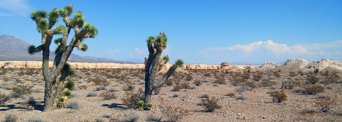
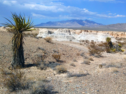
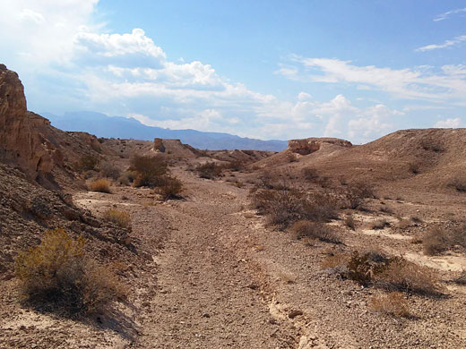
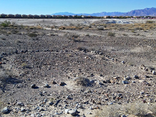
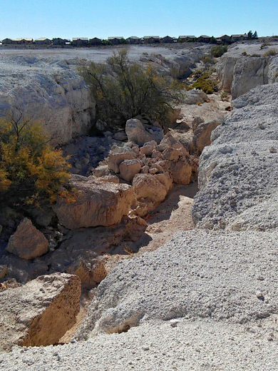
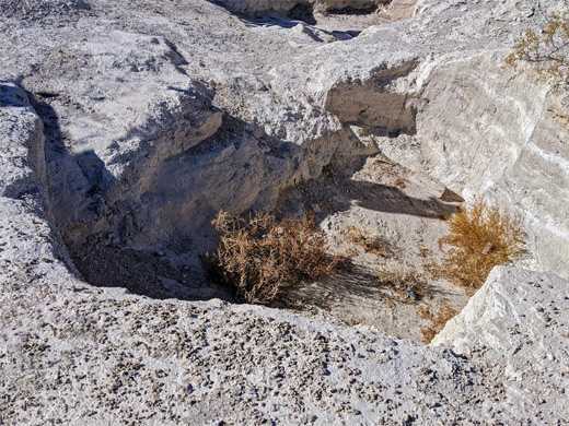
The national monument extends for 20 miles along the valley, centered on the usually dry Upper Las Vegas Wash that runs down the middle, and it also contains various tributaries, but most of the land is gravelly flats and groups of low mud hills. The scenery is generally unremarkable, not significantly different to countless other desert valleys in Nevada; the main reason for creation of the monument is to protect the many Ice Age (Pleistocene) fossils found here, of which the most visible are mammoth tusks. Other animals whose bones have been unearthed include bison, lions, horses, camels and sloths, all of whom lived in a wooded, riparian environment, very different to the barren plains of today.
The national monument extends for 20 miles along the valley, centered on the usually dry Upper Las Vegas Wash that runs down the middle, and it also contains various tributaries, but most of the land is gravelly flats and groups of low mud hills. The scenery is generally unremarkable, not significantly different to countless other desert valleys in Nevada; the main reason for creation of the monument is to protect the many Ice Age (Pleistocene) fossils found here, of which the most visible are mammoth tusks. Other animals whose bones have been unearthed include bison, lions, horses, camels and sloths, all of whom lived in a wooded, riparian environment, very different to the barren plains of today.
Tule Springs Fossil Beds Table of Contents
Introduction
As the national monument is administered by the NPS rather than the BLM, the place will eventually have some facilities including signed trails, a visitor center and museum, but to date there is no development apart from notices at several of the main access points. The desert has very little large vegetation - only creosote bush, saltbush, other straggly bushes and, most prominent, the Mojave yucca, and most of the land is flat, so cross country walking is relatively easy, during cooler times of the year, and for now this is the only activity in the monument.
Visitors have a reasonable chance of spotting fossils, though they are not so abundant, and of course all collecting is prohibited. Other attractions are the desert landscape - the large scale plains and distant mountains, and the small-scale washes and creviced hills, plus spring wildflowers and occasional wildlife, such as bighorn sheep, mule deer, snakes and lizards. One notable plant found here is arctomecon californica, the Las Vegas bearpoppy, which has very limited distribution on desert plains surrounding the city.
Entrances to the National Monument
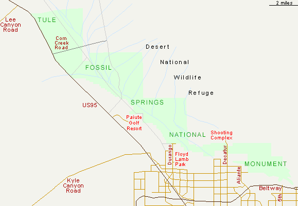
The north edge of the national monument is approximately opposite Lee Canyon Road towards Mount Charleston, and it borders both Nellis Air Force Base and the Desert National Wildlife Refuge; this latter preserve also forms most of the eastern boundary. From here, the monument extends southeast towards Las Vegas and then east, becoming narrower, and ending approximately by the junction of Losee Road with Bruce Woodway Beltway; this is a possible access point though the nearest usual entrance is one mile west, at the 5th Street intersection. Further west, other approaches include Grand Teton Drive and the linked Aliante Parkway, Decatur Boulevard (which crosses a narrow part of the monument and ends at a shooting complex), and Durango Drive, probably the most used entrance. This passes the oasis of Floyd Lamb Park and terminates soon after at an intersection with Moccasin Road, where a parking area has been constructed, and two semi-official trails loop over the mud hills and washes to the north. One other access route is in the northwest, along Corn Creek Road which leads to a group of springs, and links with several lesser tracks that penetrate deeper into the monument.
Fossils of the Tule Springs Beds
Fossils unearthed within the monument range greatly in age, from 250,000 to 7,000 years. One of the major excavation sites is near Decatur Boulevard, where a group of trenches, some up to one mile long, are evidence of the 'Big Dig' of 1962. Other fossil-rich places are subject to ongoing paleontological research, and can be visited by prior arrangement with the Protectors of Tule Springs, a local volunteer group; one such location, reached by a 2 mile hike, is the Super Quarry, where the bones from three mammoths were unearthed, one with the longest trunk (11 feet) yet discovered in the monument. Unfortunately the areas close to the city are also affected by litter, though the NPS will be carrying out cleaning operations.
Tule Springs Fossil Beds - Nearby Places
- Mount Charleston (20 miles) - major peak in the Spring Mountains, site of many recreational activities
- Old Las Vegas Mormon Fort State Historic Park (18 miles) - the earliest non-native settlement in Las Vegas
- Red Rock Canyon (20 miles) - colorful cliffs and canyons on the west edge of Las Vegas
Tule Springs Fossil Beds - Similar Places
- Cabeza Prieta National Wildlife Refuge, Arizona - remote and hostile desert region; mountains and vast, empty plains
- Hagerman Fossil Beds National Monument, Idaho - cliffs and grassy hills bordering the west bank of the Snake River, site of Pliocene fossil discoveries
All Contents © Copyright The American Southwest | Comments and Questions | Contribute | Affiliate Marketing Disclosure | Site Map