Highlights:
Small area of steep cliffs and grassy hills bordering the west bank of the Snake River, site of important Pliocene fossil discoveries. Crossed by one road, which passes two overlooks and a short trail
Nearby towns:
Twin Falls, 33 miles
Management:
Location:
42.770, -114.961 (Oregon Trail Overlook)
Seasons:
All year
Rating (1-5):
★★★★★

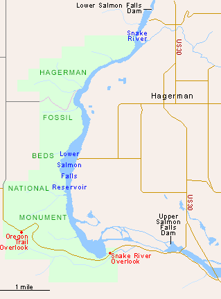
Hagerman Fossil Beds is a candidate for the least well-known national monument in the West, perhaps competing for this title with other paleontological preserves like Fossil Butte in Wyoming and Florissant Fossil Beds in Colorado. The national monument covers a thin strip of land extending six miles on the west side of the Snake River, where this is dammed forming Lower Salmon Falls Reservoir. The visitor center for the monument is located in the nearby small town of Hagerman, on the east side of the river, along US 30, which meets I-80 eight miles north and also passes close to the various units of Thousand Springs State Park.
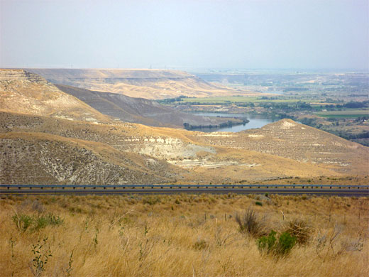
Most of the Snake River in this part of Idaho flows over volcanic rock, but near Hagerman the surrounding cliffs are sedimentary, dating from the late Pliocene period, and have proved very rich in both plant and animal fossils (especially a zebra-like creature known as the Hagerman horse), but, as is usually the case for such locations, there are no fossils to be seen in situ, only in the museum at the visitor center. Instead, developed sites in the monument are limited to two overlooks, one of the river, the other of a section of the historic Oregon Trail.
Most of the Snake River in this part of Idaho flows over volcanic rock, but near Hagerman the surrounding cliffs are sedimentary, dating from the late Pliocene period, and have proved very rich in both plant and animal fossils (especially a zebra-like creature known as the Hagerman horse), but, as is usually the case for such locations, there are no fossils to be seen in situ, only in the museum at the visitor center. Instead, developed sites in the monument are limited to two overlooks, one of the river, the other of a section of the historic Oregon Trail.
Hagerman Fossil Beds Table of Contents
- Map of the Hagerman Fossil Beds
- Snake River Overlook
- Oregon Trail Overlook
- Nearby places
- Similar places
Map of Hagerman Fossil Beds National Monument
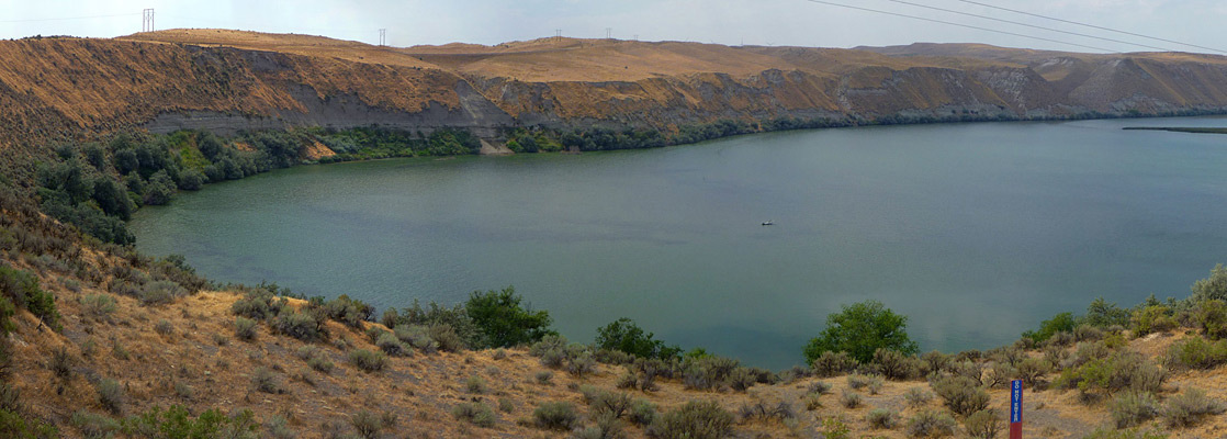
Snake River Overlook
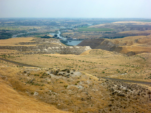
A quiet, country backroad (Bell Rapids Road) winds through the southern section of Hagerman Fossil Beds National Monument, forking off US 30 a few miles south of Hagerman; this crosses the Snake River, passing close to Upper Salmon Falls Dam, then reaches the first viewpoint, looking out over the widest part of the reservoir. Downstream, the river is bordered by flat land to the east (Hagerman Valley) but steep, layered cliffs to the west, which extend northwards for a little way beyond the monument boundary and are cut by several narrow gullies. All the land hereabouts is completely treeless, covered only by short grass, so the bedrock is exposed in many locations, making fossil hunting very fruitful. The excavation sites are not open to the public however, and cross-country hiking is not allowed, supposedly because of the dangers of rattlesnakes, scorpions and landslides, but perhaps also to discourage fossil hunters. Several major landslips have occurred over the years, down the cliffs west of the river, some of which are visible from the viewpoint.
Oregon Trail Overlook
| Hagerman Fossil Beds - one of the 20 least visited national monuments in the West |
Hagerman Fossil Beds - Nearby Places
- Thousand Springs State Park (14 miles, to Malad Gorge) - springs in the volcanic canyons of the Snake River
Hagerman Fossil Beds - Similar Places
- Fossil Butte National Monument, Wyoming - grassy mesas and sagebrush valleys
- John Day Fossil Beds National Monument - fossil-bearing sandstone in the remote, grassy hills of east Oregon
All Contents © Copyright The American Southwest | Comments and Questions | Contribute | Affiliate Marketing Disclosure | Site Map