Black Mountain Trail, Sloan Canyon National Conservation Area
Nevada > Sloan Canyon National Conservation Area > Black Mountain Trail
Black Mountain Trail
Exposed, shadeless path to a 5,092 foot peak, the highest point in the McCullough Mountains - mostly follows a rocky ridgeline, approaching from the west
Length: 3.8 miles
Elevation change: 2,060 feet
Difficulty: Strenuous
Type: One way
Usage: Low to medium
Season: Late fall, winter
Trailhead: Shadow Canyon Drive
Rating (1-5): ★★★★★
Elevation change: 2,060 feet
Difficulty: Strenuous
Type: One way
Usage: Low to medium
Season: Late fall, winter
Trailhead: Shadow Canyon Drive
Rating (1-5): ★★★★★

The Black Mountain Trail to the highest point in the McCullough Mountains is the second most popular hike in Sloan Canyon National Conservation Area, though always sees far fewer visitors than the well known route up Petroglyph Canyon, especially in summer, when the 7.6 mile round trip, gaining over 2,000 feet, is too strenuous for most people.
The hike starts along a residential road in the southern Henderson suburbs; the first part of the route is along the paved Anthem East Trail, up to a small stone dam, from where the actual Black Mountain Trail departs, following an exposed, treeless ridge all the way to the summit. Rocks along the trail are volcanic, dark blocks of the Hidden Valley Andesite, and the ground becomes intensely hot during the summer months; the best time for the trip is November to April. The round trip takes between three and four hours.
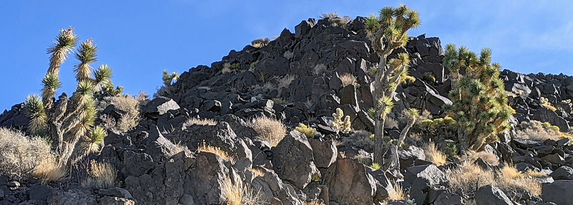
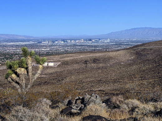
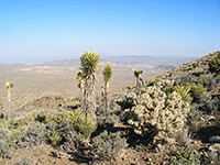
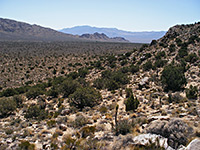
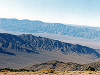
The terrain is dry, completely lacking water sources, so the vegetation is limited, with scattered Joshua trees and other shrubs, not so many wildflowers. The main attraction of the hike is of course the panoramic vista, with no higher peaks for many miles. The numerous other ranges in view include the Spring Mountains and Mount Charleston to the west, the Sheep and Las Vegas ranges to the north, and the Muddy and El Dorado ranges to the east.
Map of Sloan Canyon NCA.
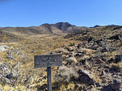
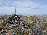
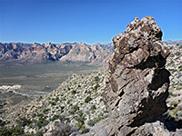
The Anthem East Trail begins along Shadow Canyon Drive, a relatively recently developed street in Anthem on the south side of Henderson, elevation 2,970 feet, from where Black Mountain is clearly visible to the east, above the tiled roofs of the adjacent, single story houses. A parking area has space for dozen or so vehicles, with more room along the street. The path heads south for half a mile alongside a rocky gully, to the west end of the small dam, from where the Boulder Mountain Trail Crosses into the NCA (marked with a wooden sign) and begins a long, steady ascent of the ridge that leads to the top. It starts with some switchbacks, up past a minor high point to a saddle, and a junction with a path that leads southwards for 1.2 miles to Park Peak, a 3,824 foot summit. The remaining 2.4 miles to Black Mountain are consistently steep, and all along the ridgeline, while the final quarter mile is especially rocky and precipitous. The summit is somewhat elongated, north to south, and the land slopes much more sharply on the far side, precluding any trails here, though another ridge to the northwest in theory allows for a loop hike, descending back to another intersection with the Anthem East Trail, but this route is barely evident, so is rarely followed.
The hike starts along a residential road in the southern Henderson suburbs; the first part of the route is along the paved Anthem East Trail, up to a small stone dam, from where the actual Black Mountain Trail departs, following an exposed, treeless ridge all the way to the summit. Rocks along the trail are volcanic, dark blocks of the Hidden Valley Andesite, and the ground becomes intensely hot during the summer months; the best time for the trip is November to April. The round trip takes between three and four hours.
The terrain is dry, completely lacking water sources, so the vegetation is limited, with scattered Joshua trees and other shrubs, not so many wildflowers. The main attraction of the hike is of course the panoramic vista, with no higher peaks for many miles. The numerous other ranges in view include the Spring Mountains and Mount Charleston to the west, the Sheep and Las Vegas ranges to the north, and the Muddy and El Dorado ranges to the east.
Location
Map of Sloan Canyon NCA.
Black Mountain Trail
The Anthem East Trail begins along Shadow Canyon Drive, a relatively recently developed street in Anthem on the south side of Henderson, elevation 2,970 feet, from where Black Mountain is clearly visible to the east, above the tiled roofs of the adjacent, single story houses. A parking area has space for dozen or so vehicles, with more room along the street. The path heads south for half a mile alongside a rocky gully, to the west end of the small dam, from where the Boulder Mountain Trail Crosses into the NCA (marked with a wooden sign) and begins a long, steady ascent of the ridge that leads to the top. It starts with some switchbacks, up past a minor high point to a saddle, and a junction with a path that leads southwards for 1.2 miles to Park Peak, a 3,824 foot summit. The remaining 2.4 miles to Black Mountain are consistently steep, and all along the ridgeline, while the final quarter mile is especially rocky and precipitous. The summit is somewhat elongated, north to south, and the land slopes much more sharply on the far side, precluding any trails here, though another ridge to the northwest in theory allows for a loop hike, descending back to another intersection with the Anthem East Trail, but this route is barely evident, so is rarely followed.

Black Mountain Trail - Similar Hikes
All Contents © Copyright The American Southwest | Comments and Questions | Contribute | Affiliate Marketing Disclosure | Site Map