Robbers Roost Cave
One large and several smaller cavities in limestone cliffs either side of a steep drainage, at the entrance to a short stretch of narrows; reached by a short, easy trail
Length: 0.2 miles
Elevation change: 230 feet
Difficulty: Easy
Type: One-way, or partial loop
Usage: Medium
Season: Spring, summer, fall
Trailhead: Pullout along Hwy 158
Rating (1-5): ★★★★★
Elevation change: 230 feet
Difficulty: Easy
Type: One-way, or partial loop
Usage: Medium
Season: Spring, summer, fall
Trailhead: Pullout along Hwy 158
Rating (1-5): ★★★★★

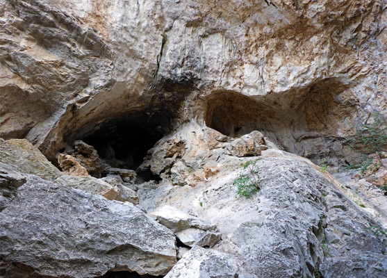
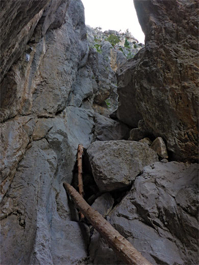
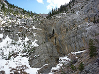
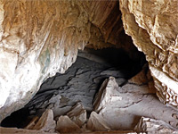
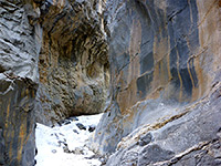
Five miles northeast of the summit of Mount Charleston, Robbers Roost Cave is not a true cavern, rather a group of wind- and rain-eroded alcoves in a limestone cliff at elevation 8,000 feet, either side of the entrance to a short stretch of narrows along a minor, unnamed drainage. The cliffs are a popular location for rock climbing, while the trail to the cave, although short at just 0.2 miles, is quite scenic, ascending a partly wooded ravine beside the usually dry streambed to a cool, enclosed basin beside the largest cavity, from where the smaller, higher caves may be reached by a short scramble up the rocks.
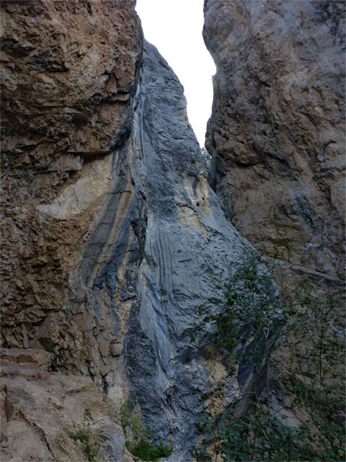
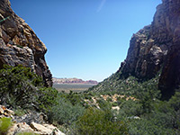
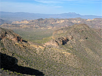
With a lot more effort the narrow, border filled section of the drainage just upstream can be climbed, giving access to a longer and more rugged stretch of the canyon, but most people stay on the path. A spur trail contours little way below the cliffs to a viewpoint, looking through gaps in the trees across the desert lands far below to the east.
The name Robbers Roost relates to a legend about the cave being used as a refuge for outlaws in the 1880s, preying on travellers on the Old Spanish Trail, which ran from Mesquite to Las Vegas then through a pass towards Tecopa, though this is perhaps unlikely since there would been many other such hiding places somewhat closer to the road.
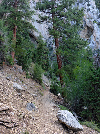
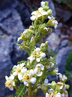
The signed trailhead parking for Robbers Roost Cave is in a pull-out on the east side of the road across the eastern slopes of Mount Charleston, 20 miles from US 95 via either highways 157 or 156. The path starts opposite, climbing steadily but not too steeply through open woodland dotted with grey limestone boulders, with a reasonable amount of wildflowers. The cliffs soon come into view, after a few sections of stone steps, as the path approaches the start of the narrows. On the left are two small caves, while the main opening is on the right - a big cavity formed by an overhanging cliff, on which are fixed several bolts and hangers, used by the climbers.
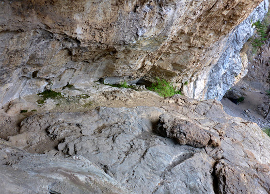
The rocks below the smaller caves are smooth, slippery and dusty when dry, though it is easy enough to scramble up. Upstream, the drainage quickly gains height via several falls; the first can be climbed without too much effort but the next is harder to pass. The smaller caves contain a few weathered, faded limestone formations, and are generally unremarkable. The side trail follows the base of the cliffs southeastwards to a viewpoint then contours back down to the main path. Trees on the slopes are a mix of white fir, mahogany and pinyon pine, plus ponderosa pine in the moister, more confined areas of the canyon.
With a lot more effort the narrow, border filled section of the drainage just upstream can be climbed, giving access to a longer and more rugged stretch of the canyon, but most people stay on the path. A spur trail contours little way below the cliffs to a viewpoint, looking through gaps in the trees across the desert lands far below to the east.
The name Robbers Roost relates to a legend about the cave being used as a refuge for outlaws in the 1880s, preying on travellers on the Old Spanish Trail, which ran from Mesquite to Las Vegas then through a pass towards Tecopa, though this is perhaps unlikely since there would been many other such hiding places somewhat closer to the road.

The Trail
The signed trailhead parking for Robbers Roost Cave is in a pull-out on the east side of the road across the eastern slopes of Mount Charleston, 20 miles from US 95 via either highways 157 or 156. The path starts opposite, climbing steadily but not too steeply through open woodland dotted with grey limestone boulders, with a reasonable amount of wildflowers. The cliffs soon come into view, after a few sections of stone steps, as the path approaches the start of the narrows. On the left are two small caves, while the main opening is on the right - a big cavity formed by an overhanging cliff, on which are fixed several bolts and hangers, used by the climbers.
The Cave
The rocks below the smaller caves are smooth, slippery and dusty when dry, though it is easy enough to scramble up. Upstream, the drainage quickly gains height via several falls; the first can be climbed without too much effort but the next is harder to pass. The smaller caves contain a few weathered, faded limestone formations, and are generally unremarkable. The side trail follows the base of the cliffs southeastwards to a viewpoint then contours back down to the main path. Trees on the slopes are a mix of white fir, mahogany and pinyon pine, plus ponderosa pine in the moister, more confined areas of the canyon.


Robbers Roost Cave - Similar Hikes
All Contents © Copyright The American Southwest | Comments and Questions | Contribute | Affiliate Marketing Disclosure | Site Map