Whitney Pocket Wash, Gold Butte National Monument
Nevada > Gold Butte National Monument > Whitney Pocket Wash
Whitney Pocket Wash
Shallow, usually dry drainage leading to a red rock amphitheater, past rock formations, Joshua trees and many other desert plants
Length: 1.5 miles, to the middle of the basin
Elevation change: 300 feet
Difficulty: Moderate
Type: One-way, off trail
Usage: Low
Season: Fall, winter, spring
Trailhead: Parking area along Gold Butte Road, just north of Whitney Pocket
Rating (1-5): ★★★★★
Elevation change: 300 feet
Difficulty: Moderate
Type: One-way, off trail
Usage: Low
Season: Fall, winter, spring
Trailhead: Parking area along Gold Butte Road, just north of Whitney Pocket
Rating (1-5): ★★★★★

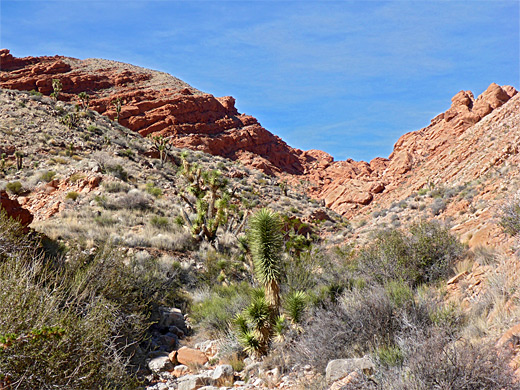
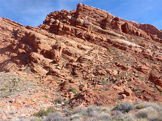
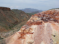
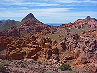
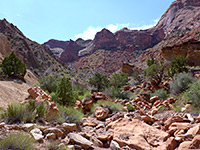
Deep red Aztec sandstone is exposed in many places in Gold Butte National Monument, including Little Finland, and more noticeably, Whitney Pocket, a popular place for primitive camping, at the end of the partly paved road from Hwy 170 near Mesquite. The pocket is an isolated group of buttes, surrounded by flat desert, with higher mountains just to the north, and they conceal another red outcrop, lining an enclosed basin, or amphitheater, drained by a seasonal drainage - Whitney Pocket Wash - that exits through a narrow gap on the south side, then flows west close to the rocks of the pocket.
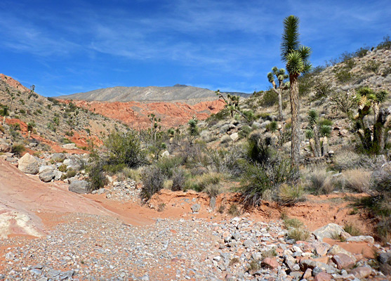
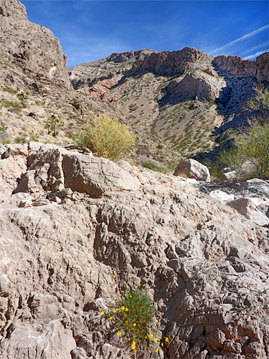
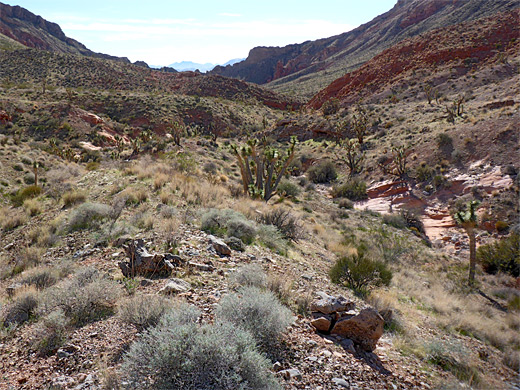
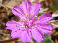
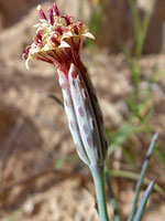
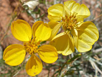
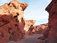
There is no trail into the basin though it can be explored easily enough by walking up the wash, along which are red outcrops, patches of gypsum and small-scale eroded formations, together with a good range of desert wildflowers and shrubs. There is no particular end point to the hike, though a viewpoint on a little knoll towards the upper end of the wash, at the center of the basin, is as good a target as any; reached after 1.5 miles. This place affords a grand panorama of the surrounding red cliffs, which are topped in some places by thick layers of grey limestone.
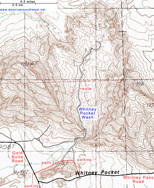
Whitney Pocket is reached by driving 21 miles along the semi-paved Gold Butte Road, starting along Hwy 170 beside the Virgin River bridge - a bumpy drive that takes upwards of one hour. Parking is in a cleared area on the west side of road just before it divides and becomes much rougher. Directly opposite, a path follows below the north face of one of the rocks of the pocket to an alternative start point slightly closer to the wash leading to the amphitheater - at a primitive camping area at the east end of the rock, this along Whitney Pass Road, the left route at the fork.
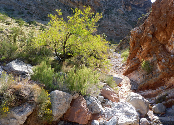
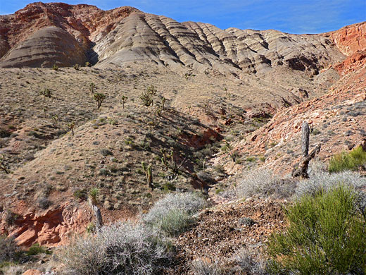
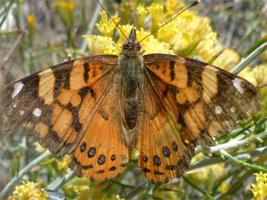
From the parking place along Gold Butte Road, the broad path heads west, crossing flat land below the butte, past some shapely boulders then curves round towards Whitney Pass Road. The wash from the amphitheater run's parallel, around 500 feet away, reached by an easy cross-country walk. Ahead, the streambed curves from in my curves from the narrow gap, formed by two sloping ridges of layered limestone. The floor of the wash changes from sand to pebbles and angled strata, initially all gray, later with some red outcrops as the drainage moves north, through the limestone and into the open bowl beyond. Although normally dry, residual pools and water-loving plants like desert willow hint of occasional heavy rainfall. Damp areas attract many butterflies in spring and summer, and bighorn sheep also inhabit the area, looking for water. The land slopes up gradually, and the streambed climbs over a few minor falls, past a tributary on the left and on to another fork, near the middle of the basin. Walls of the amphitheater are mostly sandstone, nearly all red just with a few whitish layers, and overtopped by the limestone, towards the south. The main wash is to the east,, and it becomes briefly cliff bound before dividing again, then fades away as it reaches the steeper slopes.
There is no trail into the basin though it can be explored easily enough by walking up the wash, along which are red outcrops, patches of gypsum and small-scale eroded formations, together with a good range of desert wildflowers and shrubs. There is no particular end point to the hike, though a viewpoint on a little knoll towards the upper end of the wash, at the center of the basin, is as good a target as any; reached after 1.5 miles. This place affords a grand panorama of the surrounding red cliffs, which are topped in some places by thick layers of grey limestone.
Whitney Pocket Trailhead
Whitney Pocket is reached by driving 21 miles along the semi-paved Gold Butte Road, starting along Hwy 170 beside the Virgin River bridge - a bumpy drive that takes upwards of one hour. Parking is in a cleared area on the west side of road just before it divides and becomes much rougher. Directly opposite, a path follows below the north face of one of the rocks of the pocket to an alternative start point slightly closer to the wash leading to the amphitheater - at a primitive camping area at the east end of the rock, this along Whitney Pass Road, the left route at the fork.
The Hike
From the parking place along Gold Butte Road, the broad path heads west, crossing flat land below the butte, past some shapely boulders then curves round towards Whitney Pass Road. The wash from the amphitheater run's parallel, around 500 feet away, reached by an easy cross-country walk. Ahead, the streambed curves from in my curves from the narrow gap, formed by two sloping ridges of layered limestone. The floor of the wash changes from sand to pebbles and angled strata, initially all gray, later with some red outcrops as the drainage moves north, through the limestone and into the open bowl beyond. Although normally dry, residual pools and water-loving plants like desert willow hint of occasional heavy rainfall. Damp areas attract many butterflies in spring and summer, and bighorn sheep also inhabit the area, looking for water. The land slopes up gradually, and the streambed climbs over a few minor falls, past a tributary on the left and on to another fork, near the middle of the basin. Walls of the amphitheater are mostly sandstone, nearly all red just with a few whitish layers, and overtopped by the limestone, towards the south. The main wash is to the east,, and it becomes briefly cliff bound before dividing again, then fades away as it reaches the steeper slopes.
Topographic Map
Whitney Pocket Wash - Similar Hikes
All Contents © Copyright The American Southwest | Comments and Questions | Contribute | Affiliate Marketing Disclosure | Site Map