Highlights:
Remote preserve in far eastern Nevada, centered on a 70 acre reservoir, in a scenic canyon lined by volcanic rocks. Activities include boating, fishing, camping and hiking, along the 2.5 mile (loop) Ash Canyon Trail
Nearby town:
Cedar City (UT), 88 miles
Management:
Location:
Seasons:
All year
Rating (1-5):
★★★★★

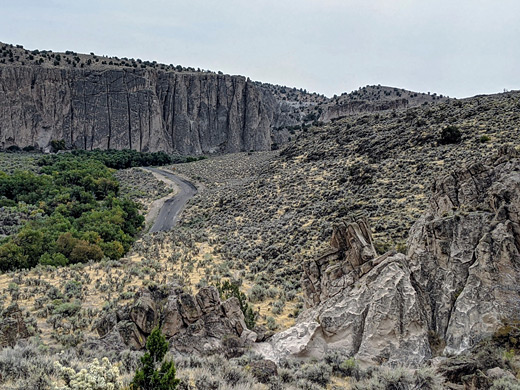
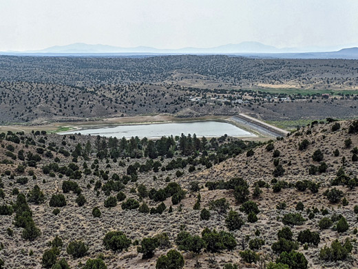
Echo Canyon is one of six state parks in eastern Nevada near the small towns of Caliente, Panaca and Pioche, and is reached by a 12 mile drive on paved roads starting from US 93. Like many Nevada parks, the centerpiece is an artificial lake, Echo Canyon Reservoir, and the attraction for most visitors is recreation rather than scenery, here principally boating, fishing, swimming and camping, though there is one hiking route, the 2.5 mile Ash Canyon Trail, along part of a narrow ravine through photogenic volcanic rocks.
Established in 1970, the 65 acre state park encompasses the majority of the reservoir and some of the low hills to the north and south - along Meadow Valley Wash, near the south edge of the Wilson Creek Range, 11 miles from the Utah stateline. The reservoir was created in 1969, primarily for flood control purposes and water storage. The surroundings are mostly uninhabited though were once frequented by the ancient Fremont peoples, as shown by pictographs in the canyon and pottery fragments discovered in the vicinity. No stone ruins have been found, suggesting that their occupation was only temporary, and seasonal, moving between permanent settlements elsewhere.
Established in 1970, the 65 acre state park encompasses the majority of the reservoir and some of the low hills to the north and south - along Meadow Valley Wash, near the south edge of the Wilson Creek Range, 11 miles from the Utah stateline. The reservoir was created in 1969, primarily for flood control purposes and water storage. The surroundings are mostly uninhabited though were once frequented by the ancient Fremont peoples, as shown by pictographs in the canyon and pottery fragments discovered in the vicinity. No stone ruins have been found, suggesting that their occupation was only temporary, and seasonal, moving between permanent settlements elsewhere.
Echo Canyon Table of Contents
The Park
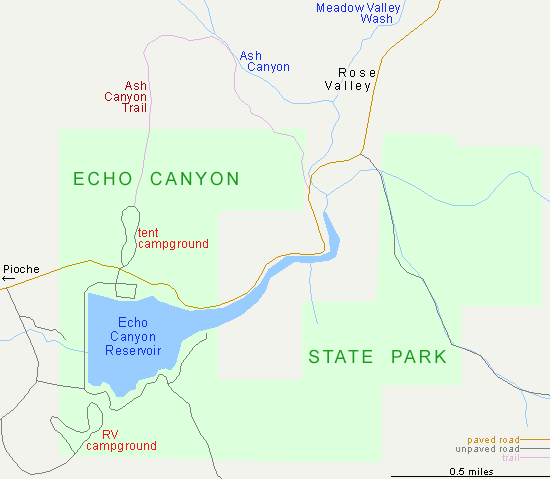
Echo Canyon State Park is reached by Hwy 322 starting in Pioche then via a lesser road that forks off to the southeast, meeting the wash, at this point flowing over open terrain, and following this upstream to the reservoir, at the edge of the mountains. A side road just below the dam leads to an RV campground, which has 20 full hook-up sites, set on a small hill overlooking the lake, while a little further is a 33-site tent campground, opposite a boat ramp and parking/picnic area. The water level varies considerably during the year though the ramp should always be usable. Fish species in the lake are largemouth bass, crappie and rainbow trout. To the east, the reservoir narrows abruptly, within an enclosed section of the canyon, then the valley widens, still followed by the road, which continues 14 miles the more remote Spring Valley State Park.
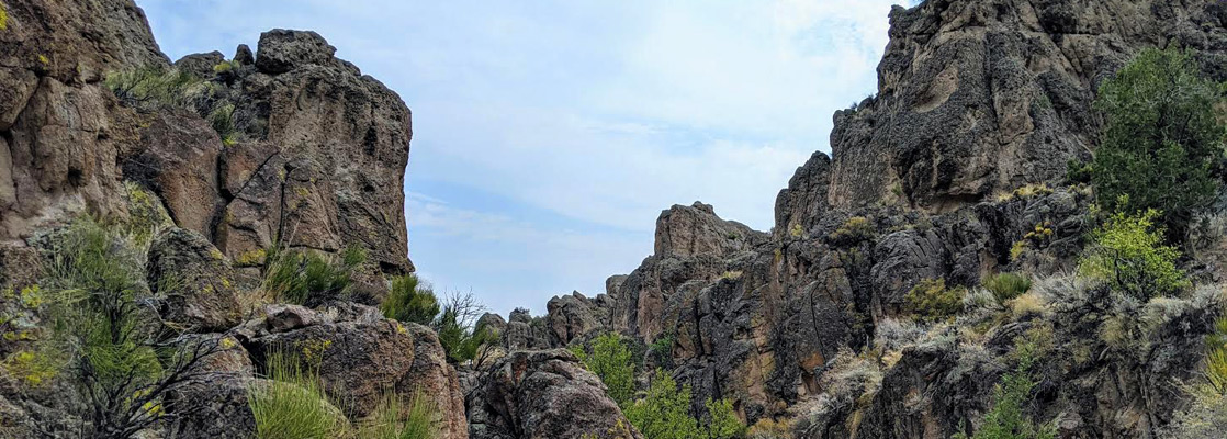
Ash Canyon Trail
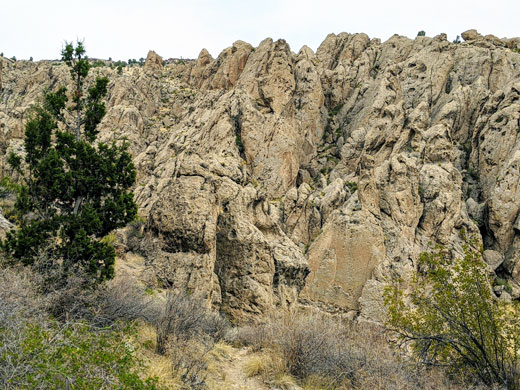
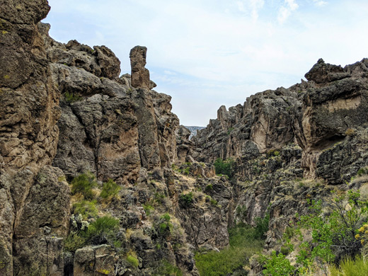
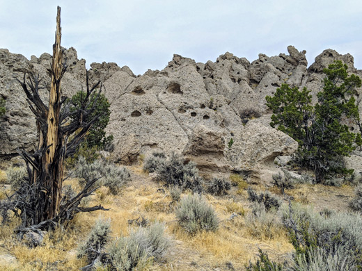
Rocks in the hills either side of the reservoir are volcanic in origin and relatively old, in the range 17 to 41 million years, and can be seen most spectacularly along in the sheer walls around the upper section of the reservoir, and also along a narrow ravine just north of the park, Ash Canyon, explored by a 2.5 mile loop that starts from the north side of the tent campground. The path climbs gradually by nearly 300 feet, up a wide valley to a ridge, then descends a side drainage to the floor of the usually dry canyon, flanked by attractive, greyish-brown cliffs. After a short distance it exits via another side ravine in order to avoid a rockier section with some sheer drops, and heads south across open ground to the road. The loop is completed by walking alongside the road for one mile back to the campground.
Echo Canyon - Nearby Places
- Cathedral Gorge State Park (21 miles) - pinnacles, hoodoos, narrow ravines and short caves
- Panaca Kilns (17 miles) - two charcoal kilns from the 1870s
- Spring Valley State Park (14 miles) - reservoir and several historic buildings, in a remote valley
Echo Canyon - Similar Places
- Cave Lake State Park, Nevada - reservoir bordered by wooded limestone hills
- Kershaw-Ryan State Park, Nevada - spring-fed ravine south of Caliente
All Contents © Copyright The American Southwest | Comments and Questions | Contribute | Affiliate Marketing Disclosure | Site Map