Highlights:
Reservoir in a remote valley, enclosed by wooded hills with limestone rock formations; in the Schell Creek Range east of Ely
Nearby town:
Ely, 13 miles
Management:
Location:
Seasons:
All year, though cold and snowy during winter
Rating (1-5):
★★★★★
Weather:


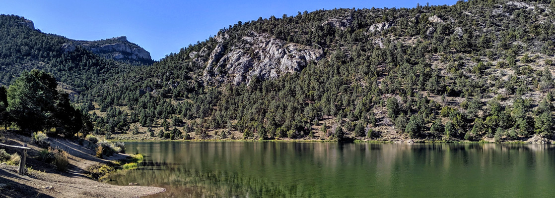
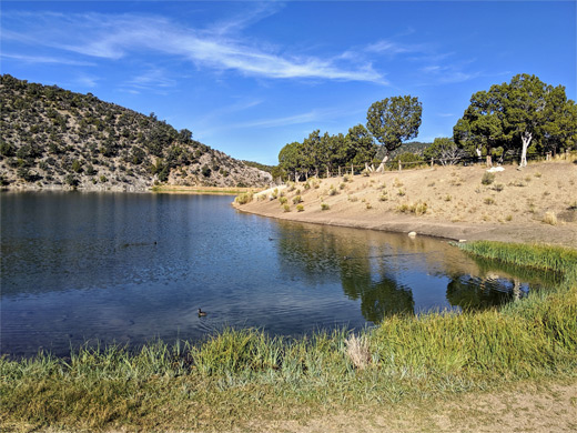
Cave Lake is one of two state parks near Ely, along US 50 in eastern Nevada, the other being Ward Charcoal Ovens. The lake is a reservoir, formed in 1932 after construction of a dam across Cave Creek, a relatively small drainage in the Schell Creek Range, a few miles east of town, surrounded by land of the Humboldt-Toiyabe National Forest.
The reservoir was used as a water supply for a nearby ranch, and was enlarged in 1961 after the dam was widened; the surface area is now 32 acres. The lake and the enclosing hills became a state park in 1973, which increased in size four-fold after transfer of more of the adjacent hills and valleys, in 2015.
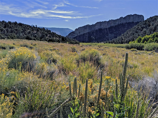
The lake sits at elevation 7,250 feet, high enough for significant snow during the winter, though summer conditions are often hot, and here at the park is at its busiest, popular for camping, boating, picnicking and fishing, for rainbow and brown trout. The park is open year round, however, and in winter is a center for snowmobiling, cross-country skiing and ice fishing. The enclosing hills are quite scenic, crossed by other ravines, some containing shallow caves, and the backcountry may be explored along five trails, totaling 16.5 miles.
The reservoir was used as a water supply for a nearby ranch, and was enlarged in 1961 after the dam was widened; the surface area is now 32 acres. The lake and the enclosing hills became a state park in 1973, which increased in size four-fold after transfer of more of the adjacent hills and valleys, in 2015.
The lake sits at elevation 7,250 feet, high enough for significant snow during the winter, though summer conditions are often hot, and here at the park is at its busiest, popular for camping, boating, picnicking and fishing, for rainbow and brown trout. The park is open year round, however, and in winter is a center for snowmobiling, cross-country skiing and ice fishing. The enclosing hills are quite scenic, crossed by other ravines, some containing shallow caves, and the backcountry may be explored along five trails, totaling 16.5 miles.
Cave Lake Table of Contents
Map of Cave Lake State Park
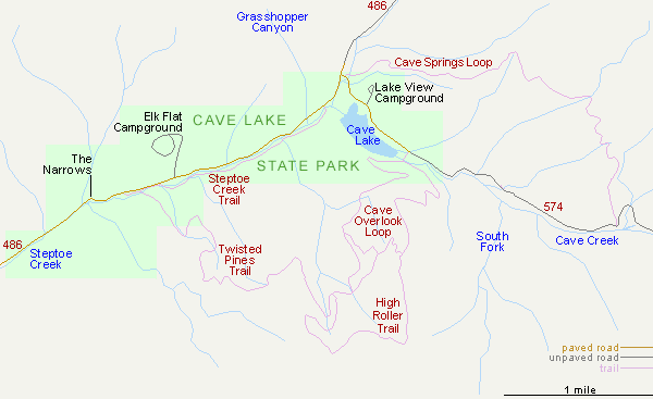
Cave Lake Location
Cave Lake State Park is accessed via Hwy 486, forking east off US 6/50/93; a paved route crossing the great expanse of Steptoe Valley and climbing a little way into the mountain foothills along the much narrower valley of Steptoe Creek. The dam is built at the lower end of Cave Creek, the first significant tributary on the south side, after which the road becomes unpaved as it bends northwards, ascending further to Success Summit (9,042 feet) then descending gradually to a junction with US 93. The park contains two campgrounds; Lakeview (open all year) on the north side of the reservoir, and Elk Flat (open between March and November), in a wider section of the valley one mile downstream. West of here, still within the park, is a short cliff-lined section of the Steptoe Creek drainage known as The Narrows. The main day-use parking area is on the north shore of the lake, near the dam.
Trails in Cave Lake State Park
The longest and best trail in the park is the 4.9 mile Cave Springs Loop, half of which follows Cave Creek upstream of the reservoir, along a vehicle track, while the remainder traverses the hillside to the north, crossing several tributary ravines. The 1.6 mile, nearly level Steptoe Creek Trail parallels the road, on the opposite side of the stream, while the 4.1 mile Twisted Pines Trail ascends the hills to the south, linking with the Cave Overlook Loop (3.8 miles), also with the 2.1 mile High Roller Trail which circles round a line of jagged, limestone formations. Similar ridges can be seen at several other locations including just south of the dam, and a little way southeast of the lake.
Cave Lake - Nearby Places
- Great Basin National Park (65 miles) - isolated mountain wilderness
- Ward Charcoal Ovens State Historic Park (18 miles) - well-preserved stone ovens dating from 1876
Cave Lake - Similar Places
- Gunlock State Park, Utah - reservoir lined by sandy hills and red rock formations
- Spring Valley State Park, Nevada - reservoir in a remote valley
All Contents © Copyright The American Southwest | Comments and Questions | Contribute | Affiliate Marketing Disclosure | Site Map