Highlights:
Former quarry location in the Muddy Mountains, where the Aztec sandstone bedrock was excavated. Surrounded by colorful, eroded formations including many small arches, with petroglyphs on some of the cliffs. A remote and little-visited location
Nearby town:
North Las Vegas, 30 miles
Management:
BLM
Location:
Colorock Road (4WD parking)
Seasons:
Fall, winter, spring; too hot in the summer
Rating (1-5):
★★★★★

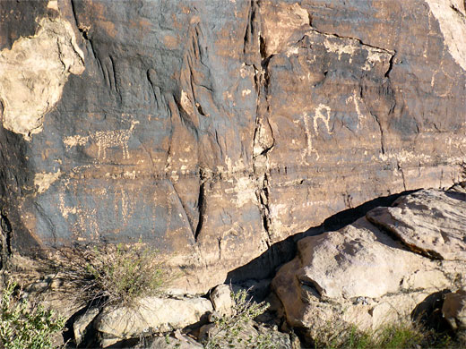
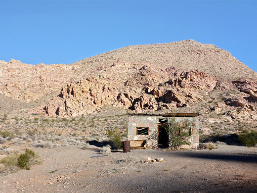
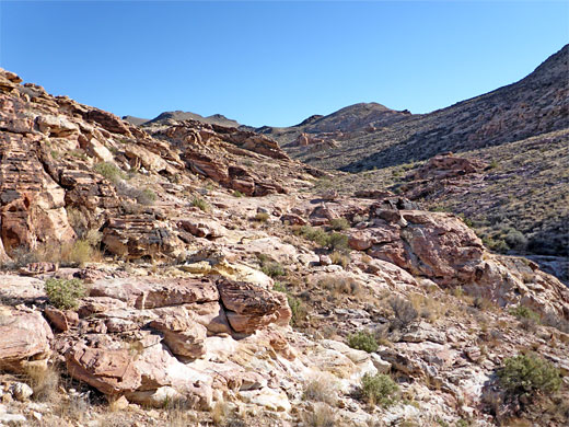
Color Rock Quarry is an area of multicolored Aztec sandstone in the Muddy Mountains 50 miles north of Las Vegas, named after a nearby summit, Colorock Peak. A short-lived quarry was established here sometime in the 20th century, though little trace remains beyond an abandoned stone cabin, however the area is of interest for the amazing colors and forms of the bedrock, and for a few petroglyph panels, together with the general remoteness and solitude.
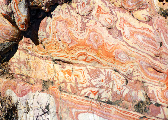
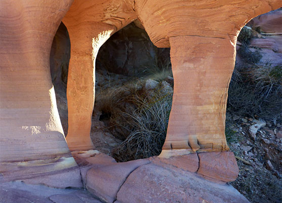
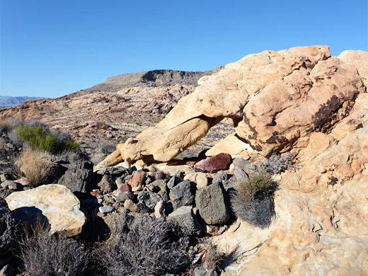
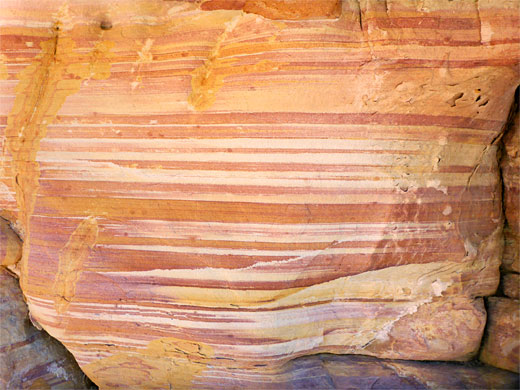
The quarry area is 3 miles south of the similar Buffington Pockets, though the rocks here are somewhat less colorful, and more searching is necessary to find photogenic scenes - quite a lot of the rocks are rather dull yellow-brown in color, and irregular in overall texture. But there are still plenty of exposures of the stripy purple/pink/red form of the sandstone, patterns which are caused by alteration bands, the colors due to presence of several iron compounds including haematite and goethite. Also of note at are many small sandstone arches.
Color Rock Quarry is reached by a rough track (Colorock Road) that may need 4WD but certainly high clearance, especially to reach the far end, at the old cabin, which is just before the edge of the Muddy Mountains Wilderness Area. 2WD and/or low clearance vehicles may have to be left up to 3.4 miles back, at the junction with the wider though still unpaved Bitter Springs Backcountry Byway.
Color Rock Quarry Table of Contents
Color Rock Quarry Topo Map
Photographs
19 views of Color Rock Quarry.
Access
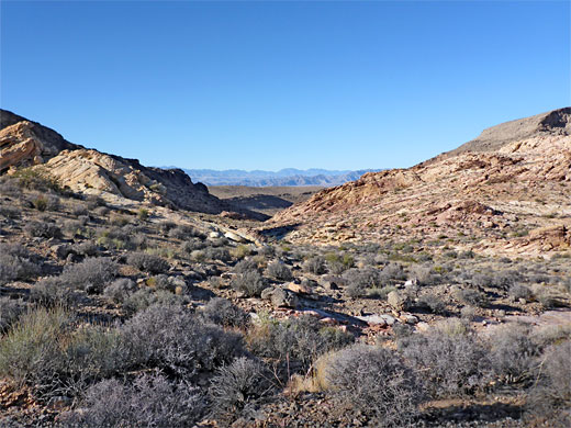
Bitter Springs backcountry byway forks south off Valley of Fire Highway 3.2 miles from I-15. The surface is ridged and stony, but generally fine for all/most vehicles up to the vicinity of the junction with Colorock Road after 4 miles, to the west. This right away crosses three little washes then veers left at a junction, heading south over a flat plain, later gradually rising, crossing a low ridge and descending to a wider wash, now approaching the north edge of the Muddy Mountains. It then crosses another small ridge and returns to the wash at the point where it divides into two forks. The main track follows the eastern fork for half a mile to a possible parking place, just before a rougher wash crossing, then continues half a mile to the old quarry cabin. Two lesser tracks branch off along this latter section, one following the west fork of the wash, the other climbing to higher ground in between the two forks, location of a primitive camping area. The photogenic rocks are generally found in between the two forks, extending quite far south, plus a smaller area on the east side of the east fork.
The Quarry Area
The westernmost of the three roads follows the wash for 0.8 miles, up to the edge of the wilderness area. Cliffs towards the end, on the east side, are marked with a few rather faint petroglyphs, and all around are extensive outcrops of pinkish or yellowish sandstone, harboring small arches and many patches of the swirling, banded colourful formations. Smaller ravines cut through the rocks, and much time could be spent exploring. Walking east, either through the sandstone, or over a stony hill just to the north, leads to the other track, along the east fork of the wash, and the old cabin. Near the cabin are some concrete foundations from other buildings, long since disappeared, while the only other quarry relics are several partially sawed stones. The whole area has relatively high relief; there are a number of tall cliffs of the fractured sandstone, so it can take some time to locate cross-country routes.
Color Rock Quarry - Nearby Places
- Buffington Pockets (6 miles, by road) - amazing Aztec sandstone formations
- Valley of Fire State Park (16 miles) - extensive outcrops of red, yellow and pink rocks
Color Rock Quarry - Similar Places
- Buckskin Hollow, Utah - eroded, stripy, thin-layered rocks
- South Coyote Buttes, Arizona - formations of red and yellow sandstone
All Contents © Copyright The American Southwest | Comments and Questions | Contribute | Affiliate Marketing Disclosure | Site Map