Highlights:
Wide, level, somewhat bumpy track beneath Chalk Bluff, at the south edge of the Volcanic Tableland plateau, past two ravines popular for bouldering (Sad Boulders, Happy Boulders), and several large, well-preserved rock art panels

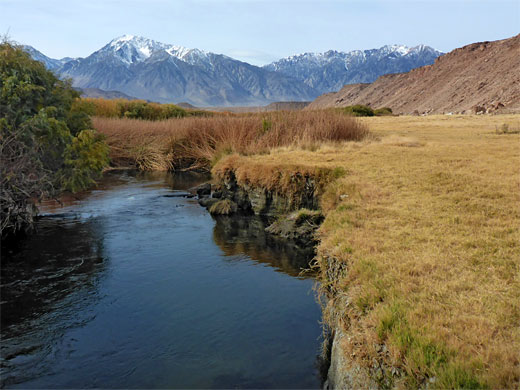
The route is 6 miles long and is reached by paved roads at either end, Five Bridges Road in the east, off US 6, and Pleasant Valley Dam Road in the west, off US 395. Along this latter route is a Nye County campground (no hook-ups), scenically situated beside the river, with fine views in all directions.
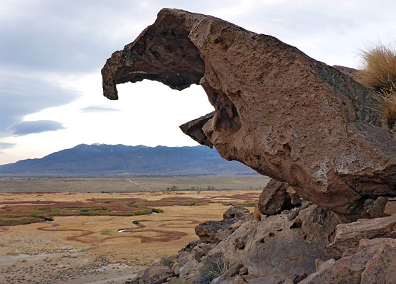
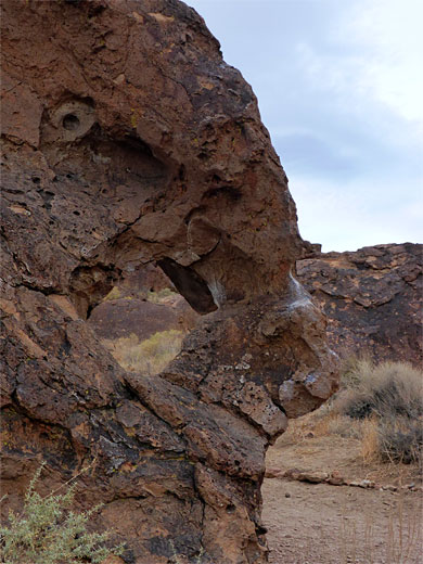
Chalk Bluff Road is mostly used by rock climbers, since along the escarpment are over a dozen short, perpendicular ravines littered with huge volcanic boulders, little caves and sections of cliffs, all ideal for bouldering; the two most popular locations are the Sad Boulders and the Happy Boulders, so called since the first is rather enclosed and gloomy, the latter lighter and more open.
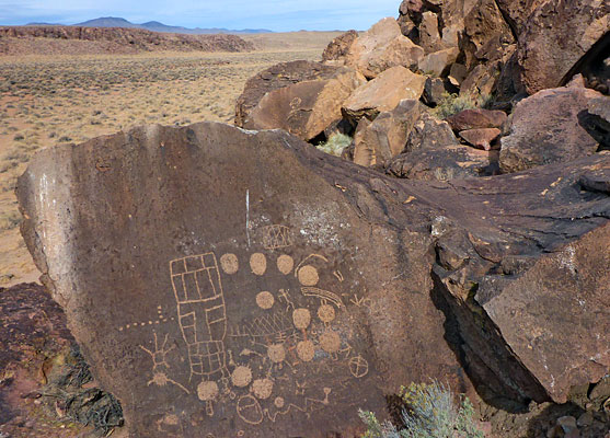
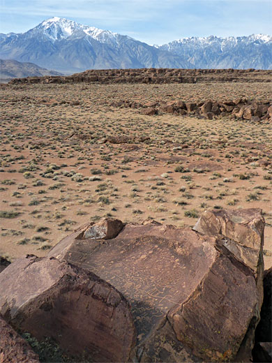
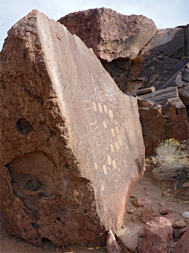
The second point of interest hereabouts is the rock art; there are several large, well preserved panels etched onto the boulders, plus many smaller designs, the two most famous panels being Sky Rock, an intricate group of designs on a flat surface facing the sky, and the 13 Moons, thought to have been used as a lunar calendar.
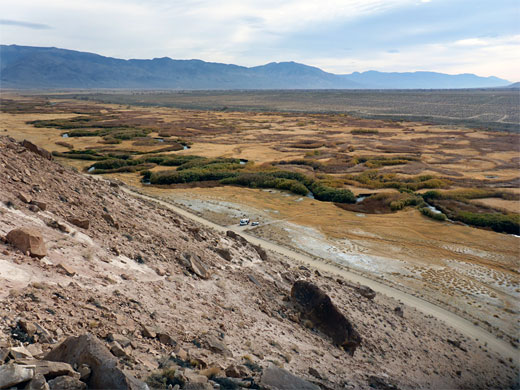
Along the road are around two dozen pullouts, for anglers and hikers. Opposite some are paths that ascend the escarpment, the two busiest, both with BLM trailhead notices, are to the Happy and Sad Boulders. Primitive camping would seem also to be permitted.
Sad Boulders
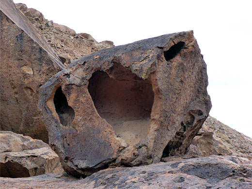
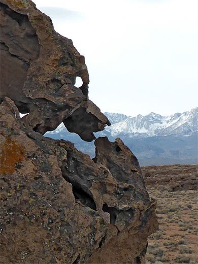
The Sad Boulders trailhead is 1.4 miles along Chalk Bluff Road, starting in the east at the four-way junction at the end of Five Bridges Road. A path ascends the steep slope to the north, into the lower end of the canyon, the enclosed part of which is a quarter of a mile long, though the drainage extends for 1.5 miles. The Sad Boulders can also be accessed from the north, along a short track off Casa Diablo Road. The canyon is initially quite enclosed, at floor level, with several bands of low cliffs above, and is filled with innumerable boulders, often bearing white chalk marks used by the climbers. Many of the rocks are eroded into strange, jagged, photogenic shapes, and the surfaces have extensive tafoni. Various short, stone-lined paths lead to specific climbing sites, and notices request visitors not to step off the trails, to avoid damaging plants. The lower reaches of the ravine affords fantastic views across Owens Valley to the Sierra Nevada and the White Mountains. There not appear to be any rock art sites in the canyon.
Happy Boulders
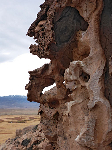
The trailhead for the Happy Boulders is 0.9 miles further west on Chalk Bluff Road, and the ravine is reached by a similar, slightly longer climb up a primitive trail. The canyon is deeper but also wider, otherwise generally similar in appearance to the Sad Boulders, perhaps with not quite so many good eroded rock formations. The drainage extends northwest for 0.4 miles then bends west and soon ends. Just beyond is a private house, accessed by another side track off Casa Diablo Road.
Chalk Bluff Road Petroglyphs
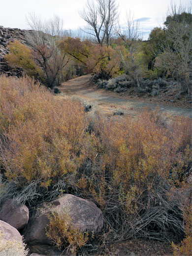
Unlike the petroglyphs along Fish Slough Road, those in the vicinity of Chalk Bluff Road are considered more in need of protection, so the exact locations are not publicised. The most famous site, Sky Rock, is along a line of boulders about half way up the slopes on the west side of a small ridge; on a smooth rockface just slightly angled up to the west, towards the Sierra Nevada; a very spectacular and evocative location. A notice advises people not to climb on the rock itself, as the designs can readily be viewed from several adjacent boulders. The 13 Moons panel is not so far away, on a similarly-sized, south-facing boulder, while a few lesser designs can be found on other rocks nearby. There are dozens of other lines of boulders in the Tablelands, in addition to the actual ravines at the edge of the bluffs, so much scope for the discovery of more rock art. One other notable petroglyph panel, the Rosetta Stone, is located a little way west; this is an isolated boulder, with a somewhat incongruous site in a willow thicket on the floor of a shallow canyon, and its designs include concentric circles and other geometric shapes, also facing the sky.
All Contents © Copyright The American Southwest | Comments and Questions | Contribute | Affiliate Marketing Disclosure | Site Map