Petroglyphs along Fish Slough Road, Volcanic Tableland
California > Volcanic Tableland > Petroglyphs along Fish Slough Road
Highlights:
Good quality unpaved road near the east edge of the Volcanic Tableland, passing three major petroglyph sites, all provided with marked trailheads, and all right next to the road - Fish Slough, Chidago Canyon and Red Canyon

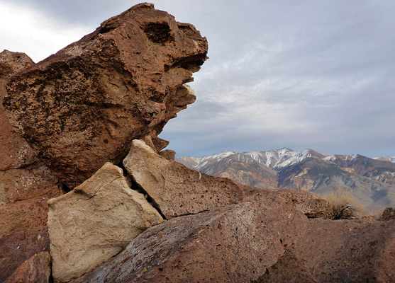
The sites are of interest not just for the rock art, with very numerous petroglyphs on some of the rock faces, but also because of the unusual, eroded forms of many of the rocks, especially photogenic when viewed against the great peaks of the White Mountains to the east and Sierra Nevada to the west. The three locations, Fish Slough, Chidago Canyon and Red Canyon, become larger and better to the north, and they may be seen by a drive of 20 miles, starting along US 6. The first (southernmost) two are fairly small, explorable in 20-30 minutes, while the latter is rather larger, and an hour or more could be spent here.
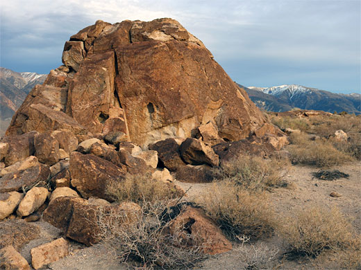
Jumbled boulders, some with petroglyphs - upper edge of the rock art area at the Chidago Canyon site
Fish Slough Petroglyphs
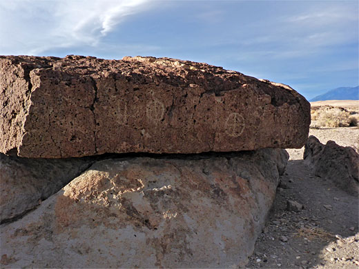
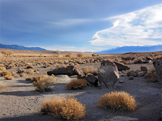
Fish Slough Road starts in the south at the end of Five Bridges Road, a paved route off US 6, one mile north of the US 395 intersection on the north side of Bishop; the bridges road heads north for half a mile then west, over a wash and canal, and ends in an open area were several routes branch off. Fish Slough Road is due north, still paved for a short distance, up to a house, then gravel or smooth dirt. The Fish Slough petroglyphs are reached after 6.8 miles, on the west side of the road. The boulders here are relatively small, just a few feet high, scattered across flat land, and the petroglyphs are also mostly small and rather faded. Some are etched onto coarsely-textured surfaces, making them more indistinct. The rocks are grey or brown, often eroded into unusual, small-scale forms, one in the shape of a wave; known as the 'lava wave'.
Chicago Canyon Petroglyphs
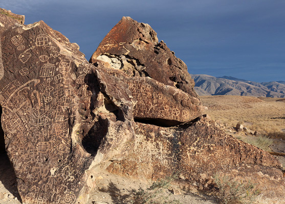
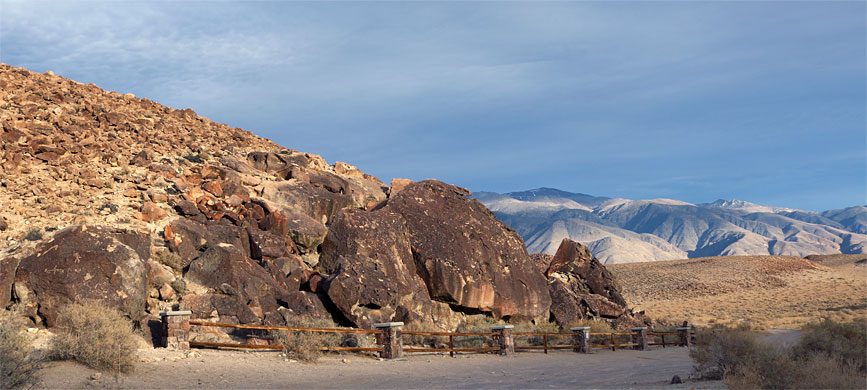
The Chicago Canyon petroglyphs are on the east side of Fish Slough Road, 11 miles from the start. This site has a big pile of boulders, on a slope, and many designs, very dense on some of the larger rocks, and all generally crisp and well-preserved. The west-facing orientation makes this site good in late afternoon, when the lowering sun enhances the already rich colors of the ignimbrite, but not always at the point of sunset since at some times of the year the sun has by then moved below a ridge to the west, which also obscures the Sierra Nevada. The petroglyphs are both on the sides of rocks and the tops, so it takes a while to see them all, looking at the hillside from various angles.
Red Canyon Petroglyphs
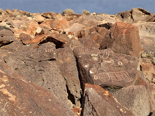
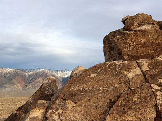
The Red Canyon petroglyphs are on the west side of the road, after 16.6 miles. The main parking place is at the north edge of the rock art area, which extends west for 1,000 feet; a short side track accesses the southern portion. There are a dozen or more groups of boulders, with the petroglyphs mostly on those closest to the main road - the site is generally similar, in terms of rock color and density of petroglyphs, to Chicago Canyon, but the overall scenery is better, with the Sierra Nevada in full view, and, as with all the three sites, the closer White Mountains to the east. This location seems to be quite often visited, based on the number of footprints, and also some litter and graffiti. Directly opposite the Red Canyon site, an equally good unpaved road to the east provides a link back to US 6, after 3.6 miles.
All Contents © Copyright The American Southwest | Comments and Questions | Contribute | Affiliate Marketing Disclosure | Site Map