Little Baldy Trail, Sequoia National Park
California > Sequoia National Park > Hiking > Little Baldy Trail
Little Baldy Trail
This path climbs quite steeply up a forested, west-facing slope then traverses a sparsely wooded ridgetop, almost level, to a bare granite summit, overlooking a vast area of the Sierra Nevada
Length: 1.7 miles
Elevation change: 700 feet
Difficulty: Easy to moderate - steep at the beginning
Type: One way
Usage: Medium
Season: Spring, summer, fall
Trailhead: Little Baldy Saddle, along Generals Highway
Rating (1-5): ★★★★★
Elevation change: 700 feet
Difficulty: Easy to moderate - steep at the beginning
Type: One way
Usage: Medium
Season: Spring, summer, fall
Trailhead: Little Baldy Saddle, along Generals Highway
Rating (1-5): ★★★★★

Baldy is a commonly-used word to describe a mountain with a treeless, rocky summit, and there are two such peaks in the southern Sierra Nevada within 6 miles of each other; Big Baldy in Kings Canyon National Park and Little Baldy in Sequoia National Park, both formed of granite.
This latter peak, elevation 8,044 feet, forms the south end of one of a number of ridges extending south from the Kings-Kaweah Divide, and it may be reached by a relatively popular trail of 1.7 miles which climbs 700 feet, mostly at the lower end where the path ascends a steep slope starting from a pull-out along the Generals Highway at its highest point, 7,338 Little Baldy Saddle.
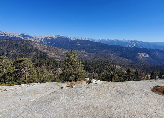
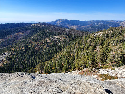
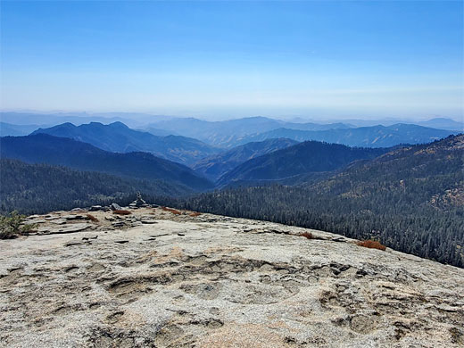
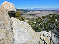
Although the terrain hereabouts is generally unremarkable, a series of rolling, forested ridges and valleys, the bare granite peak rises well above the surrounding trees and is the highest point for some distance, so offers spectacular views, across to the Central Valley and the Great Western Divide, and over many deep canyons on all sides.
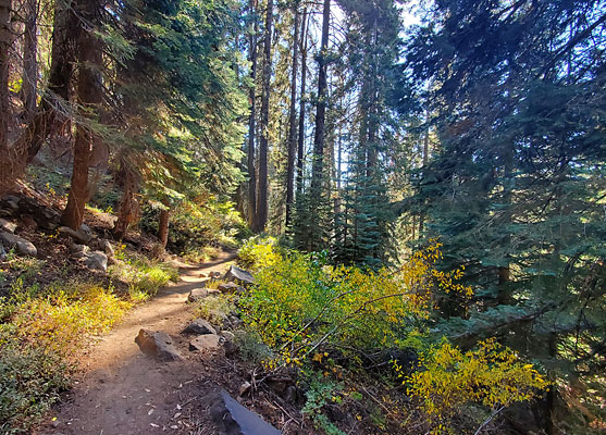
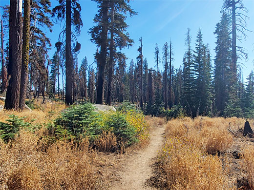
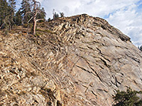
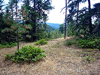
The Little Baldy Trail has an obvious, signed trailhead along the Generals Highway, 11 miles north of Giant Forest, with pull-outs at either side of the road. There are no sequoia trees in this region of the park, just endless ponderosa pines. One trail heads west, a connecting route from Dorst Campground, but most people are here for the hike to Little Baldy, to the east, which starts off with a couple of short switchbacks before a long, straight traverse northwards, initially through a somewhat moist area of ferns and extra-large trees then over drier terrain with less undergrowth.
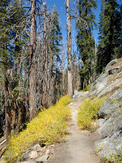
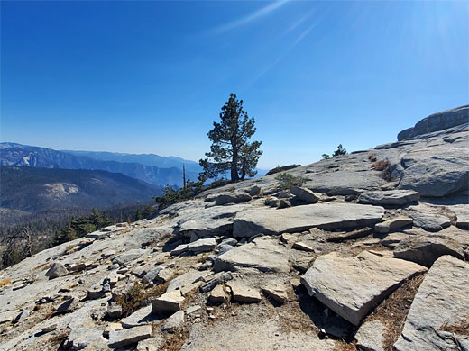
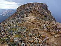
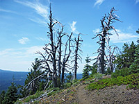
The ground becomes gradually rockier and more exposed, as the trail turns back south, a shorter straight, then north again before south once more soon after, climbing less steeply, up to the bushier land on the ridgetop, now nearly flat, with only scattered trees. A minor granite outcrop is soon passed on the right, offering good views of the Sierra crest to the east, then the last section passes through a group of pines, and climbs a slope to the Little Baldy summit, which is nearly flat for around 300 feet, just pure, light gray granite with virtually no vegetation.
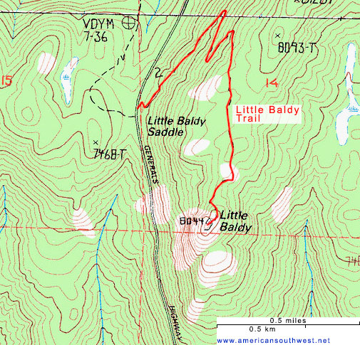
This latter peak, elevation 8,044 feet, forms the south end of one of a number of ridges extending south from the Kings-Kaweah Divide, and it may be reached by a relatively popular trail of 1.7 miles which climbs 700 feet, mostly at the lower end where the path ascends a steep slope starting from a pull-out along the Generals Highway at its highest point, 7,338 Little Baldy Saddle.
Although the terrain hereabouts is generally unremarkable, a series of rolling, forested ridges and valleys, the bare granite peak rises well above the surrounding trees and is the highest point for some distance, so offers spectacular views, across to the Central Valley and the Great Western Divide, and over many deep canyons on all sides.
Start of the Hike
The Little Baldy Trail has an obvious, signed trailhead along the Generals Highway, 11 miles north of Giant Forest, with pull-outs at either side of the road. There are no sequoia trees in this region of the park, just endless ponderosa pines. One trail heads west, a connecting route from Dorst Campground, but most people are here for the hike to Little Baldy, to the east, which starts off with a couple of short switchbacks before a long, straight traverse northwards, initially through a somewhat moist area of ferns and extra-large trees then over drier terrain with less undergrowth.

Little Baldy Video
Little Baldy Summit
The ground becomes gradually rockier and more exposed, as the trail turns back south, a shorter straight, then north again before south once more soon after, climbing less steeply, up to the bushier land on the ridgetop, now nearly flat, with only scattered trees. A minor granite outcrop is soon passed on the right, offering good views of the Sierra crest to the east, then the last section passes through a group of pines, and climbs a slope to the Little Baldy summit, which is nearly flat for around 300 feet, just pure, light gray granite with virtually no vegetation.
Topographic Map of the Little Baldy Trail
Little Baldy Plants
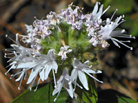 Mountain coyote mint |
 Wavy-leaved indian paintbrush |
 Naked wild buckwheat |
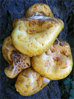 Golden scalycap |
Little Baldy Trail - Similar Hikes
All Contents © Copyright The American Southwest | Comments and Questions | Contribute | Affiliate Marketing Disclosure | Site Map