The American Southwest
Home | Parks | Trails | Plants | Canyons
Maps | Landscapes | Site Map | Whats New? |
More...
Follow americansouthwest.net on Facebook
×
General Pages
Home
Parks
Trails
Plants
Slot Canyons
Maps
Landscapes
Itineraries
Site Map
What's New?
More pages...

States
Arizona
California
Colorado
Idaho
Nevada
New Mexico
Oregon
Texas
Utah
Wyoming


ARIZONA
CALIFORNIA
COLORADO
IDAHO
NEVADA
NEW MEXICO
OREGON
TEXAS
UTAH
WYOMING
ARIZONA
MAPS | PARKS | TRAILS | HOTELS

Map of Wupatki National Monument


Arizona > Wupatki National Monument > Map
Map of Wupatki National Monument

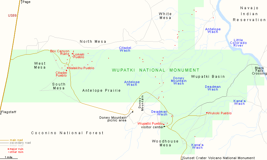
The 15 mile road through Wupatki National Monument passes close to the five main pueblos (Wupatki, Wukoki, Lomaki, Citadel and Nalakihu), plus various viewpoints, picnic areas, and one trail, to the volcanic summit of Doney Mountain. The western entrance to the monument is 30 miles from Flagstaff via US 89, while the southern entrance is along the road from Sunset Crater Volcano National Monument, 35 miles from Flagstaff.

PDFPDF format map of Wupatki National Monument, from the National Park Service (64 kb).

Back to Top
Arizona | California | Colorado | Idaho | Nevada | New Mexico | Oregon | Texas | Utah | Wyoming | Slot Canyons | Travelogue | SOUTHWEST

All Contents © Copyright The American Southwest | Comments and Questions | Contribute | Affiliate Marketing Disclosure | Site Map