Highlights:
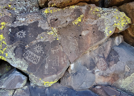
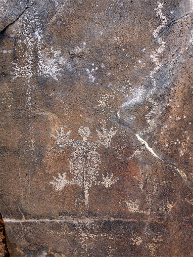
Small park on the east side of Flagstaff, centered on a year-round stream (Rio de Flag) through ponderosa pine woodland, flowing at one point down a short basalt canyon, with a waterfall at the upper end. The name of the preserve refers to the abundant Sinaguan rock art, on boulders near the stream
Nearby town:
Flagstaff, adjacent
Management:
Location:
Seasons:
All year
Rating (1-5):
★★★★★

Featured Hotel
Best Western Pony Soldier Inn
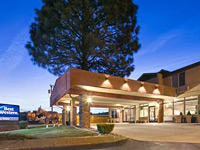 Reasonably-priced, pet friendly hotel in a residential area along old Route 66, within walking distance of shopping and dining; 8 miles from Walnut Canyon
Check Rates
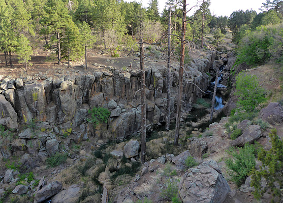
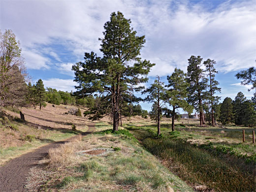
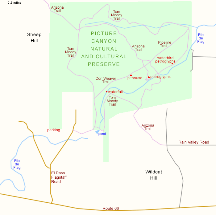
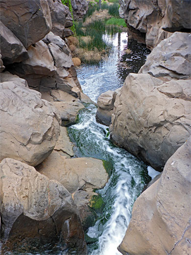
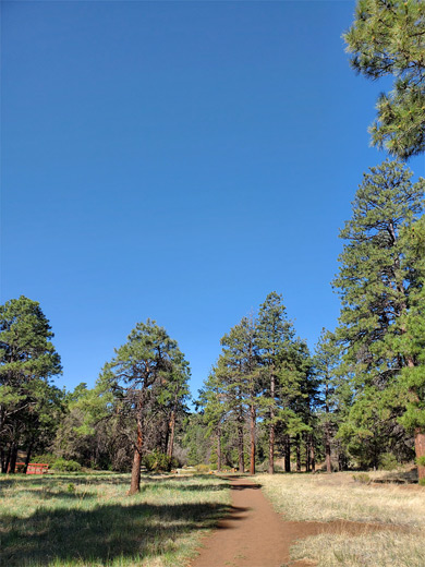
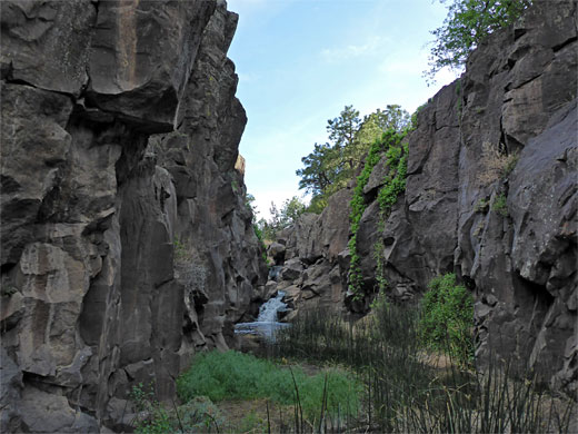
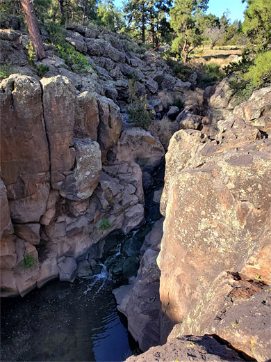
On the east edge of Flagstaff, within the city limits, Picture Canyon is a small but varied preserve, centered on a permanent stream, Rio de Flag, flowing through a mix of ponderosa pine woodland and meadows, underlain by dark basaltic rocks. At one point the stream forms a short cliff-lined narrows section, preceded by a waterfall, and elsewhere is bordered by low, sloping banks strewn with boulders, some of which are adorned with petroglyphs from the Northern Sinagua people, created between 700 and 1300 AD. The canyon is so-named because of the rock art, and the surrounding area was designated a Natural and Cultural Preserve in 2012.
The preserve occupies an area of less than one square mile, and is crossed by five miles of trails. There is no charge for entry, and the place is easily accessed, by a paved side road off Route 66. The canyon is not so well known, not signposted from the highway, and seems mostly to be visited by locals; popular for jogging, dog walking, horseriding and cycling
The preserve occupies an area of less than one square mile, and is crossed by five miles of trails. There is no charge for entry, and the place is easily accessed, by a paved side road off Route 66. The canyon is not so well known, not signposted from the highway, and seems mostly to be visited by locals; popular for jogging, dog walking, horseriding and cycling
Picture Canyon Table of Contents
Map of Picture Canyon Preserve
Photographs
19 views of Picture Canyon. Wildflowers in the canyon.
Picture Canyon Video
Access
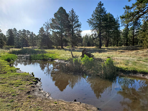
Access to the preserve is via El Paso-Flagstaff Road, heading north from Route 66, the junction 2 miles east of I-40 exit 201, crossing flat land between two low, reddish, volcanic peaks - Sheep Hill and Wildcat Hill, both being mined for cinders, for use in landscaping. The road ends after 0.7 miles at a natural gas facility; trailhead parking for the preserve is just in front, and shortly before this is the crossing of Rio de Flag. This section is usually dry, but just downstream is the Wildcat Hill Wastewater Plant, and (cleaned) output from this provides the year-round supply, flowing all the way through the preserve and at least a few miles further, sustaining an important riparian corridor, with a good variety of birds, insects and plants.
Hiking in the Preserve
Picture Canyon Natural and Cultural Preserve is crossed by 1.5 miles of the Arizona Trail, a segment constructed in 2007. The main path though is the Tom Moody Trail, a 2.9 mile loop, alongside the stream and through less interesting, wooded terrain to the northwest. One other route is the Don Weaver Trail (0.7 miles), following the west side of the upper section of the canyon, along the course of a gas pipeline from the plant at the preserve entrance. Along here are remains of a pithouse, a viewpoint of the canyon, and one group of petroglyphs, while the Tom Moody Trail passes more petroglyphs, the waterfall, and has closer views of the stream. All the best parts of the preserve can be viewed along an 2.1 mile loop, the Don Weaver Trail and part of Tom Moody Trail, as described below.
Tom Moody Trail
The suggested loop hike around Picture Canyon begins by following the one path from the parking place, eastwards, through woodland, bearing right at a junction, down to the open, grassy corridor of Rio de Flag. A short spur leads to a deepwater pond, supplied, like the stream itself, from the waste water treatment plant to the south. The path (the Tom Moody Trail) follows the stream northwards, on the east side, into more wooded terrain to the brink of the waterfall, where the drainage becomes enclosed for around 400 feet. Climbing down a way is possible, while an overlook just beyond also gives good views. The trail moves away from the canyon, climbing a little, to a junction with the Arizona Trail; it then gradually descends to a footbridge, crossing to the west side of the creek and reaching a four-way junction.
Don Weaver Trail
At the junction, the path to the right is a continuation of Tom Moody Trail, and it is well worth walking 700 feet along here, to the main group of petroglyphs in the preserve, known as the waterbird panel, on account of the distinctive effigy of an egret. The designs are spread across basalt boulders and a cliff face, and are loosely fenced off for protection. Back at the junction, the left fork (Don Weaver Trail) follows the creek to several more petroglyph panels before climbing, through a few switchbacks, to flat land, turning left again where it meets the wide pipeline corridor. It heads back towards the parking place, past the minor ruin of the pithouse, an overlook of the canyon narrows, and a group of rather faded petroglyphs, rejoining the Tom Moody Trail at the edge of the gas facility, close to the initial junction.
Picture Canyon - Nearby Places
- Sunset Crater Volcano National Monument (15 miles) - volcanoes and cinder cones, plus extensive lava flows
- Walnut Canyon National Monument (6 miles) - cliff dwellings of the Sinagua Indians
Picture Canyon - Similar Places
- Fossil Falls, California - narrow ravine through thick lava deposits
- Petroglyph National Monument, New Mexico - rock art on volcanic boulders, at the edge of Albuquerque
All Contents © Copyright The American Southwest | Comments and Questions | Contribute | Affiliate Marketing Disclosure | Site Map