The American Southwest
Home | Parks | Trails | Plants | Canyons
Maps | Landscapes | Site Map | Whats New? |
More...
Follow americansouthwest.net on Facebook
×
General Pages
Home
Parks
Trails
Plants
Slot Canyons
Maps
Landscapes
Itineraries
Site Map
What's New?
More pages...

States
Arizona
California
Colorado
Idaho
Nevada
New Mexico
Oregon
Texas
Utah
Wyoming


ARIZONA
CALIFORNIA
COLORADO
IDAHO
NEVADA
NEW MEXICO
OREGON
TEXAS
UTAH
WYOMING
ARIZONA
MAPS | PARKS | TRAILS | HOTELS

Map of Kofa National Wildlife Refuge


Arizona > Kofa National Wildlife Refuge > Map
Map of Kofa National Wildlife Refuge

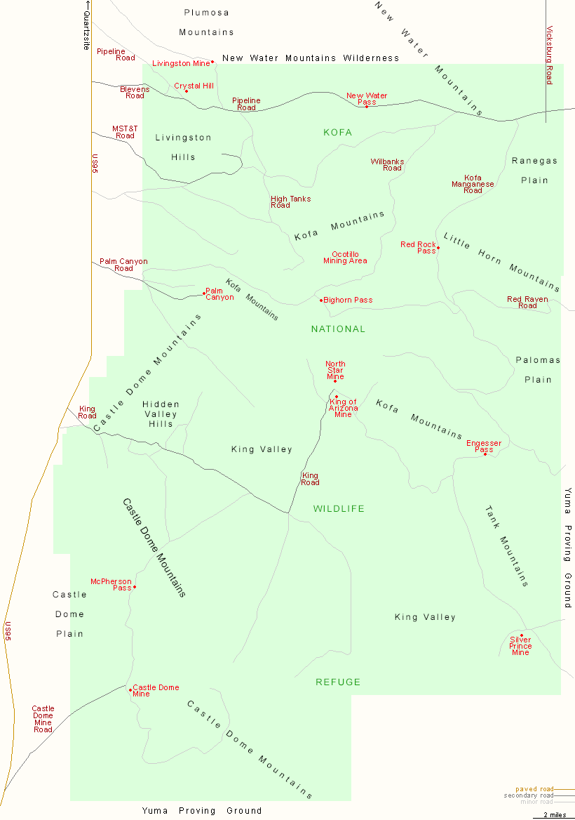
I-10 passes within a few miles of the north edge of Kofa National Wildlife Refuge, and the northeast corner is accessed by Vicksburg Road from exit 45, but most approaches are from the west, via side tracks off US 95 between Yuma and Quartzsite. Major routes are, from south to north, Castle Dome Mine Road, King Road, Palm Canyon Road, MST&T Road and Blevens Road.

Back to Top
Arizona | California | Colorado | Idaho | Nevada | New Mexico | Oregon | Texas | Utah | Wyoming | Slot Canyons | Travelogue | SOUTHWEST

All Contents © Copyright The American Southwest | Comments and Questions | Contribute | Affiliate Marketing Disclosure | Site Map