Highlights:
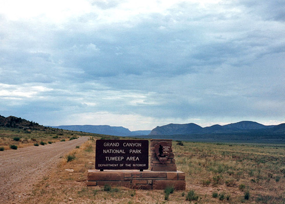
Wild, remote area in the northwest corner of Grand Canyon National Park, reached by a long drive (at least 64 miles) across uninhabited land. The road ends at a primitive campground, close to the canyon rim
Seasons:
All year, though not after rain as the access road becomes impassable

Tuweep is part of the Grand Canyon itinerary
Most of the north rim of the Grand Canyon is quite inaccessible by road; one exception is the Tuweep area in the distant northwest corner of the national park, but a journey here requires some determination and advance preparation. This region - "One of the most remote in the United States" according to the NPS - is reached only by one of three lengthy dirt tracks, that start from St George (Utah), Colorado City or near Pipe Spring National Monument (both in Arizona), and cross wild, uninhabited land for 97, 62 and 64 miles respectively.
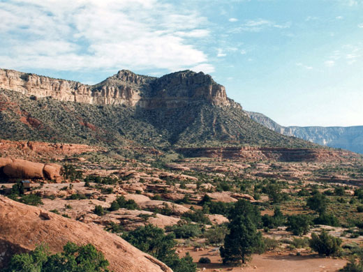
There are no facilities of any kind in this desert country so visitors need to be completely self-sufficient. The roads are generally suitable for standard cars but most sections become impassable after rains, some are rutted, and others are steep and rocky. However, the final few miles leading to the canyon rim at Tuweep are much narrower and uneven, with sharp gradients and patches of bare rock, and have deteriorated in recent years; this section requires at least a car with good ground clearance, and possibly a 4WD vehicle at some times of year. The trouble taken is rewarded by complete solitude and stunning views over the inner Colorado gorge, with the added attractions of colorful volcanic scenery and very few other people.
There are no facilities of any kind in this desert country so visitors need to be completely self-sufficient. The roads are generally suitable for standard cars but most sections become impassable after rains, some are rutted, and others are steep and rocky. However, the final few miles leading to the canyon rim at Tuweep are much narrower and uneven, with sharp gradients and patches of bare rock, and have deteriorated in recent years; this section requires at least a car with good ground clearance, and possibly a 4WD vehicle at some times of year. The trouble taken is rewarded by complete solitude and stunning views over the inner Colorado gorge, with the added attractions of colorful volcanic scenery and very few other people.
Tuweep Table of Contents
Photographs
Photographs - 14 views of the Tuweep area.
Tuweep Access
The 65 mile unpaved approach from AZ 389.
The Campsite at Tuweep
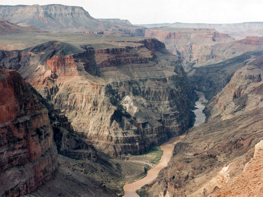
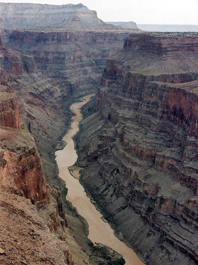
The Tuweep (also known as Toroweap) overlook has a primitive campsite on a rocky plateau half a mile from the canyon rim - this has an excellent setting with colorful cliffs visible in all directions including those of the inner gorge to the south, and with flourishing desert vegetation. A gentle stroll for a few hundred yards eastwards across sand and slickrock reaches the canyon edge, and affords a private view of the Colorado River, almost 3,000 feet directly below. Some of the huge rocks at the canyon edge are split and uneven, and it is slightly unsettling to stand at the very edge, and gaze into the chasm below.
Toroweap Viewpoints
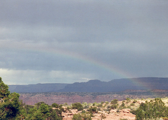
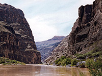
The official canyon viewpoint is nearer to very end of the road, 0.9 miles from the main campground, where a narrow ridge extends a short distance westward, then the ground falls away and in front stretches a magnificent view over several miles of the Colorado River, to and beyond the Lava Falls rapids, where the river drops by 13 feet - the steepest drop in the park, and with dramatic red and black lava flows over the cliffs at either side. The canyon rims have various cinder cones surrounded by unusual volcanic rocks, which are especially colorful in Prospect Canyon, a branch that joins the main gorge from the south just upstream of the rapids. The largest in the vicinity of the overlook is Vulcans Throne, a 600 foot hill that dominates the north canyon rim at this point.
Lava
The vulcanism occurred relatively recently compared to the other geologic events that shaped the canyon - at various times up until 30,000 years ago when a series of eruptions covered the northern plateau with lava over 30 miles in extent which also poured into the canyon and blocked the river flow for up to 2 years. The waters eventually broke through but evidence of the blockage remains in the steep lava-covered slopes and river-deposited sediment in cliff alcoves high above the river.
Trails around Toroweap
Two rough, undeveloped trails start from near the Toroweap overlook. One is the Tuckup Trail, reached by a 4WD track which branches off the main approach road about 1 mile before the campsite and follows the canyon on a generally level rock layer high above the river for over 70 miles. Some parts have alternative road access, and there are occasional difficult routes down to the river. The other is the Lava Falls Trail - this starts beneath the west side of Vulcans Throne, and heads down a steep slope with unstable lava blocks and many switchbacks to the Colorado, close to the rapids.
Featured Toroweap Hike
Lava Falls Trail
★★★★★
★★★★★
1.5 miles, 2540 feet
Very steep descent down loose scree and lava blocks, to Lava Rapids on the Colorado RiverAll Contents © Copyright The American Southwest | Comments and Questions | Contribute | Affiliate Marketing Disclosure | Site Map