The American Southwest
Home | Parks | Trails | Plants | Canyons
Maps | Landscapes | Site Map | Whats New? |
More...
Follow americansouthwest.net on Facebook
×
General Pages
Home
Parks
Trails
Plants
Slot Canyons
Maps
Landscapes
Itineraries
Site Map
What's New?
More pages...

States
Arizona
California
Colorado
Idaho
Nevada
New Mexico
Oregon
Texas
Utah
Wyoming


ARIZONA
CALIFORNIA
COLORADO
IDAHO
NEVADA
NEW MEXICO
OREGON
TEXAS
UTAH
WYOMING
ARIZONA
MAPS | PARKS | TRAILS | HOTELS

Mather Point, Grand Canyon National Park


Arizona > Grand Canyon National Park > South Rim > Viewpoints > Mather Point
O'Neill Butte
The majority of visitors to the South Rim first gaze over the Grand Canyon at Mather Point; although other places have slightly better views, Mather is the number one choice as it is closest to the entrance station, and a short walk from the visitor center (the Canyon View Plaza, opened in 2001). From summer 2010 the park road, which used to run right past the point and its rather small parking lot, has been rerouted a little way south, beside the visitor center, so now all visitors must park here and take a path to the rim. The visitor center is intended to be the northern terminus of a mass transit system, transporting people from large carparks in the village of Tusayan, but this is several years away from completion.

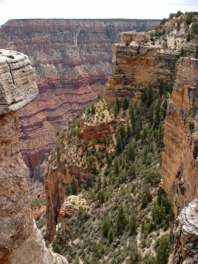
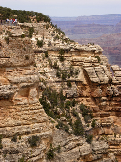
The viewing area is quite extensive - the point has two narrow, railed overlooks built on projecting rocks, various other view points along the rim in both directions, and to the west, the Rim Trail offers more vistas all the way to the next point (Yavapai).

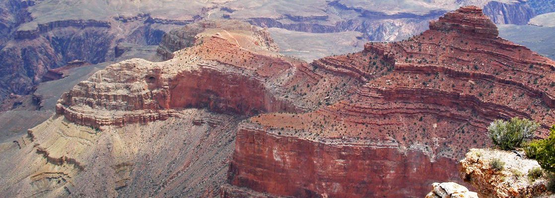
On the south side of the Colorado River, the panorama at Mather Point extends from the lower end of Garden Creek taking in some of the Bright Angel Trail, over the deep canyon of Pipe Creek and eastwards to Cedar Ridge/O'Neill Butte, along which runs the South Kaibab Trail starting from the next point to the east - Yaki. Some of the Tonto Trail is also in view, near Pipe Creek. On the North Rim, the vista is centered on the long, straight Bright Angel Creek, flowing for 10 miles between a collection of tall red buttes and other ravines.
Pinterest


Cliffs east of Mather Point

The canyon edge
The canyon edge

Next Points
West: Yavapai Point
East: Yaki Point


South Rim Grand Canyon Viewpoints

Piute Point Jicarilla Point Mescalero Point Mimbreno Point Yuma Point Pima Point Mohave Point Hopi Point Powell Point Maricopa Point Grandeur Point Yavapai Point Mather Point Yaki Point Shoshone Point Grandview Point Moran Point Zuni Point Papago Point Pinal Point Lipan Point Navajo Point Desert View Comanche Point
Back to Top
Arizona | California | Colorado | Idaho | Nevada | New Mexico | Oregon | Texas | Utah | Wyoming | Slot Canyons | Travelogue | SOUTHWEST

All Contents © Copyright The American Southwest | Comments and Questions | Contribute | Affiliate Marketing Disclosure | Site Map