The road to the Needles district of Canyonlands National Park starts on US 191, 39 miles south of Moab and 14 miles north of Monticello. It is then 48 miles to the end of the road at Big Spring Canyon Overlook. Seven miles north along US 191 is the turn off for the shorter (21 mile) road to the Needles Overlook, which is a part of the Canyon Rims Recreation Area.
The Island in the Sky region is also accessed from US 191, from where the end of the road at Grand View Point is 32 miles. The turning is 11 miles north of Moab and 20 miles south of interstate 70 (exit 182).
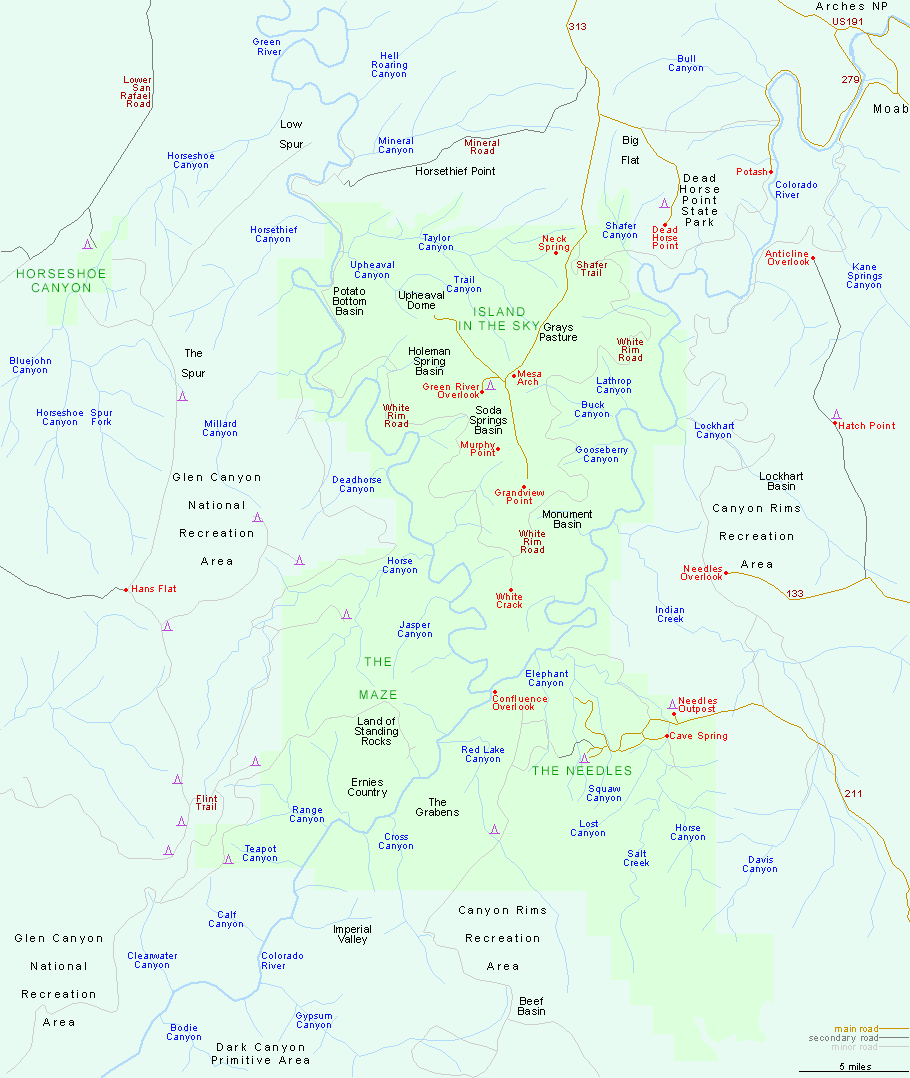
Island in the Sky detail map.
The short side track to Horseshoe Canyon is reached by a long unpaved road linking Green River with UT 24 (Robbers Roost Rd, or San Rafael Rd); the turning is 29 miles from UT 24 and 41 miles from Green River.
All Contents © Copyright The American Southwest | Comments and Questions | Contribute | Affiliate Marketing Disclosure | Site Map