Devil's Hall Trail, Guadalupe Mountains National Park
Texas > Guadalupe Mountains National Park > Hiking > Devil's Hall Trail
Devil's Hall Trail
Devil's Hall is an unusual, narrow, vertical-walled ravine through thin-layered strata, and may be reached by a fairly level trail up Pine Spring Canyon; last part of the route is along the stony streambed
Length: 2.1 miles
Elevation change: 750 feet
Difficulty: Easy to moderate
Type: One way
Usage: Medium
Season: All year
Trailhead: Far side of the NPS campground
Rating (1-5): ★★★★★
Elevation change: 750 feet
Difficulty: Easy to moderate
Type: One way
Usage: Medium
Season: All year
Trailhead: Far side of the NPS campground
Rating (1-5): ★★★★★

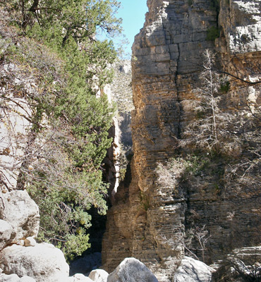
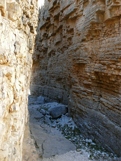
Starting from the campground at the mouth of Pine Spring Canyon near the Guadalupe Mountains National Park headquarters, the Devil's Hall Trail follows the dry wash running through the canyon to a narrow, enclosed, photogenic section where the ravine cuts through thin-layered limestone and is bordered by sheer cliffs 100 feet high.
The big-toothed maple trees lining the upper part of the canyon are especially colorful in fall but the hike is popular any time of year; apart from minor obstacles caused by boulders and loose rocks near the narrows, where the path runs right along the streambed, the hike is quite easy, gaining a moderate 750 feet in the 2.2 miles from the campground.
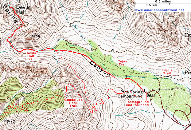
Map of Guadalupe Mountains National Park.
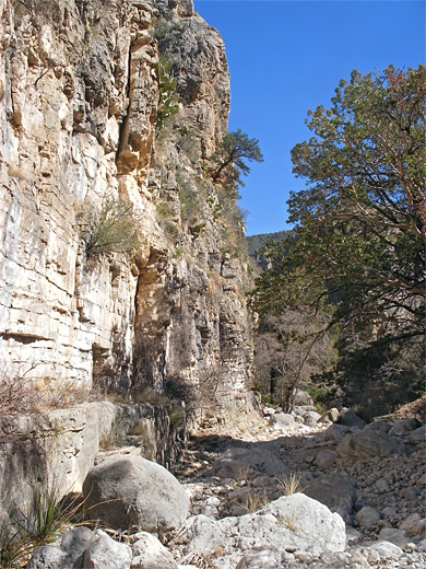
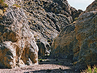
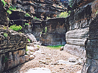
The hike begins at the far side of the RV parking area at the NPS campground, next to a noticeboard with trail register, map and other information. The path sets off to the northwest, along the banks of the sizeable dry wash running through Pine Spring Canyon, across stony, bushy land sparsely covered by a mixture of oak, juniper, yucca and cacti. This initial section of the trail is also used by horse traffic heading for Guadalupe Peak, to avoid the steep switchbacks at the start; the connecting path branches off to the south after 1.2 miles, after which the Devil's Hall Trail crosses a side drainage then drops down to the floor of the main wash. The last mile follows the streambed and is marked with cairns, leading the route past a few big boulders, dryfalls and residual pools.
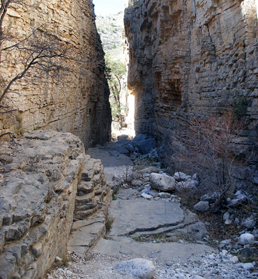
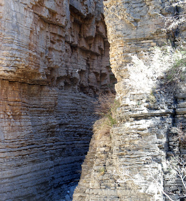
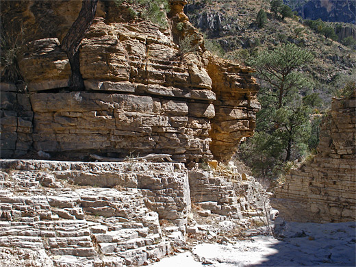
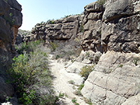
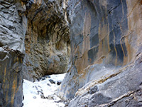
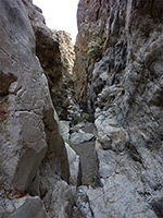
This part of the drainage is fairly overgrown with oak and maple trees so is well shaded, both by the vegetation and the surrounding hillsides, which rise up sharply to the east and west. The canyon forms a tight U-shaped bend after which the cliffs come closer, framing a short, stepped section of the streamway known as the Hiker's Staircase, where the floor is formed of many thin strata. Limestone narrows quite often have such features, sometimes much more extensive such as in Tanner Wash, a Grand Canyon tributary in north Arizona. Just above the staircase, the wash enters the 200-foot long Devil's Hall, as the vertical, parallel limestone walls become just 15 feet apart. At the far side a sign announces 'End of Trail', though walking further upstream is easy; the drainage remains sheer-walled on the west side for a while then reverts to a V-shaped gorge with grassy sides, and starts to gain elevation more steeply, winding into the heart of the Guadalupe Mountains.
The big-toothed maple trees lining the upper part of the canyon are especially colorful in fall but the hike is popular any time of year; apart from minor obstacles caused by boulders and loose rocks near the narrows, where the path runs right along the streambed, the hike is quite easy, gaining a moderate 750 feet in the 2.2 miles from the campground.
Location
Map of Guadalupe Mountains National Park.
The Trail
The hike begins at the far side of the RV parking area at the NPS campground, next to a noticeboard with trail register, map and other information. The path sets off to the northwest, along the banks of the sizeable dry wash running through Pine Spring Canyon, across stony, bushy land sparsely covered by a mixture of oak, juniper, yucca and cacti. This initial section of the trail is also used by horse traffic heading for Guadalupe Peak, to avoid the steep switchbacks at the start; the connecting path branches off to the south after 1.2 miles, after which the Devil's Hall Trail crosses a side drainage then drops down to the floor of the main wash. The last mile follows the streambed and is marked with cairns, leading the route past a few big boulders, dryfalls and residual pools.
Devil's Hall
This part of the drainage is fairly overgrown with oak and maple trees so is well shaded, both by the vegetation and the surrounding hillsides, which rise up sharply to the east and west. The canyon forms a tight U-shaped bend after which the cliffs come closer, framing a short, stepped section of the streamway known as the Hiker's Staircase, where the floor is formed of many thin strata. Limestone narrows quite often have such features, sometimes much more extensive such as in Tanner Wash, a Grand Canyon tributary in north Arizona. Just above the staircase, the wash enters the 200-foot long Devil's Hall, as the vertical, parallel limestone walls become just 15 feet apart. At the far side a sign announces 'End of Trail', though walking further upstream is easy; the drainage remains sheer-walled on the west side for a while then reverts to a V-shaped gorge with grassy sides, and starts to gain elevation more steeply, winding into the heart of the Guadalupe Mountains.
Topographic Map of the Devil's Hall Trail
Devil's Hall Trail - Similar Hikes
All Contents © Copyright The American Southwest | Comments and Questions | Contribute | Affiliate Marketing Disclosure | Site Map